Mompiche
The sand at a beach outside Mompiche is black. Not gray, not dark - actually black, the color of volcanic grit loaded with iron and titanium that makes a magnet stick to a handful of it if you hold one close enough. Locals call the place El Ostional, or Playa Negra, and it is one of several small beaches strung along a bay on the Pacific coast of Esmeraldas province, in northwestern Ecuador. The town of Mompiche sits at the southern end of that bay with about seven kilometers of beach to its name, a modest surf reputation, and an economy balanced awkwardly on fishing and tourism. The population is small. The roads are imperfect. The drinking water is delivered by tanker truck. And yet, or because of this, Mompiche has become the kind of place travelers whisper to each other about as a quieter alternative to Ecuador's better-known beach towns.
A Bay, a String of Islands
Mompiche lies in a protected bend of coast that also shelters San Francisco at its northern end, and Muisne and La Mancha in between. Offshore sit the small islands of Portete, Bolivar, and Las Manchas - the last often called Isla Bonita - which can be reached by boat in about fifteen minutes. Between Mompiche and Portete is the black-sand beach, whose iron and titanium content comes from volcanic sources further up the coast. Surfers come for a consistent left-breaking point wave that works well on south and southwest swells. Sport fishermen come for the pelagics that patrol the outer bay. Backpackers come for the simplest reason: most of the Esmeraldas coast is being paved and developed, and Mompiche has so far been paved a little less.
Moche Traders, Spanish Ships, Enslaved Labor
Wikipedia describes the area as a pre-Columbian trading center connected to the Moche culture - a claim best treated with caution, since the best-documented Moche sites lie in northern Peru. What is not in doubt is that indigenous peoples lived here for centuries before European arrival, and petroglyphs and other artifacts have been found in the area. The 16th century brought Spanish ships to this coast, and with them the familiar pattern of Christian conversion, the enslavement of indigenous people for work in mines and plantations, and the later importation of enslaved Africans to work the sugar and cacao plantations that spread along the Esmeraldas lowlands. The contemporary population of Mompiche and surrounding towns is heavily Afro-Ecuadorian, a demographic legacy of that forced movement of people - and the source of the distinctive music, cuisine, and culture that mark the Esmeraldas coast today.
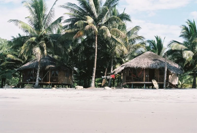
The Town of Few Tap Connections
Mompiche's tourism economy is quiet by the standards of Ecuador's better-known beach towns. Artisanal fishing and tourism are the two main livelihoods, and the tourism lean is mostly international - European and North American travelers looking for a stretch of coast where the sun goes down without a line of concrete hotels in the way. The town's infrastructure has not caught up with even that small scale of visitors. There is no municipal drinking-water system. Tanker trucks deliver water to residents. In January 2021, a strong ocean swell damaged the seaside boardwalk, and residents organized themselves to reinforce the breakwater wall, having waited without success for government help. In 2017, locals had already pushed back against mining companies extracting the valuable iron-titanium black sands, the same sands that give the nearby beach its color.
Near the Highest Mangroves in the World
North of Mompiche, further up the Esmeraldas coast, lies the Cayapas-Mataje Ecological Reserve - 51,300 hectares of coastal wetland and, reportedly, the tallest mangroves on Earth. Within the reserve are guandales, swampy areas with unstable soils supporting cungare, tangare, sijo, sande, and anime trees. Mompiche is not in the reserve, but it sits in the same coastal ecosystem and shares the same climatic and ecological patterns. Visitors staying in Mompiche often make the trip north to see the mangroves, which form part of the same northwestern coastal strip that shelters the black-sand beach, the pelagic fishing grounds, and the small towns where the Pacific has not yet been entirely rebuilt for tourists.
From the Air
Mompiche sits at 0.51N, 80.02W on the coast of Esmeraldas province, northwestern Ecuador. From the air it is recognizable by the broad, shallow bay it anchors, with the small offshore islands (Portete, Bolivar, Las Manchas) visible along the western approach. The nearest airport is Esmeraldas (SETN) to the north. Recommended viewing altitude is 2,000-5,000 feet AGL. Coastal haze and occasional afternoon cloud are common; mornings generally offer clearer light on the bay.
Nearby Stories
- 1942 Ecuador earthquake 17 km away
- Atacames 25 km away
- San Miguel (Ecuador) 60 km away
- Mindo 76 km away
- Bellavista Cloud Forest Reserve 100 km away
- Eloy Alfaro International Airport 126 km away
- Manta 156 km away
- Malpelo Plate 293 km away