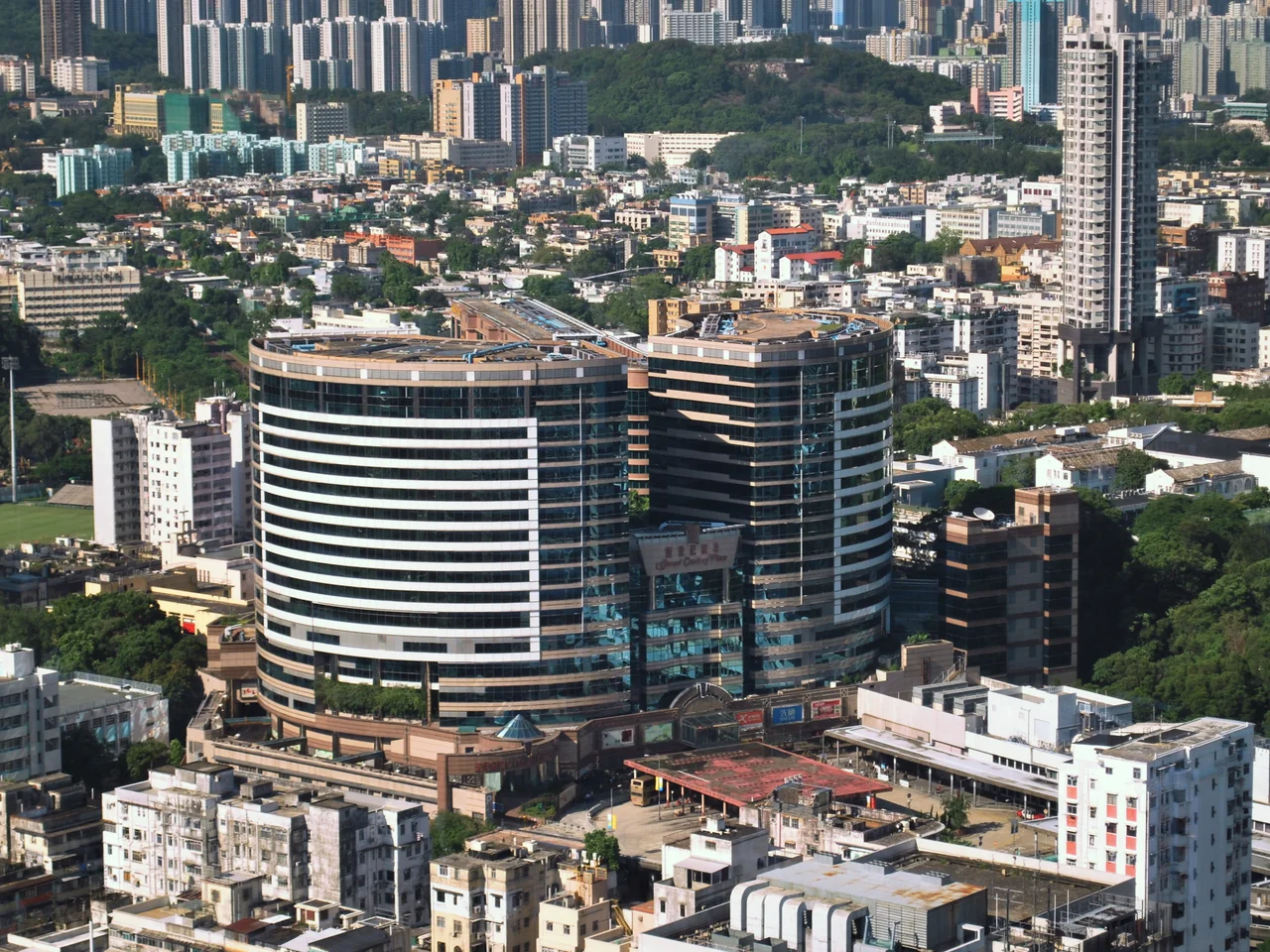

Mong Kok
The English name stayed the same even though the Chinese name changed. Until 1930, the area was called Mong Kok Tsui — named for the ferns that once grew along its coastal edge. The English transliteration held after the Chinese characters shifted to 旺角, meaning "prosperous corner" or "crowded corner". Both names turn out to be accurate. The area that was once Hakka farmland, with about 200 villagers recorded in Bao'an records from 1819, is now described by Guinness World Records as the busiest district in the world, with a population density of 130,000 people per square kilometre.
A City Built on Markets
What Mong Kok understood early, and preserved while other districts modernised it away, is the value of the specialist street. Each thoroughfare in the grid acquired a character so distinct it earned a nickname: Tung Choi Street became Ladies' Market, open daily from noon to midnight. Fa Yuen Street became Sneaker Street, dense with shops selling sports shoes from rare editions to standard models. Flower Market Road — the street, plus its side streets — fills each morning with florists and vendors. Goldfish Street clusters dozens of aquarium shops along a section of Tung Choi Street, opening at dawn. Even Tile Street has its identity, more than fifty retailers of construction materials concentrated on a Portland Street section near Argyle. The logic is old: if a customer knows where to find a thing, the cluster draws them faster than any individual shop could alone.
Layers of Time
Beneath the neon and the market stalls, Mong Kok has a preserved built heritage that most visitors walk past without noticing. The tong-lau shophouses at Nos. 600 to 626 Shanghai Street — the Cantonese verandah-type pre-war design, with covered walkways at street level — are listed Grade I historic buildings. Lui Seng Chun on Lai Chi Kok Road holds the same designation. The Old Kowloon Police Headquarters on the same patch dates to 1925; it is now part of the Mong Kok Police Station, a Grade II building. The Shui Yuet Temple on Shantung Street was built in 1927 and dedicated to Guanyin. Antique potteries at the Chinese University of Hong Kong suggest settlements in the area as far back as the western Han dynasty (206 BC to AD 8), though the present neighbourhood bears no visible trace of that depth. It lives in the present with considerable energy.
The Density Is the Point
Wong Kar-wai titled his 1988 film As Tears Go By with the Chinese phrase that translates literally as "Mong Kok Carmen" — a deliberate elevation of the neighbourhood from gritty backdrop to something approaching myth. Derek Yee's 2004 One Nite in Mongkok used the same streets to depict, as the film itself puts it, a hotbed of illicit activity. Wilson Yip had done something similar in 1996 with Mongkok Story. Robert Ludlum set part of his 1986 novel The Bourne Supremacy here. The creative attention is not coincidental. Mong Kok at street level is genuinely cinematic: the compressed lanes, the vertical signage, the mix of old shophouses and new glass storefronts, the food vendors at corners. The density that makes it exhausting is also what makes it alive.
A Neighbourhood That Holds Its Ground
In 2014, Mong Kok became one of the main sites of the pro-democracy protests that occupied parts of Hong Kong for weeks. Banks, jewellery stores, and clothing shops closed as demonstrators occupied the streets. Two years earlier, in 2008, the Cornwall Court fire had required more than 200 firefighters; four people died, including two firefighters. The neighbourhood has absorbed confrontations and disasters with the equanimity of a place that has been many different things across its history — Hakka farming village, colonial suburb, market district, film set, protest ground — and has continued in each iteration to be, above all, itself. The Yuen Po Street Bird Garden, completed in 1997 when the original bird sellers of Hong Lok Street were relocated before the old site closed in 1998, is still open from 10 a.m. to 6 p.m. The songbirds in their lacquered cages are still there. Mong Kok abides.
From the Air
Mong Kok is located at 22.323°N, 114.171°E on the Kowloon Peninsula, northwest of Victoria Harbour. From the air, the dense low-rise and mid-rise grid of Mong Kok is visible north of Yau Ma Tei and south of Prince Edward, flanked by Nathan Road running north-south. Hong Kong International Airport (VHHH) lies approximately 27 km to the west on Lantau Island. At 5,000 feet on approach to VHHH from the east, the entire Kowloon Peninsula is visible below; the tightest street grid in the frame is Mong Kok. The MTR Mong Kok and Prince Edward stations provide ground-level reference points below the MTR Island and Kowloon corridors.
Nearby Stories
- Lok Ma Chau Loop 2.3 km away
- Portas do Cerco 2.3 km away
- Kweilin Incident 17 km away
- Wanshan Archipelago Campaign 34 km away
- Nanxiong Formation 115 km away
- Battle of Nanpeng Island 148 km away
- Heyuan 169 km away
- Cape Maobitou 632 km away