
Mopti
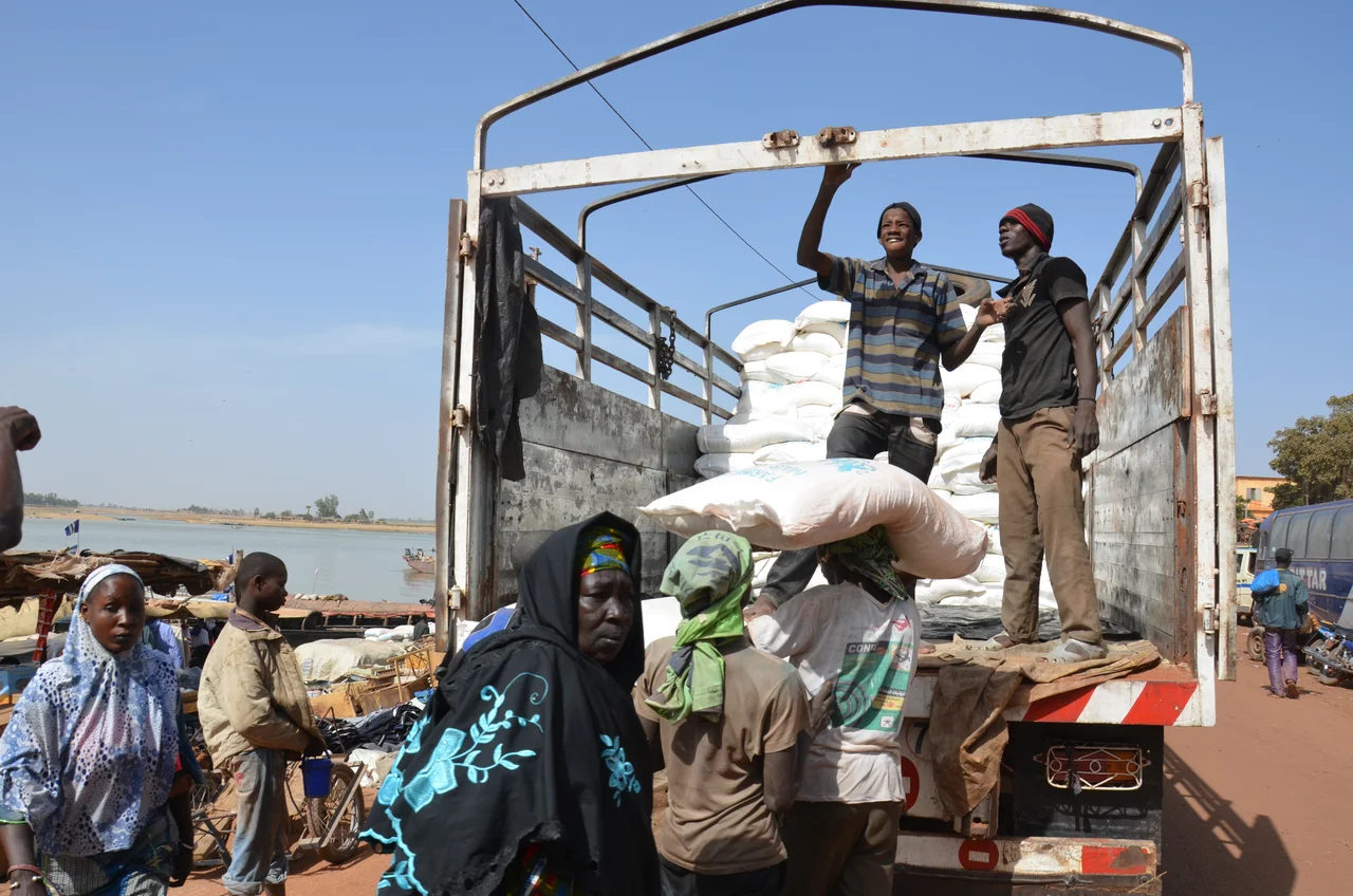
Follow the smell of smoked fish and dried river mud to the harbor, and you'll find the real Mopti. Long wooden pinasses nose into the bank, stacked with millet, salt slabs, and passengers; women sort the catch; the call to prayer drifts from the mosque in the old quarter. Built where the Niger and the Bani rivers braid together, Mopti is the place where central Mali loads and unloads itself - a working port that earns its old nickname, the Venice of Mali.
The Gateway
Most travelers don't come to Mopti for Mopti - they come because almost everything worth reaching in central Mali runs through it. This is the launching point for Djenné and its colossal mud mosque, for the long river road to Timbuktu, and for the cliff villages of Dogon Country to the east. The harbor is the heart of it all, bustling with the loading and unloading of river craft, and the market near the old mosque rewards an unhurried wander. The Grand Mosque of Mopti itself, a restored Sudano-Sahelian masterpiece of mud and timber, presides over the old section of town.
Life on the Water
The river defines the rhythm here. When the waters run high, usually from June to December, boats connect Mopti upstream and down - to Timbuktu, to Djenné, even to Bamako. The classic outing is a pinasse trip to one of the nearby Bozo fishing villages, the Bozo being the river people whose settlement Mopti grew from. A couple of hours on the water should cost only a modest fare - though be warned, an informal cartel at the harbor has been known to quote outrageous prices to newcomers. Hold your ground and walk away; a fair boatman is never far.
Getting In and Around
Mopti pairs with its neighbor Sévaré, which sits on the main road and often makes the easier arrival point - take a bus there, then a local connection into Mopti. Regular buses also run to and from the capital, Bamako. Once you're in, the center is compact enough to cover on foot, though taxis are available if you'd rather ride. The real transport adventure, of course, is by river, and Mopti is the place to arrange it.
The Hustle, and the Truth About It
Be ready: Mopti can be relentless. Sellers of souvenirs, river trips, and Dogon tours will approach you constantly, and many will not take no for an answer - a skill you'll sharpen over a few days. Around spots like Bar Bozo, the de-facto gathering place for foreign travelers, the pressure is heaviest, and not everyone offering a trip is on the level. But keep perspective: the people who solemnly offer to be your daytime bodyguard are selling a problem that doesn't exist. Mopti is not that dangerous. Persistence is the local sport, not menace.
A Note for Today
Mopti's role as a crossroads is exactly why current conditions matter. Central Mali has faced serious instability since the early 2010s, and the wider region has not been spared - nearby Sévaré was shelled during a national election in July 2018. The river port endures, as it has for over a century, but anyone planning to pass through should check up-to-date travel advisories with care. The Mopti of the harbor and the market is timeless; the Mopti of the moment deserves a clear-eyed look before you go.
From the Air
Mopti sits at 14.49°N, 4.19°W at the confluence of the Niger and Bani rivers in central Mali. Its own airport, Mopti-Ambodédjo (GAMB / MZI), lies just to the east near Sévaré. From the air the braided rivers, the harbor, and the towers of the Grand Mosque in the old quarter are the defining landmarks. Clearest viewing in the dry season (November-February), when Harmattan haze is lower; rainy-season cloud and dust reduce visibility otherwise. Recommended viewing altitude 3,000-6,000 ft AGL to take in the confluence and the port.
Nearby Stories
- Tireli, Mali 22 km away
- Battle of Konna 27 km away
- Dia, Mali 45 km away
- Battle of Jenné 66 km away
- Tominian 106 km away
- Ouahigouya 139 km away
- Hand of Fatima (rock formation) 192 km away
- Néma 354 km away