Morro de São Paulo
The beaches are named First, Second, Third, and Fourth. That is not a placeholder; that is the name. On Tinharé Island in southern Bahia, where there are no cars and no paved streets and every suitcase is pushed up the hill in a wooden wheelbarrow, the people who live here gave up on cleverness long ago. What Morro de São Paulo has instead is a 1630 stone fortress built to fight off Dutch and French corsairs, a Tupi name older than the Portuguese who borrowed the island, and a village where schools still sit beside jewelry shops and children still play barefoot soccer in the main square. To arrive you either take a catamaran across open Atlantic swell from Salvador - two and a quarter hours if the sea is kind - or a twenty-minute charter flight that lands on one of the beaches.
A Fortress Against Pirates
Martim Afonso de Sousa came ashore on this island in 1531 and recorded the name the Tupi people used: *Tinharé* - that which advances over the sea. The channel it commands was the gateway into the Bay of All Saints, and for a century Portugal half-defended it while Dutch and French corsairs took notice. In 1630, under Governor-General Diogo Luiz de Oliveira, construction began on the Fortaleza do Tapirandu - a fortress so large its curtain wall still stretches 678 meters across the headland, among the most extensive defensive works of colonial Brazil. It was listed as federal heritage by IPHAN in 1938. Today you can climb the path from the port, turn left at the top of the rise, and walk ramparts where cannon once pointed seaward. From here the Canal de Itaparica opens south, and you understand at a glance why this particular rock mattered - and why every pirate and every governor wanted it.
No Cars, Just Feet
There is no road onto the island. Vehicles cannot arrive, and inside the village they are almost entirely forbidden. Until the early 2000s only tractors for garbage and heavy cargo were allowed; today you will see buggy-taxis on the sandy tracks behind the beaches, but the main street - the Caminho da Praia - belongs to pedestrians and the occasional donkey. This gives Morro a texture found almost nowhere else in coastal Brazil. The hill from the port is steep enough that newly arrived travelers pause halfway up, catching breath, while local kids carry coolers past them as if the slope were flat. At the top sits a lighthouse and a viewing deck where people gather for sunrise over the mainland, sunset over the open Atlantic, and in between, the uncomplicated business of watching boats cross the bay.
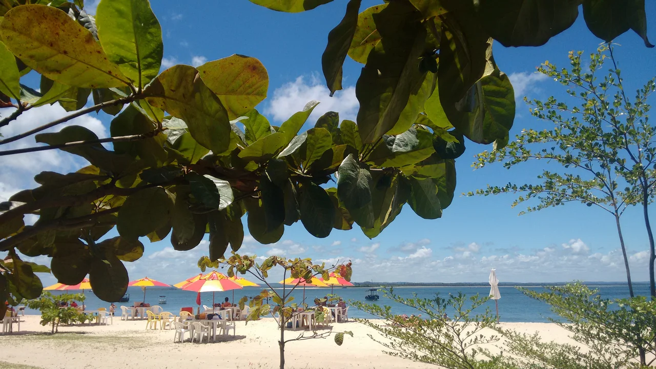
Numbered Beaches
Praia Primeira is small and rocky, closest to the village - the one you pass on your way in. Praia Segunda is the party, lined with *barracas* that run beach-side bar service by day and open as open-air drink stands by night, where vendors blend whatever fruit you point at with cachaça for ten or fifteen reais. Praia Terceira has the calmer water, the natural pools at low tide, the families. Praia Quarta, furthest out, stretches long and empty enough that footprints in the sand are news. The charter planes touch down on airstrips cut into the Third and Fourth beaches themselves, which is the kind of detail that seems invented until you see a Cessna rolling to a stop between swimmers and a beach bar. Offshore, the water runs through every shade of green and blue; Fonte Grande, the 1746 fresh-water system that was once the largest in colonial Bahia, still feeds pools near the fishing village of Gamboa on the other side of the hill.
Going Onward
Morro is not the end of the line. South from here lies Boipeba, reachable by boat across the Rio do Inferno and even quieter - sand tracks, a handful of pousadas, mangroves full of crab-hunters working the tide. You can make the crossing on a speedboat tour or a 4x4-and-boat combination. North, the catamaran will carry you back to Salvador's Terminal Turístico Náutico da Bahia, a five-minute walk from the Lacerda Elevator. The open-ocean stretch of that crossing can be rough; locals sell seasickness pills at the dock and mean it. If the Atlantic is having a day, the boat companies swap to a longer multi-leg route through Itaparica and Valença, which is how you learn that islands in this part of Bahia are less destinations than a loose network of ferries and buses held together by mangrove and patience.
From the Air
Located at 13.38°S, 38.91°W on the northern tip of Tinharé Island, southern Bahia. Two unpaved airstrips serve Morro directly - one aligned with Third Beach and one with Fourth Beach - both used by single-engine charters from Salvador and typically around 600-700 m long; local knowledge essential. Recommended approach altitude 1,500-2,500 ft, descending over the village with the 1630 fortress and lighthouse as primary visual landmarks. Nearest controlled airports: Salvador International (SBSV) about 70 km north, and Valença (SNVB), a small field on the mainland across the channel. Sea breezes from the east dominate most of the day. Scattered cumulus builds over the Tinharé archipelago in the afternoon; thunderstorms can develop rapidly in summer (December–March). Open-ocean swell on final approach to the beach strips can make short-field landings unforgiving.
Nearby Stories
- Battle of 4 May 33 km away
- Barra (neighborhood) 40 km away
- Itacaré 65 km away
- Praia do Forte 76 km away
- Pé de Serra 152 km away
- Vitória da Conquista 203 km away
- Sincura 208 km away
- SS Principessa Mafalda 363 km away