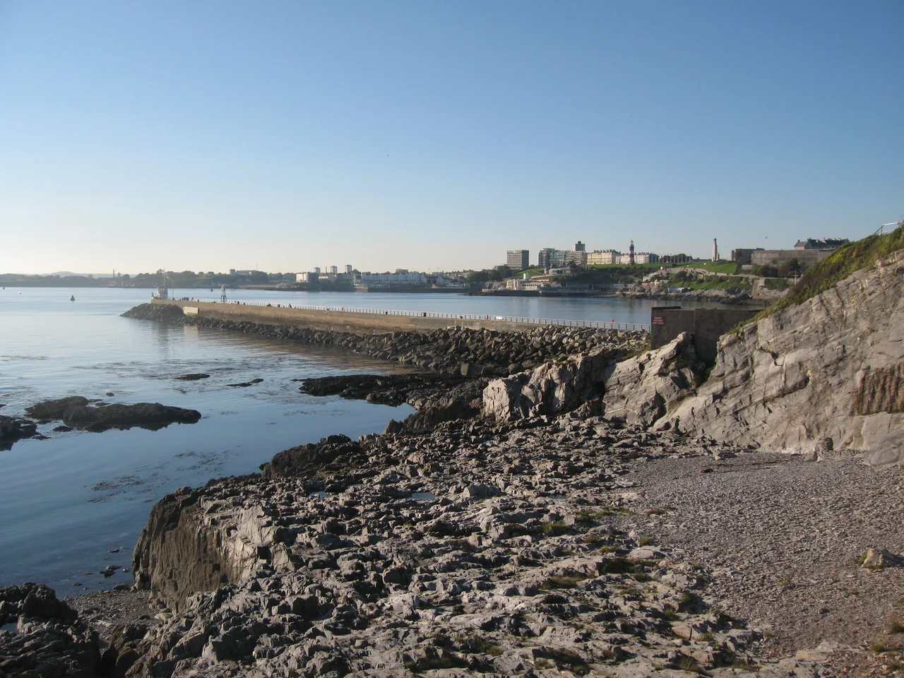

Mount Batten
Three thousand years ago, this small lump of rock on the eastern edge of Plymouth Sound was already doing business with the continent. Iron Age and Roman traders brought wine, pottery, and metal goods across the Channel and offloaded them here, on a 600-metre peninsula tipped by a 24-metre outcrop. So much continental commerce flowed through Mount Batten that some classical scholars have wondered whether this might be the trading centre Diodorus Siculus called "Ictis," or the harbour Ptolemy listed as "Tamaris" in his Geographia. Three exquisite British-made bronze mirrors were excavated here, evidence of a sophisticated local culture that minted its own influence. The mirrors are gone now, lost when German bombs hit Plymouth's museum during the Blitz. The rock, the peninsula, and the history are still here.
How Stert, Then Mount Batten
Before it was named after Sir William Batten, the seventeenth-century MP and Surveyor of the Navy, the peninsula was called How Stert. It served as a useful defensive position throughout the late Middle Ages because it commanded a clean field of fire across the Cattewater, the channel that connects Plymouth's old town to the open sea. In 1652, with the Civil War only just settled, the Commonwealth built Mount Batten Tower here, a circular artillery fort thirty feet high. It still stands. The tower is a Scheduled Ancient Monument now, a stout little drum of stone watching the harbour traffic three and a half centuries after its guns were last fired in anger. By the seventeenth century, coastal erosion had become a serious problem; the Cattewater was being dredged annually and the spoil dumped on the peninsula's south side, but in 1633 and again in 1634 the isthmus itself was breached by storms. The sea was eating the place faster than men could shore it up.
The Quarrying Decades
Between 1839 and the mid-1860s, the quarrymen came. Mount Batten's stone was needed for the great steam yards being built at HM Naval Base Devonport, and the appetite for granite was enormous. Workers chipped away at the peninsula year after year, hauling cart after cart of dressed stone down to the shore for shipment around the Sound. The landscape changed visibly. Mount Batten Tower, perched on its outcrop, came under direct threat as the surrounding rock disappeared beneath it. Fifty-three of Plymouth's leading citizens petitioned the Admiralty, who in turn pressured Lord Morley, the landowner, until he agreed to restrict the quarrying. The tower was saved. Two breakwaters eventually solved the erosion problem the sea had begun three centuries before: the great Plymouth Breakwater out in the Sound, completed in 1841, and the Mount Batten Breakwater itself, built between 1878 and 1881 at a cost of £20,000.
The 10,000 Visitors of 1906
There was a window, before the military took over completely, when Mount Batten was a day-trip destination for Plymouth. The coastal walk to Jennycliff was magnificent. The inns built originally to feed and water the quarrymen now did brisk business in tea and beer for visitors who arrived by ferry from the town. On one bank holiday in 1906, an astonishing 10,000 Plymothians made the short crossing to spend a few hours on the peninsula. They came for the views back across the water to the Hoe, the air, the cliff paths, the simple pleasure of being somewhere that felt like elsewhere without actually being far. That fledgling tourist trade ended abruptly. In 1913 the Royal Naval Air Service began seaplane trials in the waters off the peninsula, and within a few years the entire area was closed to the public for military use. It would not reopen for eighty years.
Aircraftsman Shaw
The air station went through three names in seven decades: RNAS Cattewater from 1913, RAF Cattewater from 1918, and finally RAF Mount Batten from 1928. Between 1917 and 1945 it was a flying boat base, hosting Royal Air Force and Royal Navy aircraft and operating high-speed search and rescue launches that plucked downed airmen from the cold water of the Channel. During the Second World War, Shorts Sunderland flying boats of the Royal Australian Air Force flew anti-submarine patrols from Mount Batten as part of the Battle of the Atlantic. And in the years before the war, one of the station's most enigmatic personnel was a man enlisted under the name Aircraftsman Shaw. He was, in fact, T. E. Lawrence, Lawrence of Arabia, who had renounced his fame and re-enlisted in the ranks to escape it. He worked on the design of the rescue launches, ran trials with them in the Sound, and lived quietly in the barracks. He left the RAF in early 1935 and was dead within months.
What's Here Now
The RAF finally left Mount Batten in 1986, and the former base was transferred to Plymouth Development Corporation in 1992. The breakwater, closed for decades and used for a time to store flying boats, was refurbished and reopened to the public in 1995. Each August the British Firework Championships light up the night sky above it, and anglers fish from its stones year-round. In 1999 the Mount Batten Sailing and Watersports Centre opened on the site of the former sergeants' mess, putting the peninsula back to one of its oldest uses: launching small craft into the protected waters of the Sound. The 22 houses of Spinnaker Quay, built in 2001, give Mount Batten its first permanent residents in modern times. The Bronze Age traders are gone. The flying boats are gone. The tower is still here, watching.
From the Air
Mount Batten sits at 50.359 degrees north, 4.130 degrees west, on the eastern shore of Plymouth Sound directly across the Cattewater from the Royal Citadel and Plymouth Hoe. From the air, look for the distinctive 600-metre peninsula projecting south-southwest into the Sound, with the small drum of Mount Batten Tower clearly visible on its tip and the 915-foot breakwater extending west into the Cattewater. The former runway and seaplane slipways of RAF Mount Batten are still recognisable on the peninsula. Nearest controlled airport is Exeter (EGTE), 38 miles northeast; Newquay (EGHQ) lies 48 miles west. The Sound is a military exclusion zone in places due to Devonport naval activity. Maritime traffic into Plymouth is continuous; expect Royal Navy movements, cross-Channel ferries, and a constant scatter of small craft.
Nearby Stories
- Davidstow Circuit 3.7 km away
- Golden Hind 3.9 km away
- Powderham Castle 4.4 km away
- Fowey Lifeboat Station 5.1 km away
- Okehampton Castle 12 km away
- Battle of Plymouth (1652) 19 km away
- Goonhilly Satellite Earth Station 44 km away
- German Submarine U-672 73 km away