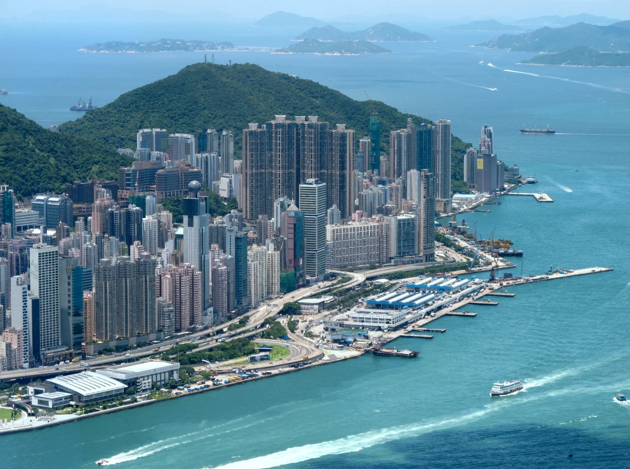

Mount Davis, Hong Kong
The Peak District Reservation Ordinance of 1904 drew a careful line across the hillsides of Hong Kong Island. Above a certain altitude, no Chinese person could own property. Wealthy families who found themselves excluded from Victoria Peak's prestige addresses looked west instead — and found Mount Davis, perched at 269 metres above Kennedy Town, with unobstructed views across Victoria Harbour and beyond. The hill that colonial zoning pushed them toward turned out to have a fine view of its own.
Named for a Governor, Armed for an Empire
Sir John Francis Davis served as the second Governor of Hong Kong from 1844 to 1848, a tenure marked by tension with both the local population and his own colonial superiors. The hill that would bear his name already existed, of course — it had been there for a hundred million years. By the time British military planners turned their attention to it in the late 1890s, its western position made it an obvious choice for coastal defence. An artillery depot was formally established by 1911, housing five 9.2-inch naval guns — later reduced to three — trained across the western approaches to the harbour. The guns sat on a hill built from coarse ash crystal tuff, Cretaceous volcanic rock laid down some 80 to 100 million years ago when the Repulse Bay Volcanic Group was still active across southern Hong Kong Island.
Christmas 1941
The Battle of Hong Kong lasted 18 days, from 8 December 1941 to Christmas Day. Japanese aircraft began bombing the colony on the morning of 8 December, the same day Japan attacked Pearl Harbor. Mount Davis absorbed a heavy share of that bombing — its artillery batteries were a priority target. As the Japanese army pressed across Hong Kong Island in the final days of the battle, British defenders made the decision to demolish the artillery depot rather than let the guns fall into enemy hands. The installation was destroyed by British forces toward the end of the fighting. On Christmas Day, Governor Mark Aitchison Young surrendered to Japanese Lieutenant General Takashi Sakai at the Peninsula Hotel in Kowloon. The guns on Mount Davis had already been silenced.
Science on the Summit
After the war, the hilltop found a quieter purpose. In 1969, physicists Oulton Walker and Tim Closs from the University of Hong Kong converted a surviving military bunkhouse into an ionospheric station, housing an instrument called an ionosonde — a radar-like device that measures the height and density of the ionosphere's charged layers. The station continued to collect atmospheric data from the western edge of Hong Kong Island for years. Microwave towers have since joined the equipment on the summit. The Chiu Yuen Cemetery occupies the eastern slope, serving as the burial ground for Hong Kong's Eurasian community; many members of the Hotung family, one of the most influential dynasties in Hong Kong's commercial history, are interred there.
The View from 123 Mount Davis Path
The Hong Kong Jockey Club Mount Davis Youth Hostel sits at 123 Mount Davis Path, reached by a steep winding route that branches from Victoria Road. The hostel underwent a HK$9.54 million renovation funded by the Hong Kong Jockey Club before reopening in 2012. Dormitory beds and private rooms accommodate visitors who come for one particular reason: the panorama. From the hostel's position near the summit, Victoria Harbour spreads below in its full width, with Kowloon's dense towers rising across the water and, on clear days, the hills of the New Territories extending beyond. The hostel runs a free shuttle service to Shun Tak Centre in Sheung Wan for guests who arrive by ferry — a practical concession to a location that is genuinely difficult to reach by conventional means.
From the Air
Mount Davis sits at 22.277°N, 114.125°E at the western tip of Hong Kong Island, rising to 269 metres. From the air it is the last significant high point before the land drops into Kennedy Town and the harbour. Approaching from the west at 1,500–2,500 feet, the artillery battery terracing is still visible on the upper slopes. Hong Kong International Airport (VHHH) is approximately 25 km to the northwest. The terrain rises sharply and pilots should maintain safe altitude — Victoria Peak at 552 metres lies only 3 km to the east.
Nearby Stories
- Lok Ma Chau Loop 2.3 km away
- Portas do Cerco 2.3 km away
- Kweilin Incident 17 km away
- Wanshan Archipelago Campaign 34 km away
- Nanxiong Formation 115 km away
- Battle of Nanpeng Island 148 km away
- Heyuan 169 km away
- Cape Maobitou 632 km away