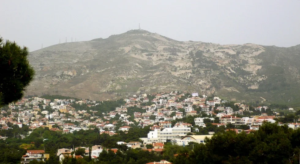

Mount Pentelicus
Look up at the Parthenon and you are looking at this mountain. Every gleaming column, every weathered frieze, every fragment of the carvings that European museums still argue over - all of it was hewn from the flanks of Mount Pentelicus, twenty-one kilometers to the northeast. The Athenians did not import their masterpiece. They quarried it from the hill on their own horizon, then hauled it home. Pyrgari, the highest peak, rises to 1,109 meters, and from its slopes an estimated twenty thousand tons of stone made the slow journey down to the Acropolis. The mountain became the temple.
The Stone That Glows
Pentelic marble has a quality that other white stone lacks: a faint, uniform yellow tint that turns gold in the sun. Cut a fresh block and it reads as cool ivory. Leave it on a hillside for centuries and it weathers to a warm honey color, so that the Parthenon seems lit from within at dusk. The stone is calcitic, fine-grained, flecked here and there with quartz and the ghosts of ancient fossils. Geologists can now read its chemistry like a fingerprint - the ratios of carbon and oxygen isotopes divide the marble into three distinct units. Using those signatures, researchers traced the contested Parthenon sculptures known as the Elgin Marbles back to a specific seam, Unit 3, on this very mountain. The hill remembers what was taken from it.
The Road Down to the Parthenon
Quarrying marble is only half the problem; moving it is the other. The ancient road that carried blocks from the Pentelic quarries to the Acropolis runs continuously downhill, following the natural slope of the land so that gravity did the heaviest work. Professor Manolis Korres, the chief architect of the Acropolis restoration, walked and mapped that route, documenting it in his award-winning study From Pentelicon to the Parthenon. The ancient quarries are no longer open to commerce. Protected by law, they yield stone for one purpose only: replacing the broken and missing pieces of the Acropolis itself. When a new marble drum is set into a column today, it comes from the same mountain as the original - a restoration in the truest sense of the word.
When the Mountain Burned
Marble outlasts almost everything, but the pine forest that once cloaked Pentelicus did not. In early July 1995, a fire raced across the range for roughly five days, consuming three-quarters of its slopes and blanketing northeastern Athens in smoke. It ranked among the worst wildfires Greece saw in the twentieth century. The flames returned again and again - a string of often arson-set blazes from 1998 to 2001, a furious double assault in 2007 when one front threw flames fifty to sixty meters into the sky, and another in July 2022. With each fire the forest thinned, and where trees once held the soil, mudslides began to scour roads and homes. The ancient core of white stone endures; the green skin around it has proven heartbreakingly fragile.
A Mountain With Two Names
Long before it was Pentelicus, the ancients called it Brilessos, or Brilettos - a name that survives in the modern suburb of Vrilissia clinging to its lower slopes. The mountain sits in a charged landscape, northeast of Athens and southwest of Marathon, the plain where Greek hoplites turned back a Persian invasion in 490 BC. A monastery still occupies the mid-slopes, and the city has crept steadily up the eastern half, streets curling into grids where forest used to stand. To stand on Pentelicus is to look down on the whole sweep of Attic history: the quarries that built the classical city, the plain that defended it, and the modern capital spreading toward the sea.
From the Air
Mount Pentelicus (Pentelikon) lies at 38.081 N, 23.883 E, roughly 21 km northeast of central Athens and southwest of Marathon. Its highest peak, Pyrgari, reaches 1,109 m (3,640 ft) - a prominent terrain feature on the northeastern rim of the Attic basin. Athens International Airport (LGAV) lies about 20 km to the southeast; the Acropolis sits to the southwest with clear sightlines on haze-free days. Maintain safe terrain clearance and watch for mountain-induced turbulence and rapidly forming afternoon cumulus over the ridgeline. The marble quarry scars are visible as pale gashes on the southern face.
Nearby Stories
- Great Sand Beach 5 km away
- Battle of Delium 7.7 km away
- Tower of Aliartos 9 km away
- HMHS Britannic 10 km away
- Saronic Gulf 15 km away
- Sousaki Volcano 17 km away
- Sanctuary of Apollo Maleatas 24 km away
- Skyros 66 km away