
Mount's Bay
At low tide on the beaches at Ponsandane and Wherrytown, on either side of Penzance, you can sometimes see them - the partially fossilised trunks of trees that grew here when the sea was somewhere else. Radiocarbon-dated to between six thousand and four thousand years ago, this drowned forest extended two to five kilometres further south than the modern coastline of Mount's Bay. Divers and trawlers still bring up its timbers from the seabed offshore. The bay you see today, with St Michael's Mount rising out of the water like a fairy tale, is geological youngster - a Holocene bay that flooded a Mesolithic landscape. Stand on Penzance promenade and look out across the half-moon of water, and you are looking across a sunken country.
The Shape of the Bay
Mount's Bay is the largest bay in Cornwall, arcing from Lizard Point in the east to Gwennap Head in the west. Its half-moon shape resembles Donegal Bay in Ireland and Cardigan Bay in Wales, though Mount's Bay sits in the rare position of being partly sheltered from the prevailing Atlantic westerlies. The cliffs change character as you trace the coast. From the Lizard, serpentine and hornblende schist climb to high points at Vellan Head, broken by the famous coves at Kynance and Mullion. North of Porthleven the rock turns to Devonian slate and granite. Past Rinsey Head the cliffs are crowned with Pleistocene periglacial head, eroded into the sandy beaches at Praa Sands. Around Penzance the cliffs are low and the towns gather - Penzance, Marazion, Newlyn, Mousehole. Beyond Mousehole the granite rises again to sixty metres, cut by the streams at Lamorna Cove and Penberth. Half the geological story of southern Cornwall is laid out in a single curve.
The Drowned Forest
About 12,000 years ago, as the ice sheets melted, sea level began to rise. Offshore surveys of Mount's Bay have found submerged erosional plains and valleys filled with deposits of peat, sand, and gravel - the cyclical record of a coastline that turned from wetland to coastal forest to brackish marsh as the water came up. By around 6,000 years ago, sea level reached approximately its current height during the Flandrian Marine Transgression. The forest that had grown across the bay floor died as the salt water reached its roots. Trees can still be seen on the beach at low tide on the right kind of day. Evidence of older sea levels works the other way too: Marazion is built on a raised beach, deposited during an interglacial when the sea was higher than today, and the road from Newlyn to Mousehole follows another. The geology is a sequence of advances and retreats by an ocean that has not finished moving.
Spaniards and Barbary Pirates
The bay's history is salted with violence from the sea. In August 1595, a Spanish naval squadron under Carlos de Amesquita, patrolling out of Brittany during the Anglo-Spanish War, came ashore in Mount's Bay and burned Newlyn, Mousehole, Penzance, and Paul over two days. A militia force led by Francis Godolphin could not push them back to the boats. Thirty years later, in August 1625, the Barbary corsairs reached Cornwall: a contemporary record states that "Turks took out of the church of Munigesca in Mount's Bay about sixty men, women and children and carried them away captives." The Barbary slave trade, fundamental to the economies of Tripoli, Algiers, and Sale, took more than a million Europeans to North African slave markets in the seventeenth century. The villagers of Mount's Bay were among them - sixty souls dragged from a Cornish church to be sold across the Mediterranean. In the churchyard wall of St Paul Aurelian's church in Paul stands an 1860 monument to Dolly Pentreath, traditionally the last native speaker of Cornish - a different kind of loss recorded in the same parish.
Mines Beneath the Waves
Tin made Cornwall, and Cornwall worked the tin even where it had to drive shafts below the high-water mark. An elvan dyke rich in tin runs almost parallel to Penzance promenade, about 240 yards offshore. From 1778 Thomas Curtis sank a shaft on the Wherrytown reef and built a twenty-foot wooden tower with a dressed stone breakwater around it. In 1790 ten men brought up six hundred pounds' worth of tin. By 1798 the operation had produced seventy thousand pounds' worth before an American ship is said to have demolished the tower in a storm. Attempts to reopen the workings in 1823 and 1836 failed. The Long Rock reef, less rich, produced tin between 1819 and 1823. Folklore speaks of the "old men" - generations of unrecorded tinners - working veins of nearly pure cassiterite from the early eighteenth century. Walk Penzance promenade today and you are above a network of submarine mine workings still under the bay.
1755 and the Lisbon Tsunami
On 1 November 1755 the great Lisbon earthquake destroyed much of the Portuguese capital. About four hours later, around two in the afternoon, the resulting tsunami crossed open ocean and hit the coast of Cornwall. At Mount's Bay the sea rose ten feet at great speed and ebbed at the same rate - then rose again, and again. The bay, normally a sheltered harbour in summer, suddenly emptied and refilled like a basin. No major settlement was destroyed, but the day passed into Cornish memory. The eastern arm of the bay, around Marazion and St Michael's Mount, was designated a Marine Conservation Zone on 29 January 2016, protecting the seagrass beds where fish and shellfish nurse, the stalked jellyfish, the giant goby. Above water, more than 150 nineteenth-century wrecks lie on the bay's floor - sailing ships caught on a winter onshore gale and pinned against this gentle-looking coast.
From the Air
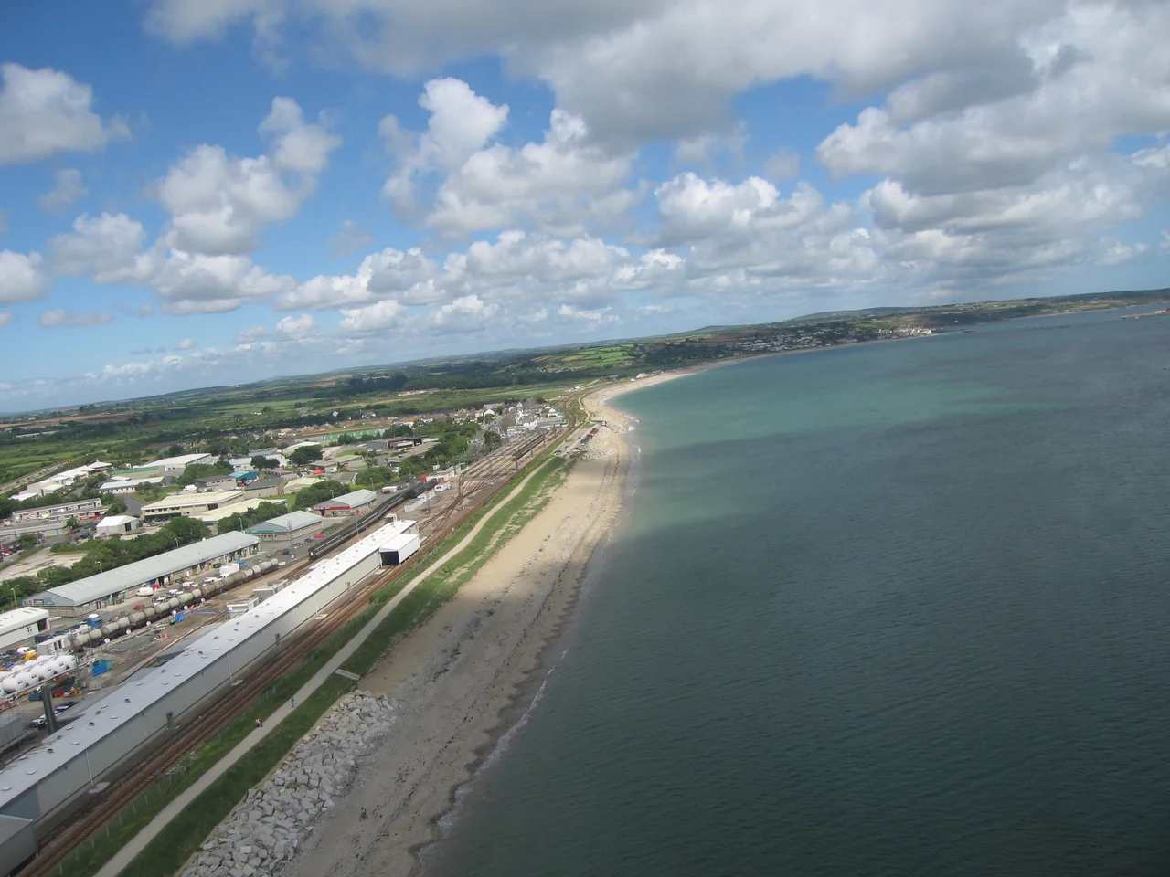
Mount's Bay (centred near 50.06 N, 5.42 W) arcs from Lizard Point (49.96 N, 5.20 W) on the east to Gwennap Head (50.04 N, 5.66 W) on the west. Land's End (EGHC) is on the western horn, 4 nm west of Gwennap Head. Newquay (EGHQ) lies 25 nm to the north. From 2,500 feet the half-moon of the bay is obvious, with St Michael's Mount a granite islet rising from a shoal on the north shore near Marazion - a tidal causeway connects it to the mainland twice a day. Penzance promenade fronts the central north shore; Mousehole's small harbour tucks into the west arm. In summer the bay is benign; in winter, southerly and south-easterly gales drive onshore swell against the long beach, which has wrecked ships here for centuries. Watch for shifting fog in spring and autumn.
Nearby Stories
- Seven Stones Reef 7.8 km away
- Lost Gardens of Heligan 8 km away
- Great Wheal Charlotte 15 km away
- SS Georgia (1890) 21 km away
- Caerhays Castle 26 km away
- SS Irma (1905) 34 km away
- 1979 Fastnet Race 77 km away
- HMS Affray 101 km away