The Island That Changed Hands
In July 1842, James Brooke sailed the schooner Royalist into Brunei Bay and dropped anchor off a low, sandy island near the mouth of the Brunei River. The island was known for wild boars and excellent fishing, and Brooke chose it for a more practical reason: from this anchorage, he could watch the coast of Brunei Town without entering it, monitoring Sultan Omar Ali Saifuddin II's agents who were stirring trouble in his territory. It was a vantage point, not a destination. Muara Besar Island has been playing that role ever since, serving whoever needs it -- the British, the Japanese, the Australians, and now the Chinese -- while remaining, in itself, little more than three and a half miles of flat marshland between the South China Sea and Brunei Bay.
Wild Boars and Warships
Brooke returned to the island in 1846, this time accompanied by Sir Thomas John Cochrane and the Royal Navy. The political situation in Brunei had grown more complicated, and the British needed to project presence without provoking a confrontation. Cochrane chose not to intervene in Brunei's domestic affairs directly, but anchoring warships off PMB sent a message that required no translation. The island sits at the junction of coastal landscapes, a natural bridge between the striking shores north of Brunei Town -- now Bandar Seri Begawan -- and the low-lying mangrove coast to the south. Its geography made it strategically obvious: anyone who controlled PMB controlled access to the Brunei River. The island itself remained sparsely populated, its forest canopy thickening toward the eastern end, its shores lined with casuarina trees and mud flats where migratory shorebirds gathered.
Operation Oboe Six
During World War II, the Japanese Navy turned the island into a naval support base, constructing five piers at Cape Sapo totaling 300 metres in length, in waters 10 metres deep. By June 1945, those piers had become a target. Operation Oboe 6, the Australian campaign to liberate Brunei, assigned the 20th Brigade under Brigadier Victor Windeyer to secure the island. The plan designated three beaches: Green on the Bruneian peninsula, White on PMB itself, and Yellow at Cape Sapo, to be opened once the island fell. From 3 May to 7 June, US and Australian bombers pounded Japanese positions across Brunei Bay. On 9 and 10 June, aircraft hit the island every two hours. The 2/15th Battalion landed at White Beach after intense naval bombardment. The Japanese garrison, understrength and poorly supplied, offered no resistance at the shore. By 17:45, the battalion had secured the island without a single engagement. Yellow Beach opened for logistics, and PMB became an Allied anchorage for the remainder of the war.
Dolphins and Mangroves
Between the wars and the industrial development, the island harbored something quieter. Mangrove forests spread across its interior. Migratory birds and shorebirds used it as a stopover. In 1949 and 1950, the naturalist Carl Alexander Gibson-Hill documented Irrawaddy dolphins near Brooketon -- present-day Muara -- at the entrance to the Brunei River and in the waters surrounding the island, where he observed them in "some numbers." A skull of an Irrawaddy dolphin taken from the island's waters ended up in the collection of the British Museum of Natural History. In 1988, conservationists recommended protecting 90 hectares at the island's southeast end, a proposal that acknowledged what Gibson-Hill had seen decades earlier: that this unremarkable-looking patch of land sustained a richer ecological life than its flat, marshy appearance suggested.
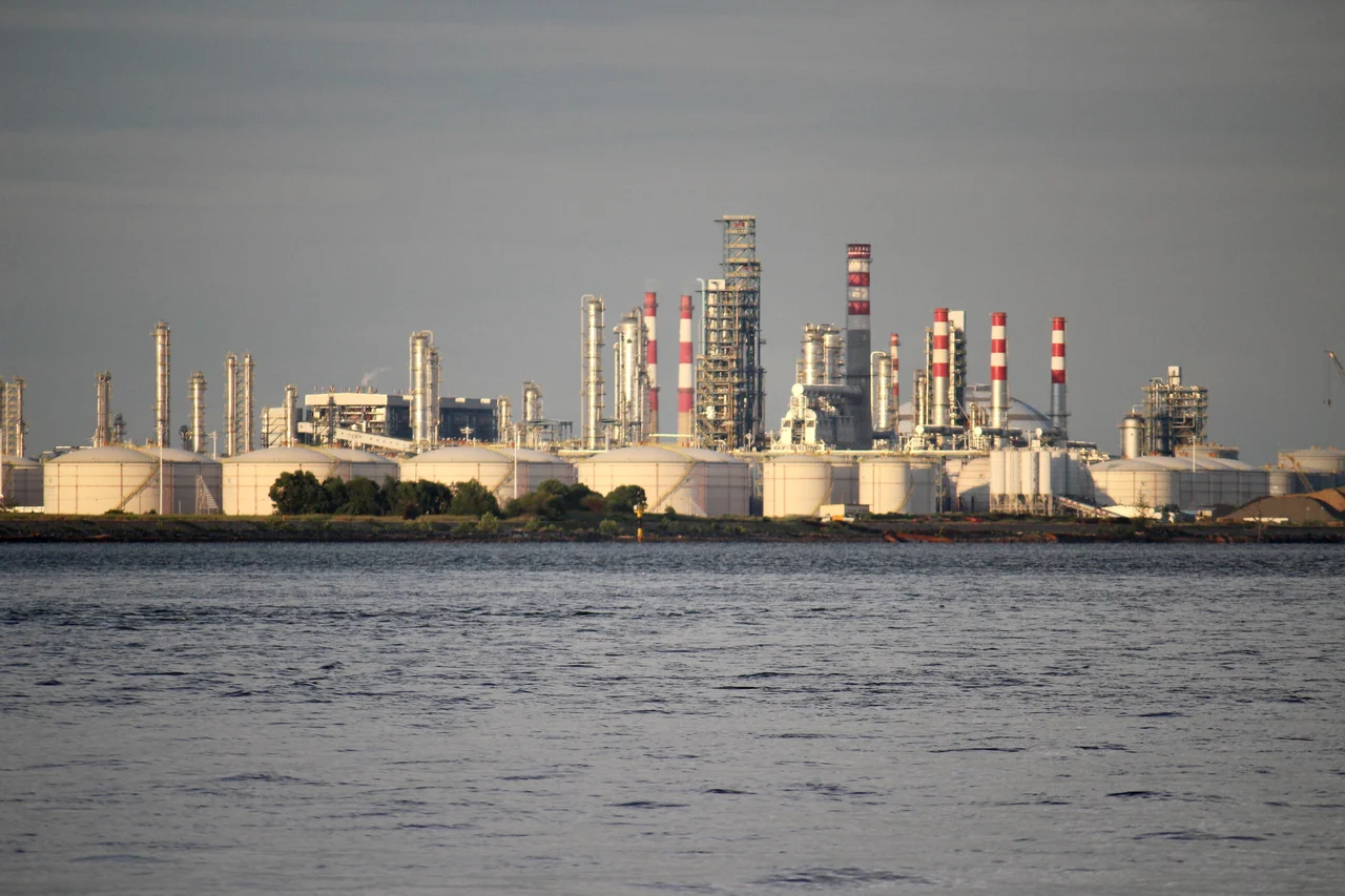
Refinery Island
The modern transformation of Muara Besar began with Brunei's 2007-2012 National Development Plan, which allocated B$300 million for a container port and manufacturing cluster. The vision soon pivoted to petrochemicals. In July 2011, the government approved Zhejiang Hengyi Group's US$2.5 billion oil refinery and aromatics cracker project, part of China's Belt and Road Initiative. Phase 1, covering 260 hectares, produces gasoline, diesel, jet fuel, paraxylene, and benzene, generating 800 local jobs. Phase 2, estimated at US$3.5 billion, broke ground on 25 September 2020 and is expected to create 1,200 additional jobs. A bridge now connects the island to the mainland at Pulau Muara Besar Bridge. An Integrated Marine Supply Base occupies 11 hectares on the southern shoreline, and a 16-hectare maintenance and decommissioning yard signed in June 2022 aims to become the anchor of Brunei's maritime industrial cluster. The island that James Brooke used as a quiet watchpost has become, by far, the most economically significant piece of ground in the sultanate.
From the Air
Located at approximately 5.01N, 115.10E in Brunei Bay, within the Brunei-Muara District. The island is 3.5 miles long and 1 mile wide, flat and marshy, visible as a distinct landmass between Pelumpong Spit and the mainland. The Hengyi Industries refinery complex dominates the western half of the island and is clearly visible from altitude. The Pulau Muara Besar Bridge connects to the mainland. Brunei International Airport (WBSB) lies approximately 15 km to the southwest. At 2,000-4,000 feet, the contrast between the industrial refinery and remaining mangrove forest is striking. Muara Port sits in the sheltered channel between the island and the western coast.
Nearby Stories
- Labuan 9.7 km away
- Sabah State Railway 12 km away
- Brunei's Billion-Dollar Bet on Urea 16 km away
- Brunei's Green Jewel Across the Bay 18 km away
- Where the River Meets the Sea 26 km away
- Starcevich Monument 38 km away
- Raid on Kalabakan 206 km away
- Luconia Shoals 238 km away