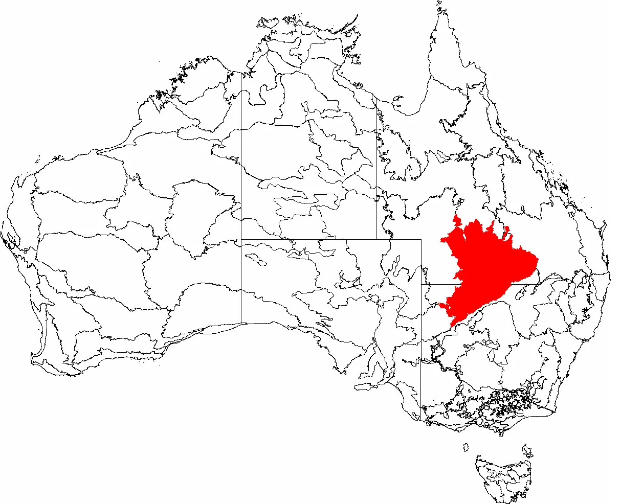

Mulga Lands
For months at a time, the country looks dead. Red sand stretches flat to the horizon, the grasses are bleached to straw, and the silver-grey acacias stand still in air that shimmers with heat. Then it rains, and within days the Mulga Lands transform: dormant seeds split open, ephemeral lakes fill across the plains, and birds arrive in their tens of thousands to feed and breed before the water vanishes again. This is a landscape built around the wait. Spanning more than 250,000 square kilometres of inland Queensland and New South Wales, the bioregion takes its name from the tree that defines it - the mulga, Acacia aneura - and from the patient, boom-and-bust rhythm that mulga has spent millions of years learning to survive.
The Tree That Engineers Rain
The mulga is not a passive survivor; it shapes its own fortune. What look like narrow grey-green leaves are actually phyllodes - flattened leaf stalks angled to reflect the harsh sun and slow evaporation. The whole architecture of the tree tilts inward, so that the rain it does catch runs down the branches to the trunk and pools directly above a taproot that can plunge metres into the earth. A mulga seedling barely ten centimetres tall may already have sent a root three metres down in search of moisture. Growth is glacially slow, perhaps a metre a decade, but the reward is longevity: a mulga can live more than a century. Across roughly 1.5 million square kilometres of arid Australia, this one species dominates - an entire habitat conjured from poor soil and unreliable sky.
Three Ways the Water Runs
Flat as it appears, the bioregion sheds its rare rain in three different directions. On the eastern side, creeks like the Wallam, Nebine and Mungallala feed the Warrego and Paroo rivers and ultimately the great Murray-Darling system. To the southwest, the Bulloo River empties into wetlands near the Simpson Desert and simply soaks away. To the north, the Barcoo drains toward the salt sink of Lake Eyre. Beneath all of it lies the Great Artesian Basin, one of the largest underground freshwater stores on Earth, surfacing here and there as mound springs that become tiny, fiercely guarded islands of life. The Paroo, almost alone among Australia's major rivers, still runs essentially wild and unregulated - a glimpse of how this country behaved before dams and bores.
Country and Custodians
Long before pastoralists arrived, these plains were home to Aboriginal peoples who read the land's rhythms with precision - among them the Bidjara, the Kunja, who speak the Gunya language, and neighbouring groups including the Kooma, Budjiti, Mardigan, Murrawarri and Kullilli. For them the mulga country was not empty waiting-ground but a living larder, its waterholes, game and seasonal abundance mapped across generations. The arrival of sheep and cattle stations in the 1860s dispossessed many of these communities and forced different language groups together onto the runs as labour. Their connection to this land was never severed, and across the region today native title and culture endure - a continuity older than any fence line.
When the Lakes Come Alive
The bioregion's drama peaks at its wetlands. When Lakes Wyara and Numalla flood within Currawinya National Park, they can host a quarter of a million birds - rainbow bee-eaters, freckled and musk ducks, black swans, pelicans, egrets and glossy ibis crowding water that will be gone in a season. Currawinya guards something rarer still: a 25-square-kilometre enclosure ringed by an electrified, predator-proof fence, opened in 2001 to give the greater bilby - a burrowing, rabbit-eared marsupial pushed to the brink by foxes and cats - a fighting chance to recover. The fence is a quiet admission of how much was lost, and a stubborn bet that some of it can still be brought back.
A Working Wilderness
Most of the Mulga Lands remain sparsely peopled and given over to grazing, and that is both their preservation and their threat. Around 80 percent of the original vegetation still stands, especially in the dry inland west - but together with the neighbouring Brigalow Belt, this is where most of Queensland's land clearing happens. Mulga leaves are cut as drought fodder for stock, other trees are pushed over to open grassland, and the delicate mound springs suffer where animals concentrate. National parks - Currawinya the largest, alongside Mariala, Thrushton, Hell Hole Gorge and others - protect fragments of the whole. The rest endures as it always has: a working wilderness that asks for patience and punishes those who forget how dry it can get.
From the Air
The Mulga Lands sprawl across inland southern Queensland and northern New South Wales; this reference point sits near 28.10°S, 145.68°E, north of the NSW border. From cruising altitude the bioregion reads as a vast, almost featureless red-and-grey plain, broken only by the darker ribbons of the Warrego and Paroo river systems and, after heavy rain, by the bright sheen of ephemeral lakes such as Wyara and Numalla in Currawinya National Park to the southwest. There are no large towns; Cunnamulla lies to the north and Bourke to the southeast. For low-level sightseeing, the nearest sealed strips are Cunnamulla Airport (YCMU) and Bourke Airport (YBKE), with Charleville (YBCV) the main regional hub further north. Best light is early morning or late afternoon, when low sun rakes across the dunes and woodland and the flatness of the land finally shows its subtle grain. Visibility is typically excellent in the dry season; watch for sudden dust haze on windy days and dramatic, isolated storm cells in summer.
Nearby Stories
- Eulo 20 km away
- Koroit opal field 41 km away
- Zero Obelisk 78 km away
- Currawinya National Park 88 km away
- Cheepie, Queensland 129 km away
- Carnarvon Gorge 361 km away
- Hornet Bank Massacre 403 km away
- Warialda 442 km away