Munim River
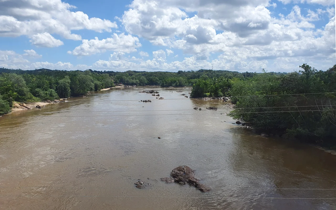
The Munim River is not long, by Amazonian standards. Three hundred and twenty kilometers, source to sea, drains a basin of 15,918 square kilometers in eastern Maranhão - about five percent of the state. But the Munim is the river that the eastern tablelands trust with their water. Twenty-three municipalities sit within its catchment. Seven of them lie entirely within its basin. The river rises in the *Tabuleiros* - the high, flat-topped plateaus of the Barreiras Formation - and flows roughly north-northwest through cattle country, soybean fields, and small farming towns before emptying into the Baía de São José near the state capital.
Where the River Begins
The Munim proper is born in the municipality of Afonso Cunha, at the confluence of two small watercourses called the Riacho da Barriguda and the Riacho do Bio. Its sources drain the northeastern edge of the Caxias plateau, where thin soils overlie the sandstones of the Barreiras Formation. Three headwater streams feed the system - the Munim itself, rising in Aldeias Altas; the Preto River, rising in Buriti; and the Iguará River, rising in Codó. The Preto and Iguará run in from the east and west, meeting the main stem as it drops out of the tablelands. On its way north, the river gathers the Paulica and half a dozen smaller streams - the Mocambo, Raiz, Cruz, São Gonçalo, Pirangi, Una, and Mata - each of them a thread of upland drainage pulling water toward the coast.
The Towns That Ride Along
Afonso Cunha, Cachoeira Grande, Chapadinha, Mata Roma, Nina Rodrigues, Presidente Vargas, São Benedito do Rio Preto - seven municipalities lie wholly within the Munim basin, their economies built around what the river and the surrounding *tabuleiros* allow. Chapadinha is the largest of them, a university town that has become the agricultural center of the watershed. Axixá sits at the river's mouth, on the left bank where the Munim meets the Baía de São José (also called the Baía do Arraial). The town takes its name from a tree with red berries that grows along the river's edges; the name itself is drawn from a language spoken here before Portuguese arrived. The region's original inhabitants - Indigenous peoples, including Tupi-speaking groups - lived along these waterways for thousands of years before colonization. Their presence survives in the place names more than in the demographics.
A Basin Under Pressure
A 2006 study of the river around Chapadinha documented what residents had already known for decades: the Munim was being degraded. Soybean expansion had cleared forest from the riverbanks. Erosion was carrying sandy soil into the channel. Subsistence farms upstream were washing pesticides and fertilizer into the water. And then there was the sand dredging. The riverbed is full of clean, graded sand - exactly the kind that construction contractors want for concrete and plaster - and crews had been extracting it for sale in nearby towns, largely without permits. The dredging left the water muddy and oily, disturbed fish spawning beds, and collapsed banks. In October 2014, State Representative Bira do Pindaré reported to the Maranhão legislature on a public hearing that had documented illegal sand extraction in the municipality of Presidente Juscelino.
What Protection Exists
Two conservation units now overlap the basin. The Chapada Limpa Extractive Reserve, created in 2007, covers 11,971 hectares and is a *reserva extrativista* - a protected category specifically designed to support traditional communities who make a living by gathering forest products without cutting the forest down. The lower Munim flows through the enormous Upaon-Açu/Miritiba/Alto Preguiças Environmental Protection Area, 1,535,310 hectares created in 1992, which stretches east to include the dunes of Lençóis Maranhenses and the Preguiças River delta. In 2013 the Maranhão state government created the Munim River Hydrographic Basin Committee, a multi-stakeholder body that brings together municipal governments, water users, and civil society to plan watershed management. It was formally installed in 2014, and in September 2015 it began discussing a proposal for a new state environmental reserve along the Rio Preto and Riacho Estrela.
A River That Still Reaches the Sea
The Munim empties into the Baía de São José between the towns of Axixá and Icatu, just south of São Luís. The bay is a shallow coastal arm where freshwater meets the Atlantic, and the Munim's sediment-laden outflow helps feed the mangrove systems that line its shores. For a river whose basin has been cleared, farmed, dredged, and polluted, the Munim still delivers water to the ocean. The fish that live in it are reduced but present. The birds that use its banks - egrets, jabirus, kingfishers - still fish its shallows. What happens next depends on whether the basin committee can translate its meetings and its studies into enforcement, and whether the farmers and miners and towns along the river can agree on what the Munim is for.
From the Air
Coordinates approximately 2.75°S, 44.08°W (middle reaches); mouth at roughly 2.9°S, 44.1°W on the Baía de São José. Recommended viewing altitude 3,000-8,000 feet to trace the meandering channel from the tablelands toward the coast. Landmarks: Chapadinha sits in the middle basin; Axixá and Icatu flank the estuary; São Luís lies just across the bay to the west. Nearest airport is Marechal Cunha Machado International (SBSL) in São Luís, about 60 km from the river's mouth. Visibility best in dry season (July-November).
Nearby Stories
- Baixada Maranhense Environmental Protection Area 23 km away
- Alcântara Space Center 32 km away
- Lençóis Maranhenses 57 km away
- Maranhão mangroves 94 km away
- Chapada Limpa Extractive Reserve 106 km away
- Santa Inês 111 km away
- Parnaíba Thermal Power Complex 205 km away
- German submarine U-164 (1941) 473 km away