Nanuque
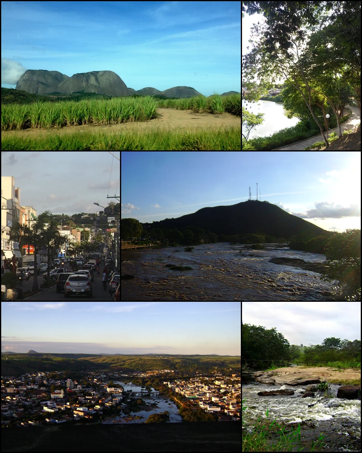
Fritz's Stone is about a thousand meters high, and from its summit you can see three Brazilian states at once. Minas Gerais beneath you. Bahia to the north. Espírito Santo to the south. The rock sits 25 kilometers from downtown Nanuque and is one of the biggest mountaineering walls in northeastern Minas Gerais - a granite wall so sheer that skydivers use it for training alongside climbers. Below, in the valley of the Mucuri River, the town of Nanuque goes about its business - cattle trucks, sugarcane trucks, 40,665 people living in the 79th most populous city in Minas Gerais at a comfortable elevation of 131 meters where three states pinch together into a single administrative corner.
Three States, One Valley
Nanuque occupies a specific kind of corner - the place where three of Brazil's regional divisions collide. Bahia forms the northern and eastern borders. Espírito Santo presses in from the south. Minas Gerais holds the town itself. The neighbors read like a list from a regional travel guide: Medeiros Neto and Lajedão up in Bahia, Montanha and Mucurici in Espírito Santo, Mucuri eastward across the line. This geography has shaped Nanuque's identity. The town is close enough to two other state capitals that people cross borders for work, shopping, and school without anyone making much ceremony of it. Belo Horizonte, the state capital, is 603 kilometers away - farther than most of the Bahia coast, which is why Nanuque often feels as though it is still deciding which region it properly belongs to.
The Inselbergs
The word geologists use for isolated stone hills rising from flat land is inselberg - island mountain - and the Serra dos Aimorés is a great example. These are granite plugs exposed by millions of years of erosion stripping away the softer rock around them. Fritz's Stone is the most famous. President Bueno Stone offers views over the city and the Mucuri River and is a canoeing put-in. The St. Helena Quarry, an old mining scar on the north side of town, now works as a lookout point. The Tree of Herons stands in the central area as a casual local landmark - the kind of tree that individual neighborhoods talk about as though it were a person. Nanuque has joined the Caminho dos Gemstones - the Gemstones Tourism Circuit - marketing its sierra and its inselbergs to visitors from further afield.
Cattle, Sugarcane, and the MHDI
The economy runs on cattle raising, small industry, agriculture, and services. The 2005 statistics tell a story of a working agricultural town: 143,000 head of cattle, 2,128 hectares of sugarcane, rotations of beans and soybeans and corn, an alcohol distilling plant using the local sugarcane. In 2005 there were 372 rural producers but only 106 tractors - an interesting ratio that says more about the scale of farms than about modernization. The 2000 Municipal Human Development Index for Nanuque was .708, placing the town in the lower middle of the Minas Gerais rankings. For comparison, Poços de Caldas, the highest in the state, recorded .841; São Caetano do Sul in São Paulo state hit .919 nationally. These numbers are always moving, and the newer reports from the 2022 census show gradual improvement in the Mucuri Valley.
The Climate and the Rainfall
The climate is humid tropical with real extremes. Summer maximums reach 39 degrees Celsius. Winter minimums drop to 20. Annual rainfall sits around 1,064 millimeters, enough for rain-fed agriculture but concentrated into a few months of the rainy season. These numbers determine everything about how people live and work here - when the cane is cut, when the cattle move between pastures, when the climbing season on Fritz's Stone is safe. The Serra dos Aimorés to the north interrupts weather systems coming down from the interior. It creates microclimates, rain shadows, and quick afternoon storms that skydivers learn to read before they jump.
Where Aimoré Means Something
The name Aimorés carries the memory of the indigenous Aimoré people who lived in these lands before Portuguese settlement. The word survives today in the name of the sierra, in the neighboring municipalities, and in the state boundary that crosses the mountains. Nanuque's own name is also indigenous. The people who fish the Mucuri, climb Fritz's Stone, and watch the herons from the Tree of Herons carry that deeper history forward in words most of them do not examine too closely but pronounce daily. A town in a valley, wedged against the state line, surrounded by the stone islands of the old Aimoré country - it is not a bad place from which to watch three states at once.
From the Air
17.84°S, 40.35°W. Nanuque lies in the Mucuri River valley at 131 meters elevation, in the northeastern corner of Minas Gerais at the three-state intersection with Bahia and Espírito Santo. Recommended viewing altitude 3,500-4,500 m AGL to see the town laid out along the river and Fritz's Stone rising to the north. Nearest airports: SNTO (Teófilo Otoni) 140 km southwest, SBPS (Porto Seguro) 250 km northeast. Afternoon thunderstorms common in summer; the Serra dos Aimorés triggers orographic lift.
Nearby Stories
- Itaúnas 35 km away
- São Mateus, Espírito Santo 80 km away
- Itaipé 96 km away
- Ladainha, Minas Gerais 104 km away
- Caraíva 105 km away
- Central Atlantic Forest Ecological Corridor 132 km away
- Governador Valadares, Minas Gerais 148 km away
- Corumbau Marine Extractive Reserve 154 km away