Itaipé
The Tupi who named this place chose their words carefully. *Itaipé* translates as *path of stones* - *itá* for stone, the rest describing the track that winds through them. The word is an inventory, not a metaphor. The landscape around Itaipé is genuinely defined by its rock formations, and chief among them is Pedra do Chifre, a 1,100-meter peak whose name means *horn rock*. The municipality sits at 847 meters elevation in the northeast of Minas Gerais, 66 kilometers northwest of Teófilo Otoni, and it is in many ways a portrait of rural Brazil: just over 12,000 people, 38,000 hectares of rural land, one bank, and a long list of waterfalls nobody outside the region has heard of.
The Horn Rock
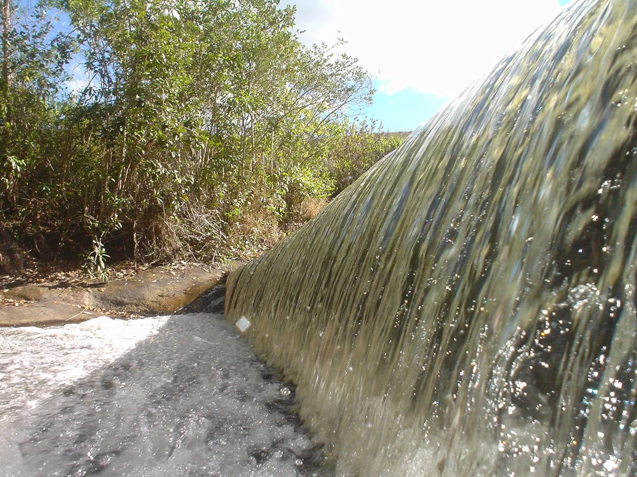
Pedra do Chifre sits on the municipal boundary between Itaipé and Teófilo Otoni. At 1,100 meters of elevation, it is the most prominent landmark in the area, visible from across the surrounding valleys. The name - *horn rock* - comes from the shape of the peak, which juts upward like a curved horn against the sky. It is not the kind of mountain that attracts international climbers, but it is the mountain of this place, the one people grow up seeing, the point toward which every road map is organized. Nearby, the Cachoeira das Bicas - the Waterfall of Spouts - falls roughly 3 kilometers from the city center, providing one of several waterfalls the region is known for.
A Late Municipality
Itaipé did not become a municipality until 1962. Before that it was a district - first of Araçuai, then of Novo Cruzeiro. These district-to-municipality transitions are common in rural Brazil. Settlements that have existed for decades finally acquire the legal status to manage their own affairs, collect their own taxes, and run their own schools. The population today is around 12,836 people spread across 483 square kilometers, giving Itaipé a density that feels properly rural: stone paths, cattle fields, coffee on hillsides, houses clustered around the old church. Distance is part of the municipality's identity. Belo Horizonte - the state capital - is 530 kilometers away.
What People Do
The economy runs on services, small industry, and agriculture. According to 2005 data, services produced about 20 million reals, agriculture about 12 million, and industry about 3 million. There were 1,232 rural producers working 38,000 hectares of land, and roughly 4,100 people depended directly on agriculture for their livelihoods. Only 16 farms had tractors in 2006; most farming work was still done by hand or with animal traction. The main crops were coffee, sugarcane, beans, and corn - the classic combination of cash crop, subsistence staple, and feed grain that defines smallholder agriculture across Minas Gerais. In 2006 there were 6,000 head of cattle in the municipality. In 2007 there was one bank. Car ownership was limited: 347 automobiles and 556 motorcycles between more than 12,000 people - a ratio of 33 inhabitants per car, which tells you something honest about the pace and scale of life here.
The Numbers Nobody Wants
Itaipé's 2000 Municipal Human Development Index - a composite measure of income, education, and life expectancy - was 0.633. In the state rankings of Minas Gerais, that placed it 786th out of 853 municipalities. Nationally, it ranked 4,071st out of 5,138. The literacy rate was 63 percent; life expectancy averaged 67 years. Per capita monthly income in 2000 was well below the state average of R$276 and the national average of R$297. These numbers describe real conditions: limited schooling, shorter lives, less money in the household. They also need context. Poços de Caldas, the highest-ranked municipality in Minas Gerais in 2000, had an HDI of 0.841. Setubinha, the lowest, had 0.568. Across Brazil's 5,507 municipalities, Manari in Pernambuco ranks last at 0.467. Itaipé is not extreme. It is typical of a wide swath of rural interior Brazil where infrastructure and opportunity have arrived unevenly.
Schools and Clinics
In 2005, Itaipé had two health clinics and one hospital with 26 beds. Patients with serious conditions were transferred to Teófilo Otoni, 66 kilometers away. This is the reality for most small Brazilian municipalities - acute care requires travel, often on roads that flood in the rainy season. Educational infrastructure consisted of 22 primary schools, one middle school, and one pre-primary school. The numbers suggest a reasonable primary-school network but limited secondary options. 83.4 percent of urban residences were connected to the sewage system in 2000, a higher figure than infrastructure-poor rural municipalities often post, but not universal. Urbanization was 37.94 percent - meaning the majority of the population still lived in rural zones, scattered across the 38,000 hectares of agricultural land. Life in Itaipé happens outside of town more than inside it, in farmhouses and along country roads, in fields of coffee and sugarcane and corn. The stones the Tupi named the place for still mark the path.
From the Air
Located at 17.40°S, 41.67°W in northeastern Minas Gerais, at 847 m elevation in the town center. Pedra do Chifre rises to 1,100 m on the municipal boundary with Teófilo Otoni. Nearest airport: Governador Valadares (SBGV) about 150 km south, or Teófilo Otoni Airport for smaller aircraft. Best flown in dry winter months (May-September) when visibility over the Minas Gerais highlands is clearest. Recommended viewing altitude: 6,000-10,000 ft to see Pedra do Chifre and the rugged rock formations that give the region its Tupi name.
Nearby Stories
- Ladainha, Minas Gerais 10 km away
- Virgem da Lapa 32 km away
- Minas Novas 44 km away
- Araçuaí 49 km away
- Mata Escura Biological Reserve 84 km away
- Nanuque 88 km away
- Rio Preto State Park 138 km away
- Itaúnas 195 km away