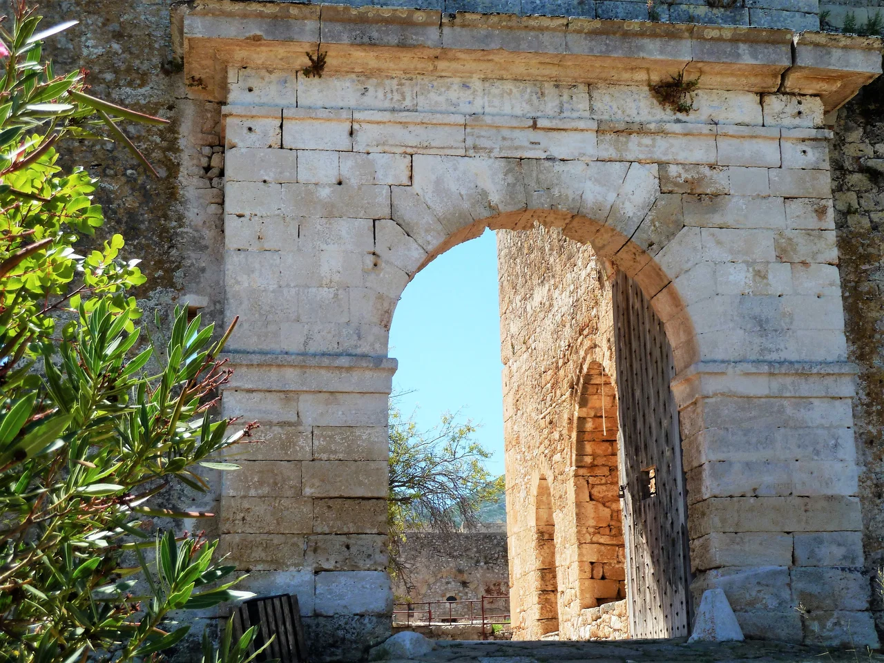

New Navarino Fortress
The Ottomans built Niokastro in a hurry, and built it to last. It went up in 1572 and 1573, just months after the Battle of Lepanto, where a Christian coalition had destroyed the Ottoman fleet and briefly convinced Europe that the empire's Mediterranean ambitions were finished. The Ottomans knew better. Lepanto was a setback, not a defeat. Uluç Ali Reis — the Kapudan Pasha, grand admiral of the Ottoman fleet — personally oversaw the construction of a new fortress at Navarino, designed to anchor Ottoman control of the southwestern Peloponnese and ensure that the great natural harbour at the bay's mouth would never fall easily again.
Built for Gunpowder, Not Swords
The old fortress at Navarino — called Palaiokastro, the Old Castle — sat on a hill to the north, built by Crusaders of the Principality of Achaea in the thirteenth century. It was designed for the warfare of its era: high walls, vertical faces, towers for archers. By the sixteenth century, such walls were liabilities. Artillery could reduce a tall, thin curtain wall in hours. Niokastro was built on entirely different principles. Its walls are thick and sloped, designed to absorb cannonball impacts rather than simply resist them. The design follows the trace italienne, the Italian style of fortification that had become the standard response to gunpowder artillery across Europe. Six pentagonal bastions protected the citadel. An additional dry moat surrounded the inner keep. Almost 60 guns could be mounted along the walls. European military engineers were brought in to design it — the Ottomans, practical as ever, hired the best expertise available.
Guardian of the Southern Entrance
Navarino Bay is one of the largest and most sheltered natural harbours in the Mediterranean — deep, calm, almost entirely enclosed, with only two navigable entrances. Niokastro sits at the southern one. Its two most important bastions, the "Seventh" and "Santa Maria," face directly out to sea, covering the harbour mouth with overlapping fields of fire. A long southern wall called the Great Bough — Megali Verga in Greek — connects the citadel to the Seventh bastion, forming a continuous defensive line along the waterfront. The main entrance to the fortress was through the "Scalding Gate" on the southeast face — a name that suggests what defenders were prepared to pour down on attackers. The entire design assumes an enemy arriving by sea and attempting to force the harbour.
Two Centuries of Ottoman Tenure
Niokastro served the Ottomans for more than 250 years, with interruptions. Venetian forces briefly held the fortress between 1686 and 1715 during the Morean War. The Ottomans retook it and held it through the opening years of the Greek War of Independence, when Greek forces besieged the fortress in 1821 — a siege that ended in the capitulation of the garrison and the massacre of the town's Muslim population. French troops of the Morea expedition under General Nicolas Joseph Maison finally received the fortress from its Ottoman-Egyptian garrison in October 1828, part of the international intervention that secured Greek independence. In 1830, the modern town of Pylos was founded just outside the old walls. The fortress itself was largely abandoned, its citadel eventually repurposed as a prison.
The Mosque That Became a Church
Inside the fortress walls, the settlement that once housed a functioning Ottoman community has largely vanished. Houses, shops, the infrastructure of daily life — all of it reduced to rubble and overgrown foundation stones. One building survives intact: the mosque. After Greek independence, it was converted into an Orthodox church dedicated to the Transfiguration of Christ. The conversion is still visible in the structure's form — a dome, a prayer space organized around the original Ottoman geometry, with Christian iconography layered over the older plan. It is one of those small, quiet survivals that says more about the passage of time than any monument could. The minaret is gone. The muezzin's call has been replaced by church bells. The building itself remains, adapted, still standing at the center of the fortress it once served.
What Endures at the Bay's Edge
Niokastro today is one of the best-preserved Ottoman fortifications in Greece. The walls still stand nearly to their original height. The bastions are intact. The Greek Ministry of Culture administers the site, and the fortress is open to visitors who walk the ramparts above the blue waters of Navarino Bay. Looking south from the walls, you see the open Ionian Sea — the same view the garrison had when scanning for approaching ships. Looking north, the bay spreads out, sheltered and enormous, framed by the long spine of the island of Sphacteria on the west. The fortress mosque, now a church, sits at the center, quiet in the afternoon heat. Pylos goes about its business on the other side of the walls. The battle of 1499 was fought out there in the open water. The battle of 1827 was fought in the bay. The fortress has watched all of it.
From the Air
Niokastro sits at approximately 36.91°N, 21.69°E on the southern edge of Pylos (ancient Navarino), commanding the southern entrance to Navarino Bay on the southwestern Peloponnese coast. From the air, the fortress is unmistakable: the pentagonal bastions, the long curtain walls, and the enclosed citadel are clearly visible against the blue of the bay. The Great Bough wall runs south along the waterfront. To the north, the bay opens up — one of the largest natural harbors in the Mediterranean — with the island of Sphacteria visible as a narrow ridge across the western entrance. The northern hilltop fortress of Palaiokastro (Old Navarino) is visible several kilometers to the north. Nearest airport: LGKL (Kalamata International), approximately 50 km northeast. Approach from the north along the coast; the bay and both fortresses are visible in a single pass at moderate altitude.
Nearby Stories
- Kardamyli 10 km away
- 1886 Peloponnese Earthquake 11 km away
- Vergadeika 18 km away
- Strofades 20 km away
- 2018 Ionian Sea Earthquake 91 km away
- Battle of Cape Spada 171 km away
- Siege of Chania (1645) 245 km away
- Valletta 595 km away