.jpg)
Ninepin Group
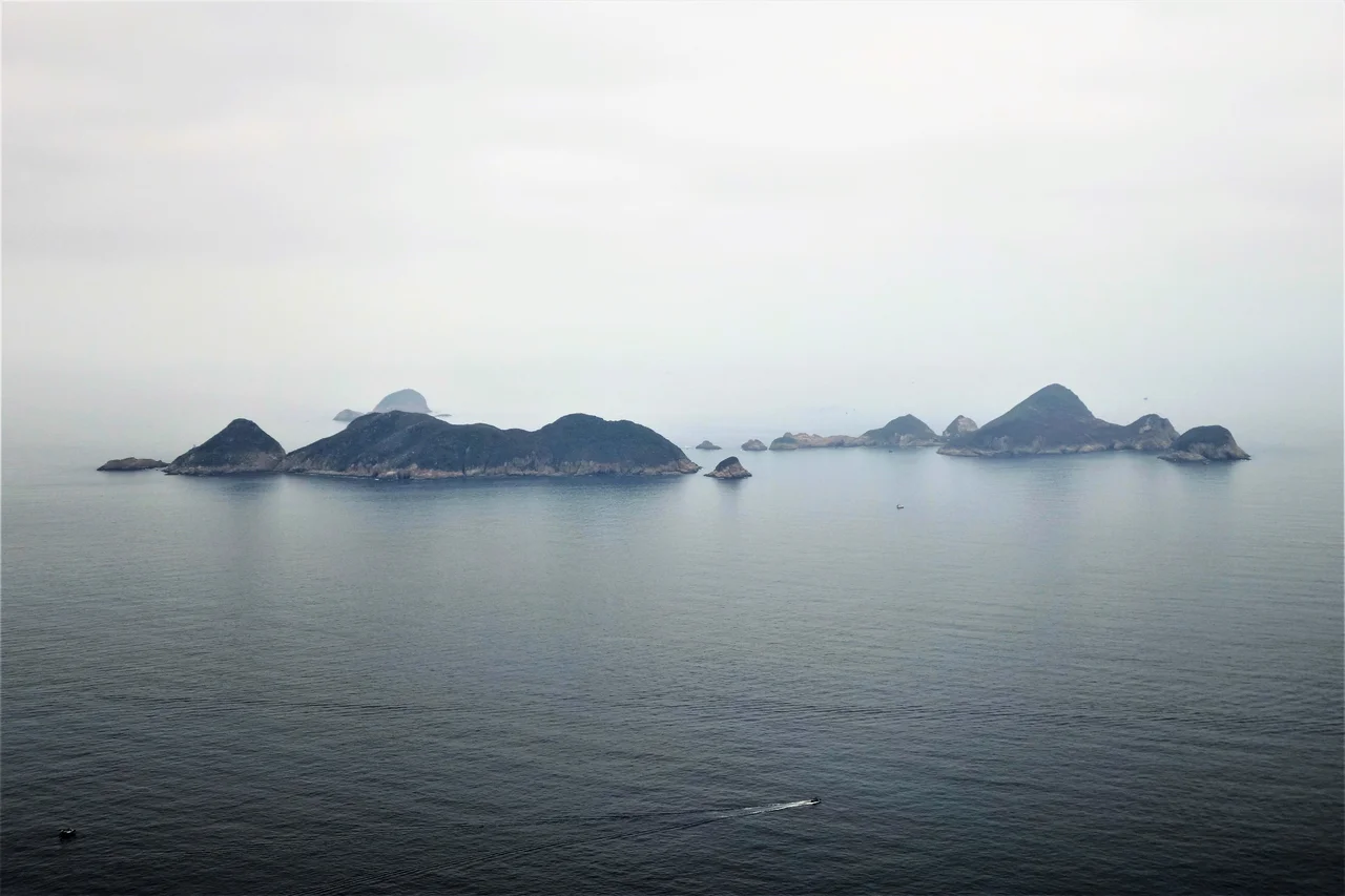
One hundred and forty million years ago, a volcano erupted near what is now Sai Kung, and the rock it produced cooled in a pattern that would astonish anyone who sees it today. The lava contracted as it solidified, cracking into hexagonal columns — some soaring to impressive heights — arranged in vertical arrays so regular they look almost engineered. The Ninepin Group, a cluster of 29 uninhabited islands at the eastern edge of Hong Kong's waters, preserves that ancient geometry in rhyolite. The name comes from their shape as seen from a distance: upright, clustered, suggesting a rack of bowling pins waiting to be scattered.
Fire Made Permanent
Rhyolite is a fine-grained volcanic rock, the extrusive equivalent of granite, rich in silica and formed when magma reaches the surface and cools relatively quickly. At Sai Kung, the eruption that produced the Ninepin Group laid down rock during the Cretaceous period — the age of the dinosaurs — and the subsequent 140 million years have shaped it into something extraordinary.
The hexagonal columns form because cooling lava contracts uniformly in multiple directions, and the geometry of stress propagation in a uniform material tends toward six-sided prisms. The result is a natural architecture that appears in a handful of places around the world — the Giant's Causeway in Northern Ireland, Fingal's Cave in Scotland, the Devils Postpile in California — but the Ninepin Group's version has a dramatic vertical scale and ocean setting that gives it a particular grandeur. The columns are not hints or suggestions; they are the dominant visual fact of these islands.
Carved by Water
Since the volcanic rock cooled, the sea has been working on it. The Ninepin Group sits in the easternmost waters of Hong Kong, exposed to the South China Sea swells and the heavy tidal action that funnels through the approaches to Victoria Harbour. That erosive force has shaped not only the columns' dramatic profiles but also a network of sea caves throughout the group — hollow chambers carved where the rock fractured and gave way to water.
The constant wave action means the islands are in slow, ongoing transformation. Joints in the hexagonal columns collect water and gradually split through the pressure of salt crystallisation and biological weathering. Sea caves that exist today will be different in a century. The Ninepin Group Special Area, designated in 2011 and covering 53.1 hectares, protects this geological process as well as the resulting landforms. The designation reflects a broader understanding: the significance here is not just in the rock as it is, but in the process that keeps shaping it.
Uninhabited, Not Untouched
No one has ever established a permanent settlement on the Ninepin Group. The tidal conditions that erode the rock so effectively also make landing difficult and sustained habitation impractical. But fishermen have been coming to these waters for a very long time, and someone — at some point in the past — built a small Tin Hau temple on South Ninepin Island.
Tin Hau is the goddess of the sea, protector of fishermen, and her temples mark the edges of the Chinese maritime world wherever it reached. Finding one on an uninhabited island in the easternmost waters of Hong Kong is an act of spiritual insurance — a recognition that if you were going to venture this far out, you wanted the goddess's attention. The temple stands today as the only human structure on any of the 29 islands. Reaching it requires renting a boat; there is no public transport to the Ninepin Group, and none is planned.
On the Edge of Hong Kong
The Ninepin Group falls under the jurisdiction of Sai Kung District, and it is part of the Hong Kong UNESCO Global Geopark — a designation that recognises the scientific and scenic significance of the territory's volcanic geology. Sai Kung itself is known as Hong Kong's 'back garden,' a district of country parks and clear water bays that feels markedly different from the urban density most visitors associate with the city.
The Ninepin Group extends that contrast to its logical extreme. Here, at the eastern margin of Hong Kong's waters, there are no buildings, no roads, no ferry schedule. Only the columns of rock, the sea caves, the working waves, and the small Tin Hau temple recording every vessel that has come this way seeking shelter or passage. It is one of the least visited places in Hong Kong and, by most measures, one of the most remarkable.
From the Air
The Ninepin Group is located at approximately 22.264°N, 114.358°E, in the easternmost waters of Hong Kong near the entrance to the Sai Kung Peninsula. At 2,000–3,000 feet, the distinctive cluster of rocky islands is clearly visible against the South China Sea. The three main islands — East, North, and South Ninepin — are identifiable by their columnar profiles. The nearest airport is Hong Kong International (VHHH), approximately 65 km to the west on Lantau Island. Sai Kung town lies roughly 20 km to the northwest and provides the nearest boat access point.
Nearby Stories
- Shek Pik 1.7 km away
- Tung Ping Chau 4.8 km away
- Hong Kong 12 14 km away
- Wanshan Archipelago Campaign 16 km away
- Pearl River Delta 18 km away
- Battle of Penghu 478 km away
- Penghu Air Raids 487 km away
- Cape Maobitou 596 km away