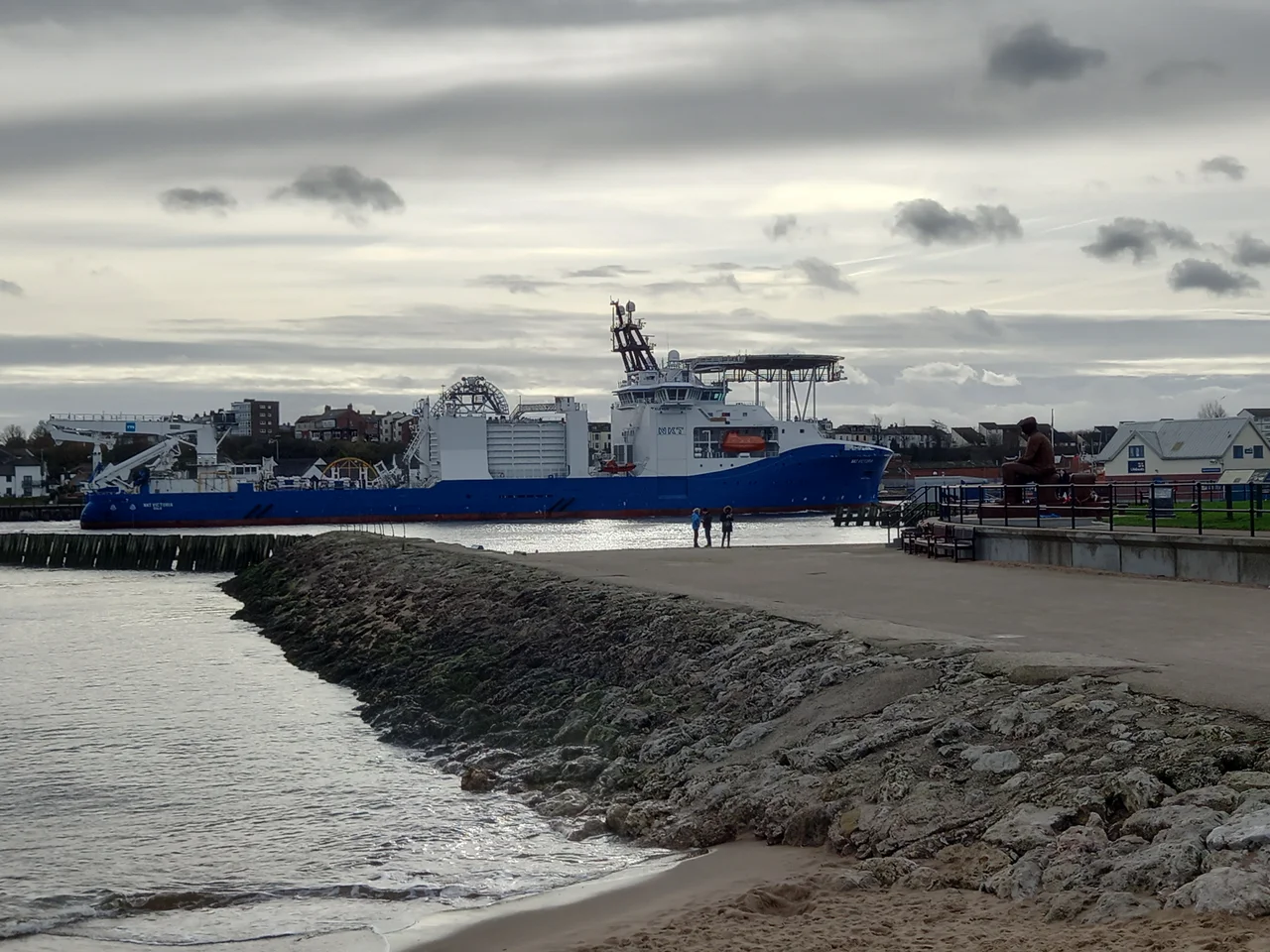

North Shields Fish Quay
In the 13th century the burgesses of Newcastle set fire to this place. The competition was the problem. The Prior of Tynemouth, Germanus, had set up a fishing port at the mouth of the Tyne in 1225 to feed his priory, and the new wooden quays at North Shields began siphoning coal and fish trade away from Newcastle's monopoly upriver. Newcastle's response was arson, followed by a successful 1290 petition to the king that suspended trade from the new settlement entirely. The port survived anyway. Today it is the largest English port for prawns.
Shielings on the Pow Burn
The name itself is a survival. Shielings were the rough seasonal huts used by hunters and fishermen, and a cluster of them grew up around the mouth of the Pow Burn in 1225 to serve Tynemouth Castle and Priory just up the bluff. The Pow Burn still flows from Northumberland Park, though it disappears underground at Tynemouth Road before sliding into the Tyne. The original wooden quays were positioned to land catches and ship the coal mined nearby for the priory. The trouble was that Newcastle's trade guilds resented anyone doing business outside the city walls. They engineered a rule so absurd it makes the cartel obvious: coal mined within 300 feet of the river at North Shields had to be carted eight miles overland to Newcastle to be loaded onto a boat. The Hostmen of Newcastle defended that monopoly for centuries.
The Black Middens and the Lighthouses
Before the north and south piers were built, many ships foundered on the Black Middens, a reef of rocks visible at low tide east of the quay. The body count was high enough that the port commissioned not one but two pairs of lighthouses. The Old High Light and Old Low Light were sited so that a captain could line them up by sight and steer clear of the rocks; one stood at river level on the quay, the other 150 feet above on the bank top. When silting and shifting channels changed the safe approach, the High Light and Low Light replaced them. All four are defunct now. The Old Low Light building reopened as a heritage centre in 2015. Clifford's Fort, built on the quay in 1672 as a coastal defence against the Dutch during the Anglo-Dutch Wars, still stands at the water's edge.
The Last Smokery
The present quay was rebuilt in 1870 to accommodate the steam trawlers that had arrived to transform North Sea fishing. The port's proximity to the Dogger Bank drew boats from Whitby and along the north-east coast. For decades North Shields was the biggest kipper producer in the United Kingdom, a trade so dominant that the air itself smelled of smoked herring on a still day. Then the herring stocks collapsed. The kipper trade contracted to a single smokery. The other traditional smokehouses still exist but have been converted into apartments, restaurants and bars as the quay reinvented itself as a riverside food destination in the 21st century. A healthy seafood trade still runs out of here, mostly crab and prawn, with refrigerated lorries leaving daily. Walk the quay at dawn and the working port and the gastropub coexist within twenty yards of each other.
Flight Context
Coordinates 55.01 N, 1.43 W on the north bank of the Tyne near the river mouth, approximately 8 miles east of Newcastle city centre. Recommended viewing altitude 1,500 to 3,000 feet. The quay runs along the river beneath a steep wooded bank, with the ruins of Tynemouth Castle and Priory visible on the headland to the east at the river entrance. Look for the four lighthouses, two on the quay and two on the bluff above. Nearest ICAO airport Newcastle International (EGNT) is 8 nautical miles west. Durham Tees Valley (EGNV) is 28 nautical miles south.
From the Air
Coordinates 55.01 N, 1.43 W on the north bank of the Tyne near the river mouth. Viewing altitude 1,500 to 3,000 feet AGL. Nearest ICAO airport Newcastle International (EGNT) is 8 nautical miles west; Durham Tees Valley (EGNV) is 28 nautical miles south. Look for the four lighthouses, Clifford's Fort, and the Tynemouth Priory ruins on the headland to the east.
Nearby Stories
- Cresswell Lifeboat Station 5.2 km away
- Auckland Castle 5.7 km away
- Battle of Otterburn 7.1 km away
- Saltburn Pier 11 km away
- Hadrian's Wall Path 11 km away
- Battle of Stainmore 18 km away
- Saltburn-by-the-Sea 39 km away
- Alexander L. Kielland (Platform) 296 km away