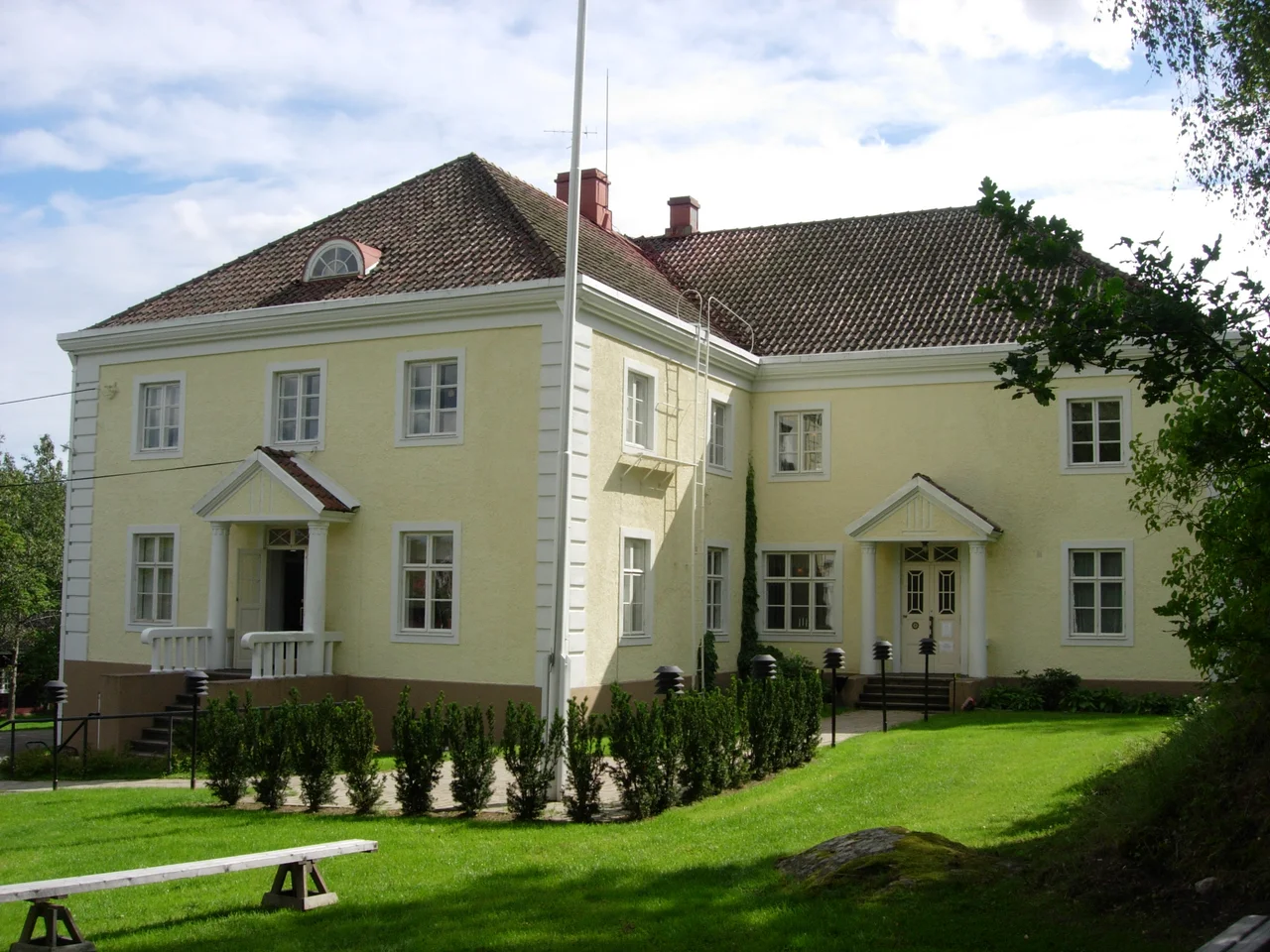

Old Castle of Lieto
The name is a joke about time that nobody meant to make. Vanhalinna translates as old castle, and people were calling it old in the Middle Ages, while the real stone fortress downriver at Turku was still going up. Nothing on this hill matches the postcard version of a castle. There is no curtain wall, no keep, no drawbridge across a moat. What Lieto has is a rock rising fifty-five metres above the sea, with the Aura River curling past one flank and Finland's most storied overland route running past the other. For something close to two thousand years, that combination was reason enough to climb up here and dig in.
A Rock Between Two Roads
The Aura carried boats inland from the coast. The Hämeen Härkätie, the Ox Road, ran overland from Turku to Hämeenlinna, a journey reckoned at 162 kilometres in the sixteenth century, linking the castle at one end to the castle at the other. The historian Jaakko Masonen argued the route was already in use by the 800s, carrying furs and forest goods down toward the trading places of the west coast. Whoever held the hill at Lieto watched both lines of traffic at once. The stretch of old road passing below, Vanhalinnantie, survives today as a protected museum road, the longest section of the Härkätie still in something close to its original gravel form. Stand on the rock and the whole logic of the place resolves in a single glance: water on one side, road on the other, and a hillside steep enough that coming up it uninvited was a bad idea.
Three Times the Hill Filled Up
Excavation has sorted the occupation into three distinct spans. People fortified the summit in the late Bronze Age, roughly 1100 to 500 BCE. They came back during the Merovingian period, between about 500 and 700 CE. Then came the long medieval tenancy, running from around 1000 to 1370. The earliest defensive structures date to 500 BCE, and the remains of eleven buildings have been traced across the top. The clearest human record on the hill, though, is burning. Layers of fire run through the sequence from the Migration Period all the way to the 1360s, and after each one somebody carried timber back up the slope and started again. Nobody kept a hillfort in repair for fun. The fires say that this rock mattered enough to be worth attacking, and enough to be worth rebuilding.
Fourteen Arrowheads, One Hundred and Fifty Bolts
The weapon finds tell a story in proportions. Fourteen arrowheads have come out of the ground, against a hundred and fifty crossbow bolt heads, along with thirty-three iron rings from chain mail and a scatter of spearheads, the oldest dated to the 500s. Crossbows do not outnumber bows by that margin unless the fighting here was concentrated in the later centuries, when the weapon and the armour arrived together. The coins mark a different kind of shift. German silver characterises the years from 1000 to 1150; from 1200 to 1370 it is Scandinavian bracteates instead, a quiet register of which way the trade and the power had swung. Building technique moved as well, from wattle-and-daub in the prehistoric phases to brick in the last one, with two concentric defensive lines and an outer bailey by the medieval period.
Eclipsed From Downriver
Around 1280, work began on Turku Castle at the mouth of the Aura, and the calculation changed. A masonry fortress on the coast, backed by the Swedish crown, did what a wooden hillfort in the interior could not, and it did so permanently. Upstream at Korois, Finland's first ecclesiastical centre had already established a rival focus of authority. Vanhalinna faded rather than fell, its last traces of fire dating to the 1360s, and then the hill went quiet and the fields around it went on being farmed. That is how the name arrived. By the time anyone needed to distinguish this place from the new castle, the only word for it was old.
The Family That Took the Ruin's Name
Centuries later the hill acquired a household that had adopted its name in the old orthography, where a W did the work of a V. Mauno and Ester Wanhalinna kept the estate as a manor, with a massive neoclassical main building finished around 1930, and on Snellman Day in 1956 they handed the whole property to the University of Turku. Ownership passed to the university's foundation in 1974, and a dedicated Liedon Vanhalinna foundation was set up in 1998. The donation came with a condition, and the condition is why you can visit: the estate had to house a museum. It does, displaying archaeological finds from Varsinais-Suomi, the province of Finland Proper, running from the Stone Age onward, alongside a folk-culture collection of farming tools and rural life. The finds are shown a few hundred metres from the ground that produced them, which is rarer than it sounds.
From the Air
60.4864 N, 22.3772 E, on the east bank of the Aura River about 12 km east-southeast of Turku city centre. The hill itself rises only 55 metres above sea level, so pick it out by the river bend and the pale line of Vanhalinnantie rather than by relief; the neoclassical manor building on the summit plateau is the clearest visual marker. Turku Airport (EFTU) lies roughly 15 km west-northwest, and its circuit traffic gives a useful reference line. A viewing altitude of 1,500 to 2,500 feet AGL shows the river, the old road and the hillfort plateau in one frame. Best light is low summer sun; winter haze and low stratus off the Archipelago Sea can flatten the whole valley into a single grey plane.
Nearby Stories
- Vaskijärvi Strict Nature Reserve 4.8 km away
- Teijo, Salo 6.9 km away
- Sarka (museum) 7.5 km away
- Karuna Church 12 km away
- Halikko Church 21 km away
- Battle of Grönvikssund 22 km away
- Pyhämaa 27 km away
- Battle of Bomarsund 87 km away