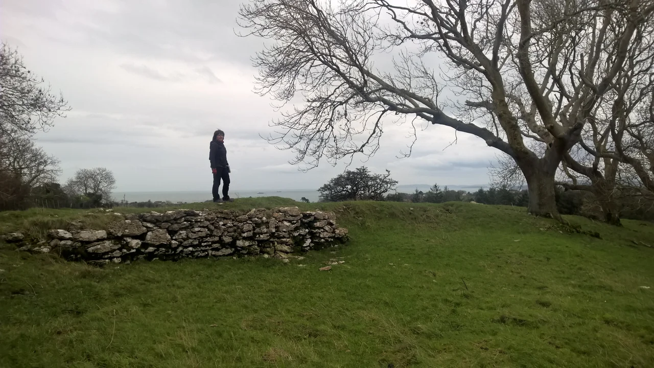

Parciau hill fort
From above, the bones of the settlement appear in dry weather as parch marks - faint discoloured rings in the grass where the buried stone foundations of huts choke the roots. Aerial photography of Parciau hill fort has counted about twenty-eight such rings inside the walls, each roughly seven to eight metres across, packed tightly together. That is a substantial Iron Age community on a small Anglesey hilltop. The fort stands on Bryn Ddiol - the 'trackless hill' - a 95-metre plateau of Carboniferous limestone whose three sides drop away as natural cliffs and steep slopes. A wall continues around the outcrop, enclosing about 110 by 80 metres of protected ground. There are caravan parks now where the views once mattered most. But the bones of the place persist.
The Trackless Hill
Bryn Ddiol is the eastern termination of a limestone outcrop two kilometres inland from beaches on the north-west coast - though strictly Parciau lies in eastern Anglesey, looking out across the Irish Sea. The summit commands sweeping sea views and would have made the settlement difficult to surprise from any direction. On three sides the natural cliffs do the work of fortification; on the fourth, the more accessible flank, the builders constructed a stone wall completing the enclosure. The protected area inside is about 110 metres long and 80 metres wide - around 8,800 square metres. With twenty-eight hut circles packed inside, the place would have been crowded. The name 'trackless hill' suggests a place without easy approach, which was probably the point. Iron Age hillforts on Anglesey often sit on outcrops chosen for exactly this reason: hard to climb, easy to see, easy to hold.
The Roman Pieces
Excavations in 1867 by a researcher named Prichard cut through the floor of one of the hut circles and found, mixed in with marine shells, charcoal and the bones of domestic animals, fragments of Roman pottery - white, light grey, black, and brick red. One sherd was identified as 'Samian,' the fine red Roman tableware that turns up wherever Romans went. Two pieces of larger bone showed possible tally marks. There was an iron nail, a small bowl carved from red sandstone (16 inches by 12), and a dressed stone twelve inches long by four inches square. Later digs by Baynes found probable fragments of box tiles - the standard component of Roman underfloor heating systems. A hypocaust nearby suggests that someone in the late Roman period was living comfortably enough on the trackless hill to want their floors heated. None of this is what you would expect of a typical Welsh Iron Age site.
Abandonment and Return
Strikingly, no finds at Parciau have been attributed firmly to the pre-Roman Iron Age. The earliest material datable with confidence is Roman. Modern interpretation, summarised by the archaeologist Waddington, suggests that the hillfort was probably built before the Roman conquest of Anglesey in 60 AD (when Suetonius Paulinus crossed the Menai Strait against the Druids) - but that it was abandoned at or shortly after that conquest. The Romans destroyed the religious centres on the island and dispersed the population. Then, perhaps two or three centuries later, as the western Roman Empire weakened and security failed across Britain, the descendants of the same families - or their successors - returned to the trackless hill. They reused the old stone walls, built new round houses on top of the old ones, and lived through the chaotic centuries between the legions and the medieval Welsh kingdoms. Roman pottery and box tiles ended up in the floors not because Romans lived here, but because Romanised Britons did, in a Roman-era hill refuge.
What the Aerial Photographs Show
Most of what we know about Parciau comes from aerial photography rather than excavation. Twenty-eight hut bases, packed tightly together. Possible structural walls extending beyond the hilltop. A fragment of a human skeleton encased in 'well constructed walls,' reported during the extension of nearby Parciau farmhouse in the eighteenth century - though Prichard's informants attributed those walls to John Bodvel, a famous local inhabitant of the 1600s. The walls were never excavated. In 2011 the Gwynedd Archaeological Trust monitored earth-moving works at Parciau farm to upgrade the buildings; mechanical stripping uncovered only the foundations of recent service trenches and the previous farmhouse. The undisturbed archaeology beneath the modern surface remains exactly that - undisturbed. Parciau is Scheduled Ancient Monument AN041, officially protected. The hilltop now hosts modern caravan sites and farmsteads in places, but the old enclosure walls and the parch marks of the Iron Age round houses persist in the fields between.
From the Air
Parciau hill fort at 53.34 N, 4.26 W, in eastern Anglesey on the limestone outcrop of Bryn Ddiol, 95 m above sea level. The hill is about 2 km inland from beaches on the east coast, with the modern caravan parks of Marian-glas and Lligwy nearby. The hill stands out from the surrounding flatter land but is not dramatically prominent from cruising altitude. Nearest airports: Anglesey/Valley (EGOV) 18 nm west, Caernarfon (EGCK) 18 nm south-west. From the air the fort's outlines are clearest in dry summer conditions when parch marks reveal the buried hut bases - the same imaging condition that lets the archaeology be read by aircraft.
Nearby Stories
- Llandudno Lifeboat Station 3.8 km away
- Glynllifon 6.1 km away
- German submarine U-1024 9.4 km away
- Irish Sea Bridge 11 km away
- Ysbyty Ifan 12 km away
- Irish Sea 18 km away
- Celtic Array 18 km away
- Birkdale Palace Hotel 56 km away