Pelumpong Island: Brunei's Accidental Eden
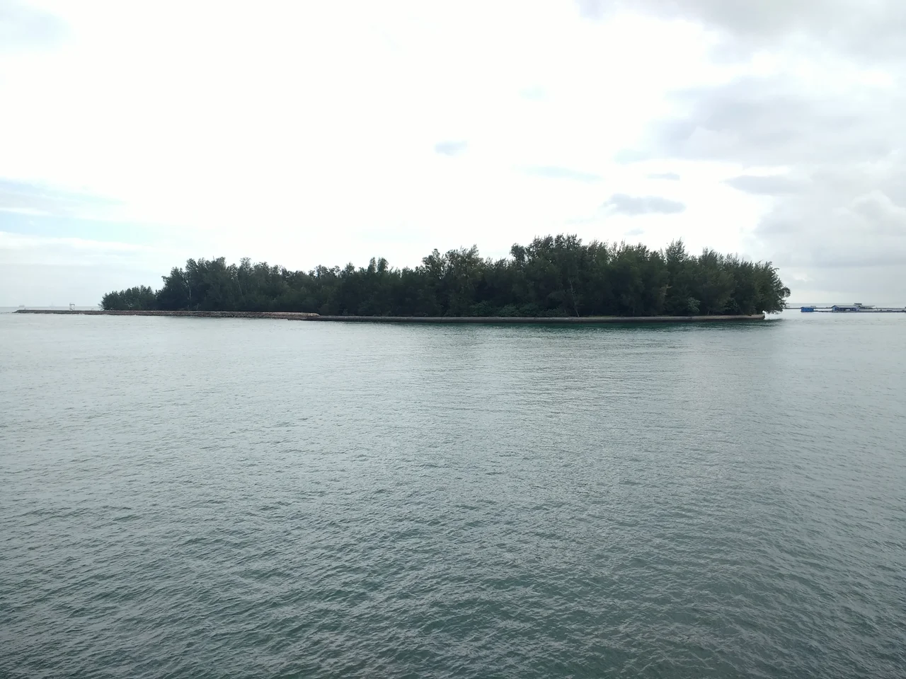
It started as an act of subtraction. When engineers dredged a shipping channel through the Tanjong Pelumpong sand spit in the 1970s to build Muara Port, they severed the spit from the mainland and left behind a 64-hectare island that nobody had planned. The channel was armored with concrete and boulders, groynes were installed to prevent silting, and the port went about its business. But the island refused to be an afterthought. Its eastern edge began creeping outward at 30 meters per year, building itself grain by grain. Corals colonized the groynes. Seagrass meadows spread across the shallows. Within four decades, Pelumpong Island had transformed from an engineering byproduct into one of the richest marine habitats in Brunei Bay.
A Reef That Shouldn't Exist
The coral community at Pelumpong defies expectations. Sedimentation rates here average over 70 milligrams per square centimeter per day -- levels that would smother most reef systems. Yet coral cover on the southeast-facing groyne reaches a remarkable 59.8 percent, with 34 identified taxa of scleractinian corals thriving in waters that, by conventional wisdom, should be hostile to them. The secret lies in a fortunate combination of physics and biology. Moderate wave exposure sweeps sediment from coral surfaces, while species like Pectinia paeonia and Turbinaria mesenterina have evolved active sediment rejection mechanisms that let them flourish where more delicate corals like Acropora cannot. Some colonies are massive and well-established, their growth reflecting 37 to 40 years of steady accumulation. Fluorescent bands in Porites lutea cores read like tree rings, recording the ecological history of a reef that nature assembled on a human-made foundation.
Where the Dugongs Graze
Below the waterline, Pelumpong holds another surprise. Seagrass meadows carpet the shallows around the island, forming a quiet cafeteria for one of Southeast Asia's most elusive marine mammals. The endangered dugong -- sometimes called the sea cow for its placid, herbivorous temperament -- feeds in these waters, grazing on seagrass with a deliberateness that belies the precariousness of its situation. Dugong populations across the region have declined sharply as coastal development destroys their feeding grounds. That Pelumpong's meadows persist alongside active port operations and aquaculture farms speaks to a delicate balance. The island sits within a tropical estuarine environment, flanked by mudflats and mangroves along the adjacent mainland shores, with the Western and Eastern Channels converging near its tip before flowing out into the South China Sea. It is a place where saltwater and freshwater negotiate their boundary, and where an animal that has been swimming these seas for 50 million years still finds enough grass to eat.
Fish Cages and Floating Fortunes
Pelumpong's economy floats. Literally. A 122-hectare offshore fish cage culture farm dominates the waters around the island, producing seabass, pompano, red snapper, and grouper in quantities that make it a cornerstone of Brunei's fisheries industry. In 2018, the farm yielded 315 metric tons of fish annually, with projections for 2019 aiming at 546 metric tons. Grouper alone accounts for roughly 60 percent of Brunei's total fisheries production, and much of it comes from these cages. Expansion plans include oyster breeding, pushing the island further into the center of Brunei's aquaculture ambitions. The scale of the operation is visible from the air: geometric arrays of floating cages stretching across the bay, tended by small boats that shuttle between them. It is industrial farming on water, and it sits beside a coral reef of uncommon richness -- a juxtaposition that captures the tension Pelumpong embodies between economic utility and ecological value.
Spit, Island, Strategic Asset
Pelumpong's transformation did not end with the dredging. The channel between the former spit and neighboring Pulau Muara Besar was originally cut to 9 meters during Muara Port's construction, then deepened to 12.5 meters in 2000 as plans advanced to develop PMB into a supercontainer port. An access canal was excavated along the spit itself, and portions near the channel were designated for port operations, marine police activities, and Royal Brunei Navy use. Historical records from 1966 note nautical beacons near the spit, suggesting it served as a navigation marker long before anyone thought to cut it loose from the mainland. Today, the island occupies an improbable niche: part military installation, part aquaculture hub, part accidental nature reserve. A grove of trees 18 to 37 meters tall stretches 1.75 kilometers westward, while the sandy Muara Spit extends 5.23 kilometers to the northeast, its first two kilometers partially submerged and its outer edge dropping to depths of 4.3 meters, marked by distinctive tide-rips that warn approaching mariners.
From the Air
Pelumpong Island sits at 5.05°N, 115.10°E in Brunei Bay, southwest of Bandar Seri Begawan. From the air, look for the distinctive sandy formation at the southern entrance to the bay, with the long Muara Spit extending northeast. The geometric patterns of fish cage farms are visible in surrounding waters. Brunei International Airport (WBSB) lies approximately 15 km to the northeast. Best viewed at 2,000-3,000 feet to appreciate both the island's shape and its relationship to Muara Port and the shipping channels.
Nearby Stories
- Labuan 9.7 km away
- Sabah State Railway 12 km away
- Brunei's Billion-Dollar Bet on Urea 16 km away
- Brunei's Green Jewel Across the Bay 18 km away
- Where the River Meets the Sea 26 km away
- Starcevich Monument 38 km away
- Raid on Kalabakan 206 km away
- Luconia Shoals 238 km away