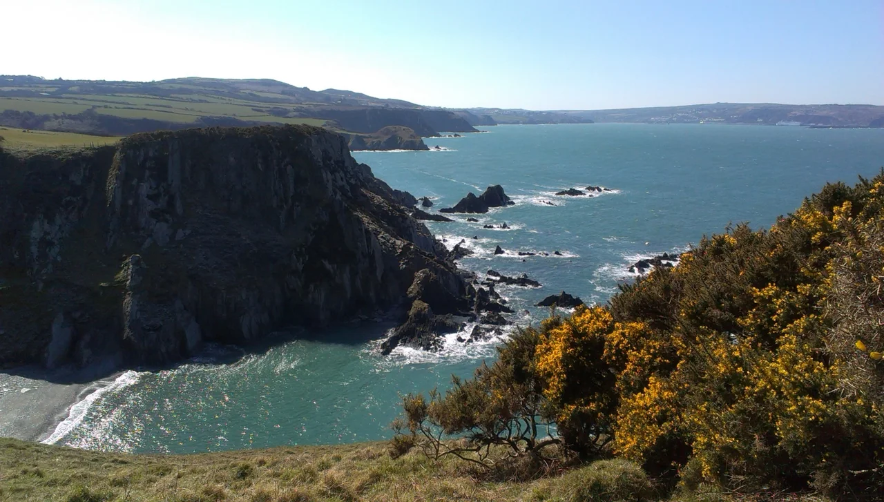

Pembrokeshire Coast Path
Thirty-five thousand feet. That is the cumulative climb of the Pembrokeshire Coast Path, which equals the height of Everest from sea level, accomplished one Welsh stile at a time. The trail runs 186 miles along the western edge of Wales, from Amroth in the south to St Dogmaels in the north, mostly hugging the cliff edge a few yards from a long drop into the Irish Sea. It opened in 1970, the result of a survey by the naturalist Ronald Lockley, who walked the coast in the early 1950s and reported back to the Countryside Commission that a continuous footpath was feasible if landowners would cooperate. Most did. Some refused, which is why the path occasionally swerves inland through hedgerows and field gates before remembering itself and returning to the sea.
A Naturalist's Line
Ronald Lockley was not a hiker by trade. He was a naturalist who had lived on the Pembrokeshire island of Skokholm and written acclaimed books about puffins and shearwaters before being asked to survey a possible route around the county's coast. The 1952 establishment of the Pembrokeshire Coast National Park, Britain's only coastal national park, gave the project political momentum. Lockley walked, measured, and negotiated. He produced a 1953 report broadly adopted by the Countryside Commission, though the path itself would take another seventeen years to open. Today, much of what he proposed has held. The trail still runs close to the cliff edge wherever possible and detours inland only where it must, around Castlemartin's tank ranges and a few stubborn estates.
Five Hundred Million Years of Stone
Every step on the path crosses a geological time machine. Precambrian granites, more than 300 million years old, surface on Ramsey Island and at the peninsula's southern tip. Cambrian sandstones built St David's Cathedral. Ordovician muds form the dark cliffs of the north coast, scrambled by ancient volcanoes that left hard plugs jutting into the sea. The southern Marloes peninsula shows Silurian limestone and shale, banded like a layer cake. Then ice came. The last glaciation gouged out drowned valleys, leaving the Cleddau estuary, Milford Haven's deep harbour, and the rounded coves at Solva. Walk the path and you walk through chapters of Earth's biography arranged in cliff faces, each headland a different age, each bay a different story.
What Lives at the Edge
The cliffs are alive in spring. Thrift and sea campion bloom pink and white along the path, kittiwakes scream from ledges, and guillemots crowd onto stacks so densely they look like grey shingle. Offshore, Skomer, Skokholm and Ramsey hold internationally significant seabird colonies, including the largest Manx shearwater population on Earth. Seals haul out on hidden beaches and pup in autumn. Porpoises hunt the tide rips. Choughs, the red-legged crows that vanished from much of Britain, still tumble around the Pembrokeshire headlands, riding the updrafts. The path passes 58 beaches and 14 harbours, and in 2011 alone Pembrokeshire's coast collected 13 Blue Flag Awards, more than any single county along this coastline.
The Pilgrim Coast
The path threads a landscape soaked in story. Neolithic burial chambers stand a few yards off the trail at St David's Head. Iron Age promontory forts, probably built by settlers from Gaul, ring almost every defensible headland. The medieval pilgrim route to St Davids Cathedral crossed this coast, with two visits to the shrine of Wales's patron saint counted as equivalent to one trip to Rome. Eighteenth-century smugglers landed brandy and salt in the coves around Solva. The Second World War left coastal pillboxes camouflaged into the rocks. The Cold War left RAF Brawdy, the SOSUS Navy hydrophones, and the Royal Naval Armament Depot at Trecwn, all close enough that a determined walker could pass them in a day. Old defences, old devotion, old smuggling routes, all laced onto the same thin ribbon of footpath.
How People Walk It
Almost no one walks the whole thing in one go. Most visitors take a few miles at a time, parking at a village and catching the Puffin Shuttle or the Strumble Shuttle back to the car. Pembrokeshire's coast buses, with names like the Coastal Cruiser and the Poppit Rocket, exist specifically to support walkers. For the brave, end-to-end takes about two weeks, with the two tidal crossings at Dale and Sandy Haven adding planning headaches if you miss the low water window. There are no chairlifts, no shortcuts, no cable cars. Just stiles, gorse, gulls, and the long blue Atlantic always to your left if you're heading north.
From the Air
The Pembrokeshire Coast Path traces the western edge of Pembrokeshire at approximately 51.87°N, 5.18°W. From altitude, the coastline reads as a dramatic crenellated edge between green farmland and dark blue sea, with the path itself invisible but its passage marked by white-painted villages strung along headlands. The nearest airfields are EGFE (Haverfordwest) inland to the east and the former RAF Brawdy west of Haverfordwest. Plan a low-level run along the cliff tops at 1,500-2,500 feet AGL for the best perspective on the volcanic stacks and sea caves; the path's highest point at Pen yr afr on Cemaes Head reaches just 175 metres above the water.
Nearby Stories
- RAF Angle 0.9 km away
- Cardigan Bay Special Area of Conservation 5.4 km away
- Abercych 11 km away
- Cantre'r Gwaelod 12 km away
- Burry Port Lifeboat Station 22 km away
- Johnstown Castle 61 km away
- Hook Lighthouse 92 km away
- 1979 Fastnet Race 157 km away