
Penbryn
Stand in the field above the church at Penbryn and you can see two thousand years of Welsh memory laid out at once. A 1.4-metre slab of stone rises from the grass, carved in the sixth century with Latin letters that nobody now reads with confidence: CORBALENGI IACIT ORDOVS. Lies here, perhaps, a man of the Ordovices tribe. Or, by another reading, the place where they were thrashed in battle. Below the field, the wooded valley of the Hoffnant runs down to Traeth Penbryn, a long sweep of National Trust sand where, in the 18th century, smugglers landed their goods in the dark.
The Corbalengi Stone
Edward Lhuyd, the great Welsh antiquary, first noted the stone in 1695 in a field near the church. It stood, at that time, above a cairn of smaller stones that contained an urn of ashes, a Roman gold coin minted in AD 69, and a scatter of silver and bronze coinage. The combination - inscribed monolith, cremation urn, dated Roman coins - is the kind of dense archaeological accident that fixes a moment. Someone of importance was buried here, sometime after the Roman withdrawal but in a culture still using Latin for monuments. The inscription's final word, ORDOVS, almost certainly refers to the Ordovices, a tribe of north Wales known to Tacitus. Whether the man honoured was a settled Ordovices noble or whether the stone records the defeat of an enemy tribe called the Corbalengi - of whom no other record exists - depends on which letter you read after IACIT. Either way, sixteen centuries later, the stone is still standing where it was set.
A Church on a Druidic Ground
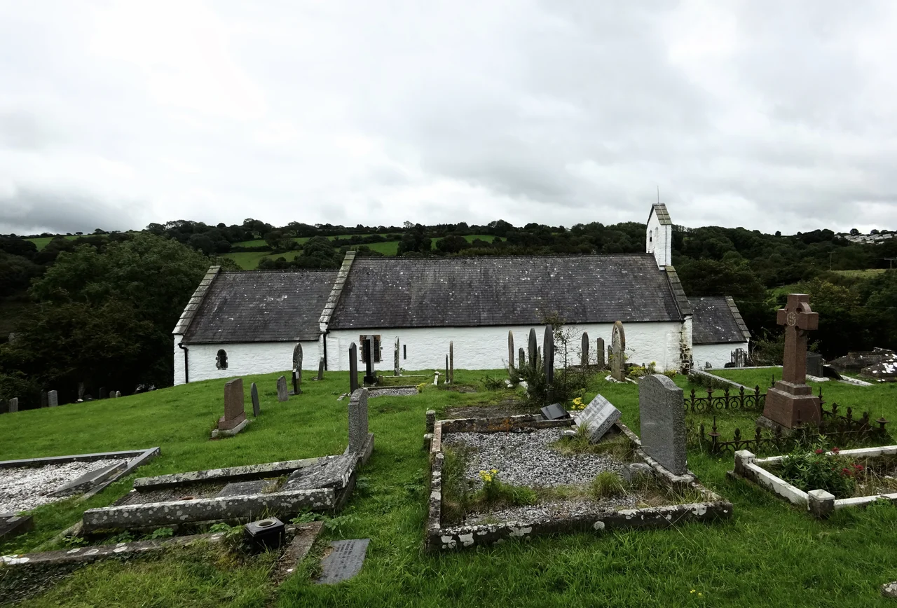
The Grade I listed church of St Michael sits inside a circular churchyard, a shape that almost always indicates a pre-Christian sacred site. Welsh tradition reasoned that a circle gave the devil no corner to hide in. The church itself is medieval - a 13th-century nave, a 14th-century chancel, a 17th-century porch - with a medieval slate roof that is one of the building's chief glories. From its perch on a promontory above the sea, you understand the name: Pen Bryn, Hill Head. The land falls away from the churchyard wall toward the cliffs and the Hoffnant valley, the river running down through woods that have screened many things over the centuries, sometimes prayer and sometimes contraband.
Robbers Valley
Cwm Lladron, the Welsh name of the wooded valley behind the beach, translates as Robbers Valley. In the 1740s the Methodist leader Howell Harris visited the area on one of his great evangelical tours and described it bluntly as dark country. He meant it in both senses. Penbryn's beach, sheltered by cliffs and screened by the wood, was a textbook landing place for the goods that the British government had spent the century taxing and that the Welsh coastal economy had spent the century smuggling. Brandy from France, tobacco, salt, lace. The trade ran in alongside the legitimate cargoes - lime barged across from south Pembrokeshire to sweeten the acidic Ceredigion fields - until the 1860s, when the exposed shoreline and the changing economics made even the legal landings unviable. By the 1880s, anti-tithe rioters were marching where the smugglers had once unloaded barrels.
Bond, the National Trust, and a Beach Without Buildings
Traeth Penbryn is a long, level sweep of sand that the National Trust now owns. There are no kiosks on the dunes, no holiday flats above the cliffs. The beach is reached down a narrow lane through trees, a deliberate choice to leave the approach quiet. In 2002 the producers of Die Another Day used Penbryn as a Korean beach for the film's final scenes, where Bond and Jinx enjoy a cache of stolen diamonds in a makeshift shack constructed directly behind the beach. At the north end, several caves cut into the rock, and at low tide a long sandy bay opens northward toward Tresaith, which can be reached on foot if the tide co-operates. The Ceredigion Coast Path runs along the cliffs above, climbing and dropping with each cove. Stand on the high ground and you have the Corbalengi Stone at your back, the circular churchyard to one side, the smugglers valley below you, and the bottlenose dolphins of Cardigan Bay perfectly possibly visible offshore.
From the Air
Located at 52.14N, 4.49W, on the Ceredigion coast about 8 miles northeast of Cardigan. The wooded Hoffnant valley running down to a tan-coloured beach is a useful low-level landmark, with Tresaith and its waterfall just to the west. Nearest aerodrome is Haverfordwest (EGFE) about 27 nm to the south-southwest; Swansea (EGFH) and Pembrey (EGFP) lie further south on the Carmarthen Bay coast.
Nearby Stories
- RAF Haverfordwest 3.7 km away
- Great Western Railway in West Wales 7.7 km away
- West Wales 9.9 km away
- Fishguard Lifeboat Station 13 km away
- Battle of Mynydd Hyddgen 15 km away
- Strata Florida Abbey 18 km away
- Neath and Tennant Canal 21 km away
- HMS Tyler 44 km away