_(cropped).jpg)
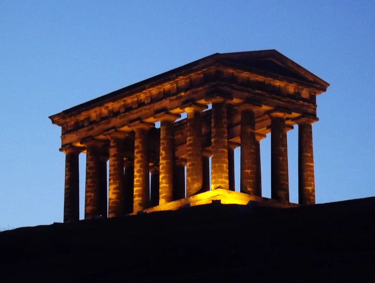
Penshaw Monument
On 28 August 1844 the Earl of Zetland laid a foundation stone in a Masonic ceremony attended by tens of thousands of people. They had come to watch the construction of a half-size Greek temple on a hill outside Sunderland. The temple was supposed to commemorate John Lambton, 1st Earl of Durham, the man who wrote the Durham Report on the governance of British North America and effectively invented the constitutional framework for Canadian self-government. Today, almost no one who passes the monument can tell you who Lambton was. The temple has become its own meaning.
A Temple to a Forgotten Earl
John Lambton, 1st Earl of Durham, died in 1840 at the age of forty-seven. He had served as Governor-General of British North America and produced a report on the future governance of the American territories that became one of the founding documents of Canadian responsible government. His Durham subscribers wanted a monument worthy of him. The architects John and Benjamin Green produced a design based on the Temple of Hephaestus in Athens, a tetrastyle temple of the Doric order. Thomas Pratt of Bishopwearmouth was hired to build it of local gritstone for around six thousand pounds raised by public subscription. Eighteen columns, seven along each long side and four along each short side, would carry an entablature with no roof and no cella. The monument has no inscription of Lambton's name. It is by any architectural definition a folly. It is also a hundred feet long, fifty-three feet wide, seventy feet high, and the largest structure in the North East built solely as a memorial.
The Spiral Staircase
Hidden in the second column from the east on the south-facing side runs a 74-step spiral staircase leading up to a parapeted walkway along the top of the entablature. From up there the view runs to the Cheviot Hills in Northumberland on a clear day, and on the right kind of light the central tower of Durham Cathedral materialises to the south. You can see the sea. The staircase closed to the public in 1926 after a 15-year-old boy fell to his death from the top. The structure slipped into disrepair through the 1930s and was fenced off, repaired in 1939, restored more extensively in 1979 when the entire western side had to be dismantled. Floodlights went up in 1988. The National Trust, which has owned the site since 1939, began offering supervised tours of the walkway in 2011, and the staircase has been open by appointment ever since.
The Lambton Worm and the Football Crest
Penshaw Hill, the 136-metre knoll the monument stands on, has older stories than the temple it carries. There may have been an Iron Age hillfort up here; partial ramparts have been identified. In March 1644 a Scottish Covenanter army camped on the hill after a failed attack on Newcastle before the Battle of Boldon Hill. Most famously, this is the hill associated with the Lambton Worm, the local legend whose 1867 folk song by C. M. Leumane has the dragon wrapping itself ten times round Pensha Hill. The monument has crept into the iconography of the region. Sunderland AFC's crest, adopted in 1997, features a depiction of it. Bob Murray, the club's chairman at the time, explained the decision as recognition that the club's support extends well beyond the city boundary. The temple has effectively become the silhouette of the North East alongside the Tyne bridges and the Angel of the North.
Visible from Fifty Miles
Tradition says that on a clear day Penshaw Monument can be seen from 50 miles away, from the A1 motorway and from much of the surrounding country. About 60,000 people visit the site each year, drawn by the views, the walking, or the photography. The Penshaw Bowl, an Easter egg rolling competition for children, has happened on the hill every Maundy Thursday for over a century. The monument is often illuminated in different colours to mark special occasions: pink for breast cancer awareness, red for Sunderland AFC, rainbow for Pride. Recent sources describe the monument as the landmark that tells locals they are home after a long journey. It is no longer about Lord Durham. It is about looking up and seeing the temple still there.
Flight Context
Coordinates 54.88 N, 1.48 W on Penshaw Hill in the City of Sunderland, between the village of Penshaw and the towns of Washington and Houghton-le-Spring. Recommended viewing altitude 2,000 to 4,000 feet for the monument; 5,000 feet for the wider Wearside conurbation. The temple sits exposed on the south-western edge of an isolated knoll, with the National Trust's 18 hectares of woodland and grassland around it. The A183 Chester Road runs to the south. Nearest ICAO airport Newcastle International (EGNT) is 12 nautical miles north-west. Durham Tees Valley (EGNV) is 19 nautical miles south.
From the Air
Coordinates 54.88 N, 1.48 W on Penshaw Hill in the City of Sunderland. Viewing altitude 2,000 to 4,000 feet AGL. Nearest ICAO airport Newcastle International (EGNT) is 12 nautical miles north-west; Durham Tees Valley (EGNV) is 19 nautical miles south. The roofless Greek temple sits exposed on the south-western edge of an isolated 136-metre knoll surrounded by deciduous woodland.
Nearby Stories
- Cresswell Lifeboat Station 5.2 km away
- Auckland Castle 5.7 km away
- Battle of Otterburn 7.1 km away
- Saltburn Pier 11 km away
- Hadrian's Wall Path 11 km away
- Battle of Stainmore 18 km away
- Saltburn-by-the-Sea 39 km away
- Alexander L. Kielland (Platform) 296 km away