
Penwith
Drop a pin on the most westerly bit of England and you'll land somewhere on the Penwith peninsula. The two Cornish words that make the name say everything: penn for headland, wydh for at the end. Beyond here the Atlantic runs unbroken for 4,000 kilometres to Newfoundland, and the granite plateau that holds Cornwall together starts to disintegrate, fraying into the Isles of Scilly 28 miles south-west. On this small piece of land, fewer than 250 square kilometres, you can find the highest density of Neolithic monuments in Europe, the cliffs and engine houses of the world's most influential tin-mining region, the last bilingual fishing villages where Cornish was spoken into the eighteenth century, and the artist colonies that helped invent British modernism. Penwith is small. It contains a great deal.
Granite All the Way Down
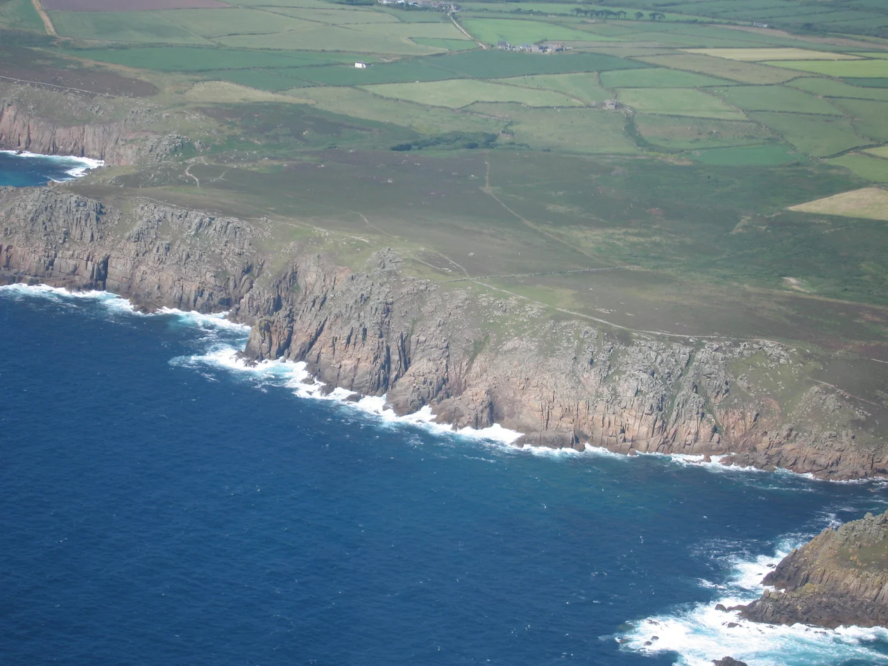
Geologically, Penwith is a granite intrusion - the western tip of a vast batholith that runs underneath all of Cornwall and surfaces in five exposures, of which Penwith is the largest. The granite gives the peninsula its character: thin soils that won't support much arable farming, dramatic cliffs where the rock meets the sea, and the tin and copper veins that made Cornwall rich. At Land's End, the most westerly point in England, you can see the geological contact zone where granite meets the older sedimentary shales it intruded through 280 million years ago. The boundary is sharp enough to read from a passing boat. Inland, much of west Penwith is a semi-bare plateau standing around 130 metres above the sea, treeless except in the sheltered valleys cut into it. The highest point, Watch Croft, rises to 252 metres. From its summit on a clear day you can see both north and south coasts at once.
Bronze Age, Iron Age, Standing Stones
Penwith holds the densest concentration of prehistoric monuments in Europe. The Merry Maidens stone circle near St Buryan - nineteen standing stones in a ring 24 metres across, dating from around 2,500 BC - is among the most complete in Britain. Lanyon Quoit and Chûn Quoit are Neolithic dolmens, their capstones balanced on uprights for five thousand years. Chysauster is the best-preserved Iron Age courtyard house village in Britain, eight stone-built homes laid out in pairs along a street, occupied roughly from 100 BC to 300 AD. Above Madron is Men-an-Tol, a curious doughnut-shaped holed stone of uncertain purpose - possibly Bronze Age, possibly a fragment of a larger monument - through which sick children were once passed for healing well into the nineteenth century. These are not isolated curiosities. They are evidence that Penwith was densely inhabited and ritually important for thousands of years before written history begins.
Tin and the Diaspora
Tin and copper have been worked here since before the Romans came. The Cornish were trading tin to Phoenician merchants by 600 BC, and stream-tin from the rivers of west Cornwall reached Mediterranean bronze foundries. The eighteenth and nineteenth centuries brought deep-shaft mining. Botallack, on the cliffs north of St Just, ran its tunnels half a mile out under the seabed - miners working a thousand feet down could hear waves rolling boulders along the rock above their heads. Levant, just along the coast, used a man-engine to lift workers in and out of the shaft, until the engine failed in October 1919 killing 31 men. Cape Cornwall, Ding Dong, Geevor - each name marks a mine. When the price crashed Penwith men sailed for Australia, Mexico, California, South Africa, Michigan, taking their skill with them. "A hole in the ground anywhere on Earth, and you'll find a Cornishman at the bottom of it." The last working mine in the peninsula, Geevor at Pendeen, closed in 1990 and is now a heritage site.
The Language That Almost Died
Penwith was the very last part of Cornwall where Cornish was spoken as a community language - not preserved by scholars but used by fishermen and their wives in their kitchens. Dolly Pentreath of Mousehole, who died in 1777, is traditionally called the last native speaker, though she was not quite the last. A year after her death the naturalist Daines Barrington received a letter from William Bodinar of Mousehole, written in Cornish with an English translation, reporting that five people in that village could still speak the language. John Nancarrow of Marazion lived into the 1790s as a native speaker. Chesten Marchant of Gwithian, who died in 1676, was the last known monoglot - someone who spoke only Cornish, no English. The community language faded into bilingual death over those decades. In the twentieth century, Cornish was revived from documents; today around 500 people speak it fluently, and signs throughout Penwith are bilingual.
The Light That Made Them Come
Painters discovered Penwith in the late nineteenth century. The clear maritime light of the peninsula, washed by sea air on both sides, illuminates the granite headlands and the slate roofs of the fishing villages in a way that nowhere else in England quite matches. Stanhope Forbes founded the Newlyn School in the 1880s, painting working fishermen at the harbour. By the 1920s St Ives, on the north coast facing across to Godrevy Lighthouse, had become a colony of its own - Alfred Wallis painting from memory on cardboard, then Ben Nicholson and Christopher Wood discovering him in 1928. Barbara Hepworth and Nicholson moved here in 1939, and a generation of post-war painters - Patrick Heron, Peter Lanyon, Terry Frost, Roger Hilton - made the town one of the most important centres of British abstract art. Tate St Ives, opened in 1993, sits above Porthmeor Beach as the institutional memory of that century.
What the District Knew
Penwith was a separate administrative district from 1974 until 2009, when local government reform folded it into the single Cornwall Council. As a district it included Penzance (the seat) and St Ives, the smaller towns of Hayle, Marazion and St Just, and a hinterland of villages: Mousehole, Newlyn, Sennen, Zennor, Pendeen, Lamorna and many more. Newlyn harbour is England's largest deep-sea fishing port by value of landings; pilchards used to dominate, then crashed, then revived in the 2000s after a rebranding exercise as Cornish sardines. The Minack Theatre, an open-air amphitheatre carved into the cliff at Porthcurno, has been staging plays facing the Atlantic since 1932. Sennen Cove holds a Blue Flag beach. The South West Coast Path runs round the entire perimeter. The Penwith district had some of the highest economic deprivation indices in England, lowest home ownership, fewest second cars, highest unemployment - the reality behind the picture-postcard scenery. It is one of the more honest views of rural Britain, where extraordinary heritage and ordinary hardship sit side by side.
From the Air
Penwith covers roughly 246 square kilometres at the far south-western tip of Britain, centred near 50.16 N, 5.53 W. Land's End lies at 50.07 N, 5.71 W, the most westerly point of mainland England. Land's End Aerodrome (EGHC) sits in the centre of the peninsula near St Just. Newquay (EGHQ) lies 24 nm north-east. The peninsula offers some of Britain's most dramatic coastal flying - Cape Cornwall, Pendeen Watch, Gurnard's Head, Zennor Head along the north coast; Porthcurno, Sennen Cove and Land's End along the south. Watch out for the helicopter route to the Isles of Scilly. The area is within Cornwall AONB and includes UNESCO World Heritage mining components.
Nearby Stories
- Wadebridge 8.1 km away
- Caerhays Castle 8.1 km away
- Sevenstones Lightship 16 km away
- Battle off Lizard Point 20 km away
- MV Cita 22 km away
- Carnewas and Bedruthan Steps 30 km away
- 1979 Fastnet Race 71 km away
- HMS Affray 108 km away