
Sevenstones Lightship
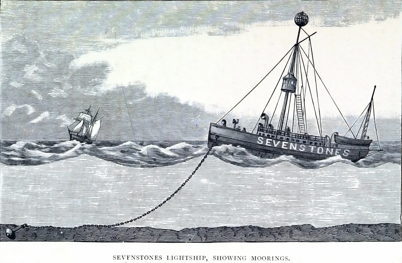
Anchored permanently in forty fathoms of open Atlantic, two and a half miles north-east of the Seven Stones reef, a red-painted ship sits alone on the horizon between Cornwall and Scilly. She has no crew. She has no engines that drive her anywhere - though the current vessel, like every Sevenstones lightship before her, can be towed away for refit. Her job is to flash a light at night, sound a horn in fog, and measure the height of the waves that try to drown her. On 8 February 2016, during Storm Imogen, she logged a significant wave height of 11.73 metres - which by statistical rule means roughly one wave in a hundred that day topped 17 metres, the height of a five-storey building.
Why a Lightship and Not a Lighthouse
Engineers in the 19th century knew how to build lighthouses on isolated rocks - Bishop Rock and Wolf Rock are nearby proof - but the Seven Stones defeated them. The reef's seven or eight named peaks only break the surface at half tide, and the rocks fall sheer into very deep water on every side. There was nowhere stable to plant a foundation. So in 1826 merchants began petitioning the government for a lightship. A second petition in 1839, signed by traders from Waterford, Liverpool and the Bristol Channel, finally produced a meeting in Falmouth in February 1840. A reliable light near the reef, they argued, would shorten the passage around Scilly by up to thirty-six hours. The first Sevenstones lightvessel was moored on 20 August 1841 and showed her first light on 1 September.
The Wooden Years
The first lightship was built by William Pitcher at Thames Ironworks and Shipbuilding in Blackwall. She was 80 feet long, 162 tons, made of wood, and cost £4,416 fully equipped. Two masts carried lights at 38 and 20 feet; red balls on each mast distinguished her from other Trinity House vessels by day; a gong sounded fog warnings. Crew of ten, with five on station at a time. In January 1873 the London barque Athole came too close and fouled her rigging on the lightship, ripping away two halyards and the starboard light. Throughout the late 19th century she was replaced and rebuilt - lightvessel 50 took over in 1879, then number 35 in 1883, each more elaborate than the last, with revolving lights and improved fog signals. Through it all the station never moved: 50 degrees 03.6 minutes north, 6 degrees 04.3 minutes west, in 40 fathoms over slate and sand.
Bombed in Wartime
Lightvessel 80, built in Liverpool in 1914 by H. & C. Grayson, served on station in the early years of the Second World War - and was bombed and strafed by Luftwaffe aircraft so frequently that Trinity House pulled her off in May 1941 and substituted a gas buoy for the rest of the war. The vessel was 116 feet long, 318 tons, carrying a 600,000-candlepower lantern. In 1954 she was refitted with electric light, hot water, a refrigerator, and individual cabins. Before that the crew had climbed the masts every morning to trim the lamps with oil they hauled up by hand - a routine the official history dryly describes as a dangerous task in rough weather. Manned lightships of the postwar era could be brutal duty: weeks at a stretch, no shore leave, the deck moving constantly under a sky that often simply refused to clear. Automation could not arrive fast enough.
Now Just a Weather Buoy
The station was automated in 1987 and the keepers have not been back since. The current vessel - lightvessel 2, on station since October 2004, with lightvessel 22 spelling her in 2021 - is now also an automated weather station for the UK Met Office. On-board sensors measure wind, pressure, temperature, dew point and water temperature, and a Ship-Borne Wave Recorder logs significant wave heights every few minutes. Sometimes the numbers it sends back are extraordinary. The October 1982 storm produced an Hs of over 11.15 metres. Storm Imogen in February 2016 beat that with 11.73 metres. The nearby Wave Hub buoy off the Cornish coast logged maximum wave heights of 19.1 metres the same day. Few places in the Atlantic generate that kind of sea. Most of the time, though, the Sevenstones Lightship just sits there flashing - 50 03.6 N, 6 04.3 W - a small red splash on the chart, marking a graveyard.
From the Air
Coordinates 50.0603°N, 6.0723°W, in open Atlantic water 2.5 nautical miles north-east of the Seven Stones reef, roughly 15 nm west of Land's End and 7 nm east-northeast of the Isles of Scilly. Best viewed at 1,500 to 3,000 feet AGL - the red lightvessel is small but distinctive against the open sea, and you can usually see the white breakers over the reef to the south-west. Nearest airports are St Mary's (EGHE) to the west-southwest and Land's End (EGHC) to the east. Busy commercial shipping below; respect SAR operations out of Newquay (EGHQ). The lightship transmits AIS as Sevenstones.
Nearby Stories
- Penlee lifeboat disaster 5.8 km away
- SS Georgia (1890) 18 km away
- Great Wheal Charlotte 28 km away
- 1979 Fastnet Race 37 km away
- Wheal Coates 66 km away
- SM U-27 93 km away
- HMS Affray 151 km away
- Tower of Hercules 719 km away