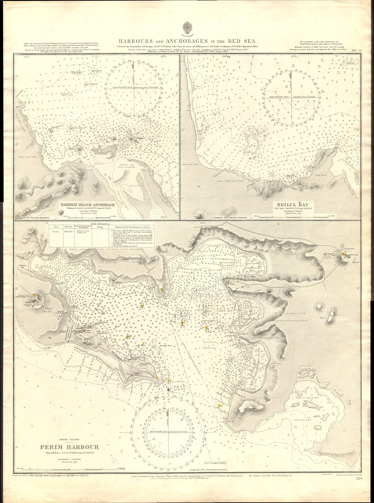
Perim
Roughly 60,000 years ago, when the seas were locked into ice-age glaciers and the Bab-el-Mandeb was shallow or dry, some of the earliest modern humans to leave Africa may have crossed here. Perim - the Arabs called it Mayyun, the Portuguese called it Vera Cruz, and the British simply took it - sits in the middle of that strait, splitting the Bab-el-Mandeb into two channels and guarding the entrance to the Red Sea. It is a crab-shaped piece of an eroded volcano whose center once stood on the southwesternmost tip of Arabia. There is no fresh water on it. There has rarely been enough rain to matter. And yet for two hundred years, the great naval powers have fought over what this small, treeless, thirsty island represents.
Bypassed by Written History
Ancient geographers noticed Perim. Pliny the Elder mentioned it. Ptolemy charted it. The author of the Periplus of the Erythraean Sea wrote of it as the island of Diodorus. Then for centuries almost nothing. Fishermen came seasonally from the Yemeni mainland. Pearl divers built huts of reed brought from elsewhere, because nothing grew here. Afonso de Albuquerque, the Portuguese admiral who would try repeatedly and fail repeatedly to take Aden, inspected Perim in 1513 on the way back from an aborted attack on Jeddah. He named it Vera Cruz and pronounced it unfit for a fortress because it had no water. For three hundred years after that, the Ottomans, the Egyptian Mamluks, and various European fleets used its natural harbor when convenient and ignored it the rest of the time. Only fishermen lived there, and only sometimes.
The British Decade and the Lighthouse
In December 1856, with the Suez Canal under construction and Prime Minister Palmerston worried that French ambitions in Egypt might become French control of the Red Sea, London ordered the occupation of Perim. The actual landing party was small and peaceful - the island was uninhabited. The stated reason was a lighthouse; the Bab-el-Mandeb was notoriously dangerous, and ships kept piling up on its reefs. An eleven-meter tower was inaugurated on April 1, 1861. Wrecks continued. For two decades the only British presence was the lighthouse and a small Aden garrison detachment. Then in 1883, a London entrepreneur named Hinton Spalding opened a coaling station in Perim's inner harbor, which could handle deeper ships than Aden's. For the next fifty years Aden and Perim fought over the Red Sea bunkering trade. Between 1923 and 1927, Perim was loading more coal than Aden. Then oil replaced coal, Aden cornered the new business, and Perim's boom ended.
The BBC and the Fire
In 1964, Perim took on one last British role. The Diplomatic Wireless Service moved its Middle East Relay Station here after losing its Somali base in a diplomatic dispute. Twenty prefabricated houses went up on the western side of the island for the engineers and their families. Three Aden Airways Dakota flights a week brought food from the NAAFI and rotated out the Aden-based security platoon, which arrived and departed on Blackburn Beverlys and Scottish Aviation Twin Pioneers. The station began broadcasting in early 1965 on 701 kHz - the BBC World Service was audible in Australia on early-morning propagation. In late summer 1965, one of the Deltic generators threw a rod, and the resulting fire crippled the station. With Aden's security situation deteriorating, the transmitters were moved up the coast to Masirah, off Oman. Perim went quiet at the end of 1966. The British flag came down in 1967. The foundations of those engineer houses are still visible on Google Earth.
Banished and Returned
When Soviet forces gained access to the naval base at Aden in the 1970s and to Perim as a listening post, the roughly 4,500 native inhabitants of Perim were banished from the island. They scattered across the Yemeni mainland. Their homes remained empty for most of a generation. After the 2015 Houthi takeover of Yemen, some of these displaced Perim natives joined the Saudi-led intervention specifically to retake their island. With United Arab Emirates support they fought a brief, violent battle against the Houthi garrison that lasted only a couple of hours but destroyed the power plant. The Houthis, retreating, planted mines that, according to the local native leader, still prevent normal life from resuming. Then came the strange airbase - satellite images in 2021 revealed a 1,800-meter runway under construction in the north of the island. The United Arab Emirates denied involvement. Saudi Arabia said the coalition was securing the strait. Yemeni officials said different things to different audiences. The small island had become, once again, a question everyone wanted to answer quietly.
Approach from the Air
Perim is approximately 13 square kilometers of dark volcanic rock, its coastline indented with the natural harbor that once made it a coaling power. From altitude it sits like a dark spot in the turquoise of the strait, with the Shaykh Said Peninsula of Yemen immediately to the north and the Eritrean and Djiboutian coasts visible to the west on clear days. The 2008 Bridge of the Horns proposal would have linked Yemen to Djibouti through this island - a $200 billion span that was indefinitely delayed in 2010 before the civil war made such ambitions moot. What flies here now is military.
From the Air
Located at 12.66°N, 43.42°E in the Bab-el-Mandeb strait. Active conflict zone - active airspace restrictions from Yemen civil war and Saudi-led coalition operations. Not suitable for general aviation. Recommended viewing altitude FL300+ for geographic overview only. The island is clearly visible as a distinct landmass between the Yemeni Shaykh Said Peninsula and the Djiboutian coast. Aden International Airport (OYAA) approximately 150 nautical miles east. Djibouti-Ambouli (HDAM) approximately 50 nautical miles southwest. Expect significant haze year-round.
Nearby Stories
- Assab 34 km away
- Mokha 39 km away
- Ashrafiya Mosque 63 km away
- French Submarine Vengeur 77 km away
- Tadjoura 78 km away
- USS Cole Bombing 115 km away
- Southern Red Sea region 172 km away
- Berbera 255 km away