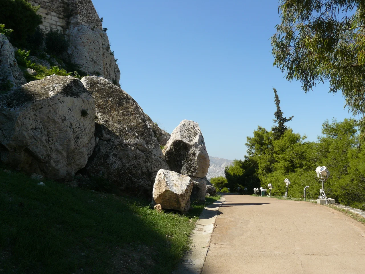

Peripatos (Acropolis of Athens)
Almost everyone climbs to the top of the Acropolis. Far fewer walk around it. Yet circling the base of the great rock runs an ancient pathway called the Peripatos, a name that simply means "the walk," and it threads together a hidden world of caves, sacred springs, and slope-side shrines. While crowds press toward the Parthenon above, this older route follows the contour of the hill at a gentler grade, past sanctuaries cut into the cliff that predate much of the dazzling architecture on the summit. The Peripatos is the Acropolis seen from below and from the side, where the rock is not a stage for temples but a living thing pierced with holy places.
The Walk Around the Rock
The Peripatos girds the Acropolis and meets the great Panathenaic Way, the processional route, on the north slope. Rather than leading to a single destination, it connects the scattered shrines interspersed around the hill, linking one sacred spot to the next. The historian Thucydides records that these shrines stood within an area where building and quarrying were forbidden, a protected zone known as the Pelasgian ground. From that detail scholars have drawn a striking inference: the path likely traces the line of the archaic Pelasgic wall, a fortification so old it had already vanished by classical times. To follow the Peripatos, then, may be to follow the ghost of the city's earliest defenses.
Five Stades and Eighteen Feet
We know the path's name and even its precise length from a single remarkable object. An inscription carved into a boulder of Acropolis limestone, found on the north slope, reads: "Length of the Peripatos: five stades and eighteen feet." It is the only piece of written evidence for the pathway, and it has fixed the route's identity for archaeologists ever since. The inscription dates to the fourth century BC, though the path itself was almost certainly older, cleared and in use at least since the great building program of Pericles in the fifth century BC, by which time the cave sanctuaries along its course had been established. An ancient measurement, chiseled into rock and still legible, telling us exactly how far the walk ran.
Caves, Springs, and a Roman Guidebook
The shrines the Peripatos connects are among the most atmospheric features of the Acropolis. The path passes the Klepsydra, a natural spring on the northwest slope whose name means "water thief," and approaches caves sacred to gods including Apollo. We owe part of our knowledge of how the route was used to Pausanias, the tireless Greek travel writer of the second century AD, whose descriptions read like an ancient guidebook. He mentions traveling this road to examine the Klepsydra and the cave of Apollo, evidence that even in Roman times the Peripatos remained a working route for the curious visitor, much as it is today for those who choose to walk around the rock rather than simply over it.
Restoring the Path
Like so much of the Acropolis, the Peripatos has needed care to survive into the modern age. Restoration work on the pathway began in 1977, part of the long and continuing effort to conserve the most studied archaeological site in Greece. The path now offers visitors a quieter alternative to the summit, a chance to experience the Acropolis at human scale, weaving past the inscribed boulder, the slope sanctuaries, and the theaters built into the southern flank. For those willing to look down and around instead of only up, the Peripatos reveals an Acropolis that is older, stranger, and more intimate than the one on every postcard.
From the Air
The Peripatos rings the base of the Acropolis at 37.97°N, 23.73°E in central Athens, following the natural contour of the rock below the summit temples. From the air, the Acropolis plateau with the Parthenon is the dominant landmark; the Peripatos and the slope sanctuaries lie along its forested flanks just below the crown of the hill, with the Theatre of Dionysus on the south slope. The nearest airport is Athens International (LGAV), about 30 km east-southeast. Low-altitude passes in clear weather best reveal the wooded slopes encircling the citadel.
Nearby Stories
- Great Sand Beach 5 km away
- Battle of Delium 7.7 km away
- Tower of Aliartos 9 km away
- HMHS Britannic 10 km away
- Saronic Gulf 15 km away
- Sousaki Volcano 17 km away
- Sanctuary of Apollo Maleatas 24 km away
- Skyros 66 km away