Planaltina, Federal District
On 7 September 1922 - the hundredth anniversary of Brazilian independence - a caravan of forty people climbed Centenário Hill just outside a small Goiás town called Planaltina and placed a stone there. The stone declared, officially, the site of a future national capital. Brasília was still thirty-eight years away. The caravan had neither engineers nor bulldozers, only a ceremonial intent. But they were right. The capital that would rise from the cerrado in 1960 would be planted directly in the territory of this town - and Planaltina would become, in the strangest way possible, both older than Brasília and a part of it.
Mestre d'Armas
Bandeirantes came to this region in the first half of the 18th century, hunting gold and emeralds across the cerrado. The settlement that would become Planaltina is believed to date from around 1790, and its first name - Mestre d'Armas, "Master of Arms" - came from a blacksmith who settled here and specialized in weapons. The nucleus grew around the ranch of José Gomes Rabelo, who moved from the provincial capital of Goiás to a small lake called Lagoa Bonita and slowly expanded onto the land near the blacksmith's forge. Marta Carlos Alarcão ordered a wooden statue of Saint Sebastian from Portugal, built to thank the saint for sparing the settlers from an epidemic. That statue, later replaced by a larger one when the church expanded, sits at the origin of everything that came next. On 19 August 1859, the Goiás provincial assembly formally established the District of Mestre d'Armas. That date is still celebrated as Planaltina's founding.
The Cruls Commission
In 1892 - three years after Brazil became a republic - a scientific commission arrived in Mestre d'Armas. They were astronomers and geologists, doctors and botanists, led by Belgian astronomer Luiz Cruls, and their task was to survey the central plateau for a site where the country's capital might someday be moved. They worked for months. They mapped terrain, measured elevations, tested water supplies, documented the cerrado. Their final report proposed a quadrilateral of 14,400 square kilometers - the Cruls Quadrilateral - where a future federal district could be built. That report sat in a drawer for sixty-seven years. The capital was not moved in 1892. But the idea was now on paper, grounded in the soil around Mestre d'Armas, and every subsequent attempt to relocate Brazil's capital would return to the maps this commission had drawn.
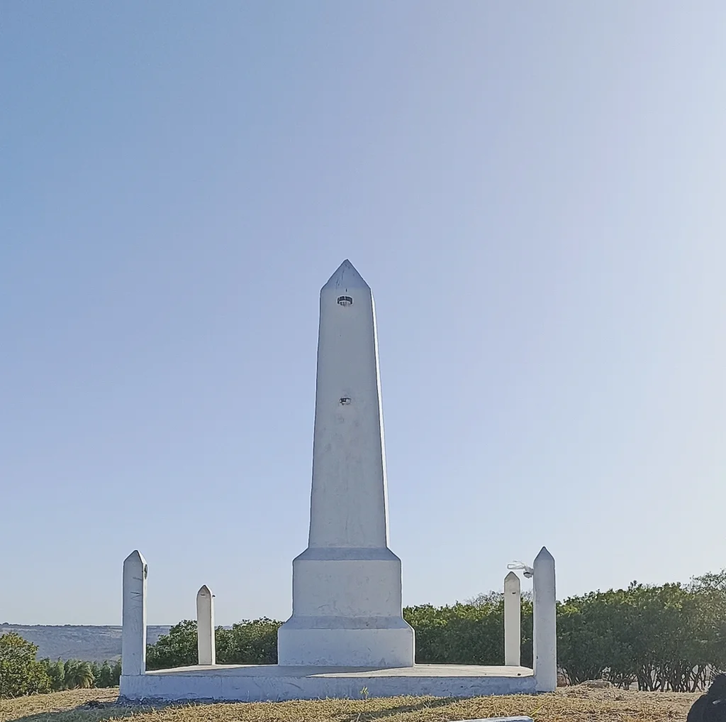
Renamings and a Stone
In 1910 the town tried a new identity: Altamir, "high and gazing," because of the views from the surrounding ridges. The name never caught on. In 1917 it tried again - Planaltina, meaning "of the high plains" - and this one stuck. By then the town had a hydroelectric plant and a road to Ipameri, small industries and a tannery. Then came 1922, the centennial year. Deputy Americano do Brasil addressed the Chamber of Deputies with a proposal: before the centennial ended, Brazil should officially place a foundation stone at the site of its future capital. President Epitácio Pessoa signed the decree. Engineer Balduino Ernesto de Almeida led the caravan. On 7 September 1922 they laid the stone on Centenário Hill, nine kilometers from Planaltina. Then nothing happened. The Depression came. Another world war. But the stone stayed, and the choice of location was now mapped, signed, and ceremonially marked.
Divided by Brasília
In 1955, Marshal José Pessoa's commission finalized what the Cruls mission had started: the 5,814 square kilometers of the new Federal District were superimposed on three municipalities of Goiás. Planaltina was one of them. When the lines were drawn, the town's territory was cut in two. The urban core stayed inside the new Federal District, becoming an administrative region of Brasília. The outlying territory remained in the state of Goiás, and a new town had to be built there to serve the remainder of the municipality - which is why Planaltina, Goiás, exists today, popularly called Brasilinha, or "little Brasília," only 40 kilometers away. Planaltina, DF, kept the oldest church in the entire Planalto Central - the Igrejinha de São Sebastião, built around 1870, declared a monument by Federal District heritage authorities in 1980. It is no longer used for services, but the original stone floor is still there.
A Divided City Still
Planaltina is two cities in the same place. The traditional sector preserves architecture from the end of the 19th century and the quiet atmosphere of a small interior town. The new neighborhoods, built after 1966 to house migrants who could not settle in Brasília proper, are crowded and underserved - according to research by Codeplan in 2004, more than 80 percent of Planaltina's inhabitants lacked rain drainage and 45 percent lacked sewage. At 1,534 square kilometers it is the largest administrative region of the Federal District. Six kilometers from the urban core lies Vale do Amanhecer - "Valley of Dawn" - the holy city of a syncretic religion founded by Neiva Chaves Zelaya in 1959, which has its own school and serves a community of over 5,000 adherents. Planaltina also contains the 10,547-hectare Águas Emendadas Ecological Station, preserving cerrado vegetation that predates the Federal District by geological scales. The capital rose. The town is still here, older than all of it.
From the Air
Coordinates 15.62°S, 47.65°W, elevation approximately 1,000 m on the central plateau. Located about 43 km northeast of Brasília's Plano Piloto, reachable by federal highway BR-020 (Brasília-Fortaleza). From the air, the two sectors are distinctive: the older traditional center with 19th-century architecture around the Igrejinha de São Sebastião, and the newer expansion neighborhoods. Nearest major airport: Brasília International (SBBR), approximately 50 km southwest. Recommended viewing altitude 7,000-10,000 feet AGL; Centenário Hill rises 9 km from town.
Nearby Stories
- Brasília 21 km away
- Alexânia 47 km away
- Unaí 65 km away
- Pireneus State Park 78 km away
- Niquelândia 97 km away
- Alto Paraíso de Goiás 130 km away
- Mambaí 140 km away
- Posse, Goiás 181 km away