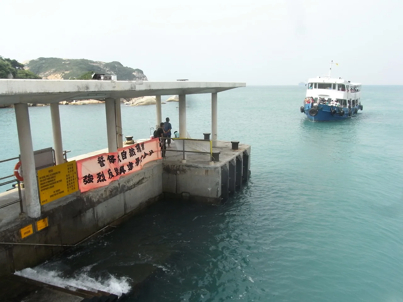

Po Toi
The name has two competing explanations, and neither one quite settles the argument. One says the island once produced dried seaweed shaped like the cushions Buddhist monks use for meditation — the seaweed was the *苔*, the cushion the *蒲團*, and over time the name contracted and blurred. The other says the island looks, from the sea, like a floating platform — *浮台* — and that the character *蒲* in local dialect means simply "to float." Both stories are plausible. Both are unprovable. Po Toi, the southernmost island of Hong Kong, has always resisted easy definition.
Edge of the Territory
Po Toi is the main island of the Po Toi Islands group, sitting at the far southern edge of Hong Kong's waters, 3.69 square kilometres of rock and scrub surrounded by the South China Sea. It is a recognized village under the New Territories Small House Policy, which makes it administratively part of Hong Kong's rural framework despite being entirely surrounded by open water, accessible only by kai-to (small motor ferries) and scheduled services from Aberdeen and Stanley operated by Tsui Wah Ferry. At its peak, the island sustained a community of roughly 1,000 fishermen and farmers, earning their livelihood through fishing, smallholder farming, and harvesting the seaweed that may have given the island its name. Those numbers have fallen steadily, as they have across Hong Kong's outer islands. The village that remains is quiet, seasonal, and smaller than it once was.
Stone That Speaks
The oldest residents of Po Toi left their marks on the rock. Ancient carvings, discovered in the 1960s and believed to date from the Bronze Age — roughly 1500 to 700 BC — were incised into the island's coastal outcrops by people who have left no other record. The images are abstract and geometric, spirals and lines whose precise meaning remains uncertain. They have been listed as declared monuments of Hong Kong since 1979, and they can be reached by a spur-track branching off the path that connects the main harbour at Tai Wan to the lighthouse at Nam Kok Tsui. The walk takes you past cliffs and sea-wind, past shapes in the rock that have survived three thousand years of salt air and human indifference, into something older than any city.
Rocks with Names
Po Toi is famous, in a specifically Hong Kong way, for its rock formations. The island's geology has been shaped into configurations that invite naming: the Buddha's Palm Cliff (佛手巖) resembles an open hand raised to the sky; the Coffin Rock (棺材石) has the angular geometry its name implies; the Tortoise Rock (靈龜上山) crouches above the water like a creature mid-ascent; the Monk Rock (僧人石) stands in the pose of a contemplating figure. Whether any two visitors will agree on exactly which formation matches which name is part of the pleasure. The coastline here is dramatic — sheer in places, sea-worn in others — and the formations reward careful scrambling.
Temple, Haunted House, Lighthouse
Three buildings mark Po Toi's built landscape. The Tin Hau Temple faces the bay of Tai Wan (大灣); its construction date is unknown, but it was documented as renovated in 1893, and festivals in its honour anchor the island's ceremonial calendar — the annual Tin Hau Festival on the 23rd day of the third lunar month, and a Jiao festival observed every three years. During celebrations, a temporary bamboo and sheet metal structure rises near the temple to host Cantonese opera performances. Then there is Mo's Old House — the Deserted Mansion of Family Mo (巫氏廢宅) — built in the 1930s at Chang Shek Pai and long since fallen into ruin. Visitors call it the Haunted House, and younger hikers make a point of stopping there. The Nam Kok Tsui Lighthouse stands at the island's southern tip, marking the edge of Hong Kong's navigable waters.
Where George Smiley's Story Ended
John le Carré set the climax of *The Honourable Schoolboy* — the second novel in his Karla trilogy, featuring the spy George Smiley — on Po Toi. Published in 1977, the novel follows British intelligence officer Jerry Westerby through Southeast Asia during the Cold War's anxious middle years, and it ends here, on this small, remote island at the outermost reach of Hong Kong. Whether le Carré chose Po Toi for its isolation, its geography, or simply the right feel of a place where a story could plausibly conclude is not recorded. What remains is the fact of it: a quiet island that entered the permanent geography of espionage fiction, visited now by hikers, birdwatchers, day-trippers on the ferry from Stanley — and occasionally by readers looking for somewhere specific.
From the Air
Po Toi lies at approximately 22.17°N, 114.26°E, roughly 20 km south-southeast of Hong Kong Island. From the air at 4,000–6,000 feet it appears as a compact, rocky landmass clearly separated from the main Hong Kong island group, with the open South China Sea to the south and east. The Nam Kok Tsui Lighthouse at the southern tip is a useful visual waypoint. The nearest major airport is Hong Kong International Airport (VHHH) on Lantau Island, approximately 45 km to the west-northwest. The island sits below the approach paths used by traffic arriving from the south into VHHH; pilots should note the island's elevation and maintain appropriate clearance from the rocky terrain, which reaches modest heights but presents coastline cliffs on several sides.
Nearby Stories
- Shek Pik 1.7 km away
- Tung Ping Chau 4.8 km away
- Hong Kong 12 14 km away
- Wanshan Archipelago Campaign 16 km away
- Pearl River Delta 18 km away
- Battle of Penghu 478 km away
- Penghu Air Raids 487 km away
- Cape Maobitou 596 km away