
Porth Hellick
On the morning of 23 October 1707, fishermen walking the strand at Porth Hellick on the south coast of St Mary's found the body of a man washed up just above the high-tide line. He had been stripped of most of his clothes and was missing the rings from his fingers. By the description that reached London, the body was Sir Cloudesley Shovell, Admiral of the Fleet, last seen alive eighteen hours earlier on the quarterdeck of HMS Association as she struck the Western Rocks of the Isles of Scilly and sank inside four minutes. Roughly 1,450 sailors had drowned with him. The Cornish word that gives Porth Hellick its name simply means willows cove. It is a peaceful inlet of sand and reed and migrating birds. It also became, on that one October morning, the gateway through which the Royal Navy's worst peacetime catastrophe came ashore.
An Admiral on the Sand
Cloudesley Shovell had spent most of the day before the wreck convinced he was off the latitude of Ushant, the north-west tip of France. He was actually drifting east into the Isles of Scilly. Longitude could not be measured at sea in 1707; sailors used dead reckoning and prayer. When the rocks took his flagship, four ships of his fleet were destroyed in less than an hour. Shovell's body, by some accounts, was either dead from the wreck or was murdered for his rings by an islander who found him alive on the beach. A confession is said to have been made decades later. He was buried temporarily nearby, exhumed on the orders of Queen Anne, and reburied in Westminster Abbey beneath a monument that depicts him reclining in carved marble. He was 56 years old.
Willows Cove
Porth Hellick takes its Cornish name from porth helack, meaning willows cove. The bay is delineated on the south by the headland of Giant's Castle, an Iron Age promontory fort, and on the north by Porth Hellick Down with its Bronze Age cemetery and Porth Hellick Point. At low tide a wide stretch of sand and rock is exposed, and a bar of fine shingle separates the salt water from the largest area of usually-fresh water on St Mary's. A stream rises a half-mile inland in Holy Vale and flows south through Higher Moors to the sea here. In its short course it falls less than 25 feet. Most of it has barely cut a channel through the wet grassland. The pool sits behind the shingle bar like a shallow lens of fresh water set into the coast.
The Marsh That Counts
The Higher Moors and Porth Hellick Pool Site of Special Scientific Interest was designated in 1971 for what its citation calls a wide diversity of habitats with several rare and notable plant species. The land is owned by the Duchy of Cornwall. The wetland is one of only three substantial freshwater wetlands in the Isles of Scilly, fed by groundwater and the stream, forming a mosaic of willow and alder scrub, mire, and reed-fringed pool. The peat below the surface has been a source of fuel in past centuries and is rich in pollen. Combined with other paleo-environmental evidence, that pollen record is one of the principal sources for understanding how vegetation has changed on the islands since the Mesolithic, when the Isles of Scilly were still partly joined to one another and to a larger landmass.
The Bird List
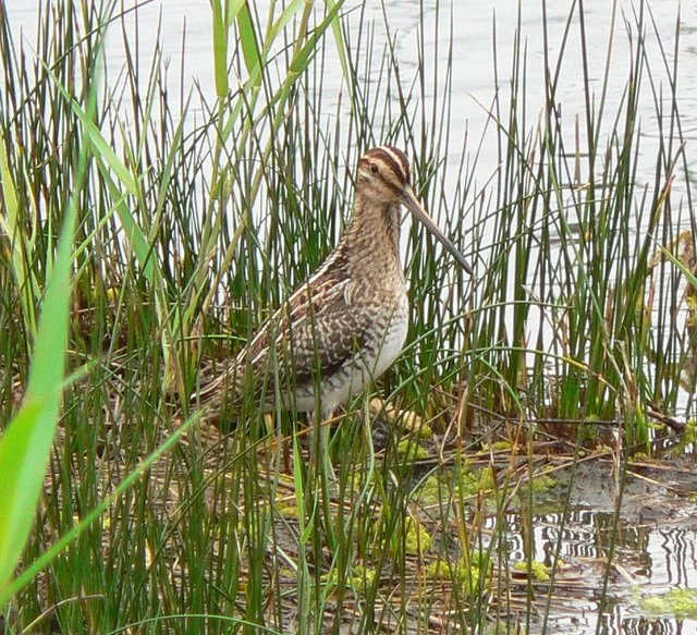
Porth Hellick is a serious bird site. Reed warblers and sedge warblers nest in the common reeds along the pool margins. Coot, gadwall, mallard, moorhen, teal and water rail all breed here. In spring and autumn the moors fill with migrants, and in October, when the islands become the magnet for North American vagrants blown across the Atlantic, Porth Hellick is one of the first places the visiting twitchers head to. The damp grassland of the moors holds greater tussock-sedge, hemlock water-dropwort, purple loosestrife, royal fern, water mint, and yellow iris. In the acidic boggy patches there is bog pimpernel, bog stitchwort, and marsh St John's-wort. Lesser spearwort grows in the wettest hollows. The combination of habitats packed into so small a space is what made the SSSI designation worth granting.
A Coast of Bodies and Birds
There is something quietly peculiar about Porth Hellick. The same shingle bar that washed up Cloudesley Shovell in 1707 also washed up oily sand from the MV Cita wreck in 1997, which had to be excavated and removed. The same reeds that host reed warblers in summer once burned as peat in Scillonian fires. Bronze Age people buried their dead on the rise above the bay, in the densest concentration of entrance graves anywhere in the world. Whatever else this small cove is, it is a place where the sea, the island, and the dead have always met. The willows that gave it its Cornish name still grow on the moor. The pool still rises and falls with the seasons. The birds keep arriving.
Flight Context
Coordinates: 49.9159°N, 6.2844°W. Porth Hellick Bay is on the south-east coast of St Mary's, between the Giant's Castle promontory to the south and Porth Hellick Down to the north. From 2,000 feet the bay reads as a curved arc of sand backed by the dark shape of the freshwater pool and the green of Higher Moors. St Mary's Airport (EGHE) sits about 800 metres to the south-west. The site pairs visually with Porth Hellick Down above it, the MV Cita wreck site at Newfoundland Point just to the south, and the broader sweep of the south coast leading to Old Town.
From the Air
Coordinates: 49.9159°N, 6.2844°W. Porth Hellick Bay is on the south-east coast of St Mary's, between the Giant's Castle promontory to the south and Porth Hellick Down to the north. From 2,000 feet the bay reads as a curved arc of sand backed by the dark shape of the freshwater pool and the green of Higher Moors. St Mary's Airport (EGHE) sits about 800 metres to the south-west. The site pairs visually with Porth Hellick Down above it, the MV Cita wreck site at Newfoundland Point just to the south, and the broader sweep of the south coast leading to Old Town.
Nearby Stories
- Penlee Lifeboat Station 5.5 km away
- Black Swan Project 20 km away
- Tater Du Lighthouse 25 km away
- The Brisons 31 km away
- 1979 Fastnet Race 54 km away
- SM U-27 110 km away
- HMS Affray 149 km away
- Tower of Hercules 700 km away