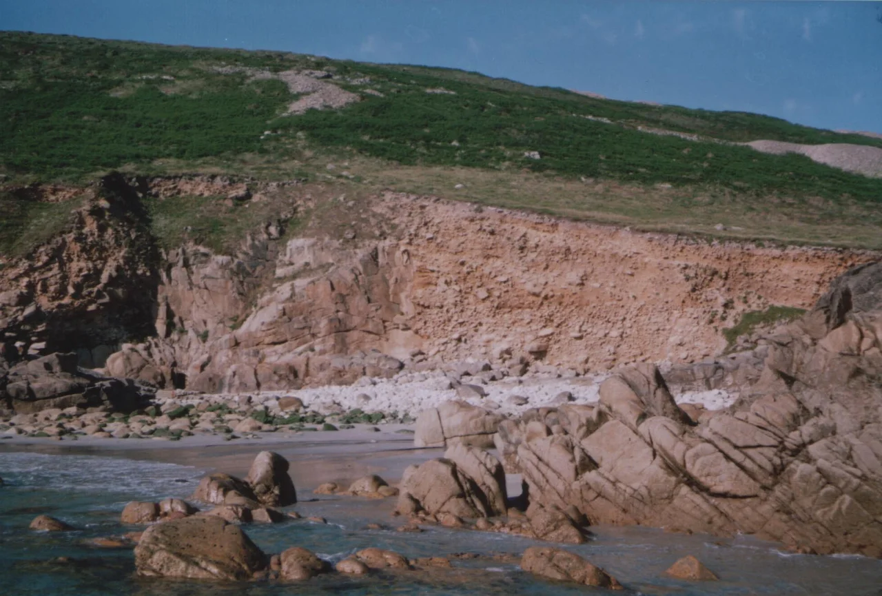

Porth Nanven
Stand on the beach at Porth Nanven at low tide and look back at the cliff. About twenty feet up, you will see a band of rounded grey boulders embedded in the rock face, as if someone had cemented them in place. They are not in place. They are an ancient beach, suspended in mid-air, waiting for the next storm to bring them down. The sea that rounded them is gone - this stretch of ocean was much higher 120,000 years ago, when those cobbles were tumbling in the surf - but their successors are still on the sand at your feet, the work of a different Atlantic on different cliffs. Geologists call this kind of fossilised shoreline a raised beach. The local press calls Porth Nanven "Dinosaur Egg Beach."
The Cove
Porth Nanven, also known as Cot Valley and occasionally as Penanwell, lies half a mile west of St Just in the far west of Cornwall. The Cot Valley itself is a narrow gulley running down from the high Penwith plateau to the sea, with a stream tumbling alongside the road. The valley closes in to a single granite-walled cove where the stream meets the Atlantic. There is a small National Trust car park at the top of the beach and a footpath down. From the cove you can look out at the Brisons, the twin granite stacks a mile offshore, and watch the swell rolling in over what was once the seabed of a much warmer Pleistocene world. The whole place sits within the Aire Point to Carrick Du Site of Special Scientific Interest, protected for both its geology and its coastal ecology.
Dinosaur Eggs
The beach is covered, at all states of tide, in ovoid boulders. They are not dinosaur eggs - that name belongs to a piece of journalistic affection - and they are not freshly rounded by the present-day sea. They range in size from a hen's egg to a metre or more in length, and they sit in the foreshore like a heap of giant marbles waiting to be played with. They are so photogenic, and so portable in the smaller sizes, that visitors used to walk away with them by the bucketful. The National Trust now owns the beach and the cobbles are legally protected; taking one is an offence. The rule sounds odd until you understand what the boulders actually are.
An Older Sea
Around 120,000 years ago, during the warm Eemian interglacial, sea levels on this coast stood several metres higher than they do today. Atlantic surf was hammering the cliffs at Porth Nanven roughly where a goat path now runs, and the cobble beach of that shoreline lay where the modern cliff face does. Then the climate cooled, the ice sheets locked up an ocean's worth of water, and the sea fell. The Eemian beach was left high and dry, became progressively buried under angular slope-deposits from the cold periods that followed - geologists call these head deposits, dating to roughly 100,000 to 20,000 years ago - and was eventually exposed again by modern weathering. Look up at the cliff and you can read three different landscapes stacked on top of each other: rounded boulders at the bottom (the warm interglacial beach), angular rubble above (the cold periglacial slope), and the granite outcrops at the very top (the bedrock that was always there). Cornwall's coast wrote its own climate history in stone, and at Porth Nanven the page is open.
The Living Beach
The cobbles on the modern beach are the descendants of the cliff boulders. As the cliff erodes, the old cobbles fall out and join the surf at the bottom; the present-day Atlantic rolls them around for another few thousand years and they become indistinguishable from the boulders being formed today. Stand at the back of the beach and you can see this in slow motion: a wall of rounded rocks waiting to break away and join those on the sand. It is one of the more legible examples of geological deep time anywhere in Britain. The cove is also, since December 2005, safe to swim in - the sewage outfall that used to spoil it has been diverted and treated. It has been listed among the ten best beaches in the United Kingdom by the national press, an honour Porth Nanven has accepted with the discretion of a cove that has, by Cornish standards, only just dried out.
Sound of the Atlantic
Most beaches sound like surf. Porth Nanven sounds like surf plus a deeper, drier note - the boulders moving against each other as each wave runs back, a slow rattle as the cobbles settle into new positions. In a winter storm the sound becomes a roar; thousand-kilogram rocks lift and bang together and the whole valley vibrates. After such a storm, beachcombers walking the strand line find new arrivals: small dark cobbles freshly tumbled out of the cliff face, surface still showing the imprint of the head deposits that buried them for a hundred millennia. The National Trust signs ask you to leave them where they are. Most visitors do. The boulders are going to outlast all of us, anyway. They have already outlasted everything else.
From the Air
Located at 50.117°N, 5.701°W on the west coast of the Penwith peninsula, half a mile west of St Just. The cove sits at the seaward end of the Cot Valley - a narrow gulley running straight to the Atlantic. The Brisons, two granite stacks, lie 1 nm offshore and are unmistakable from the air. Cape Cornwall is 1 nm to the north. Land's End Airport (EGHC) is 2 nm east-northeast. Recommended viewing altitude 1,000-2,000 ft for the cobble beach and raised-beach geology; the cove is small but the surrounding cliff line is dramatic. Best photographed at low tide when the full extent of the boulders is visible.
Nearby Stories
- Bartholomew Ledges Wreck 1.8 km away
- Carn Brea Castle 4.6 km away
- Battle off Lizard Point 12 km away
- Carnewas and Bedruthan Steps 18 km away
- King Charles's Castle 25 km away
- MV Cita 34 km away
- 1979 Fastnet Race 47 km away
- Trevose Head Lighthouse 55 km away