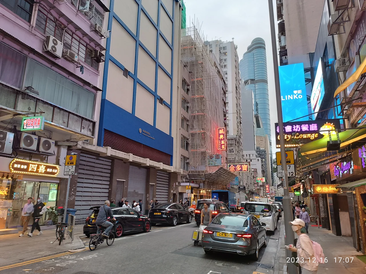

Portland Street
The street carries the name of William Cavendish-Bentinck, 3rd Duke of Portland, Prime Minister of the United Kingdom in 1783 and again from 1807 to 1809 — a man who almost certainly never gave Hong Kong a moment's thought and whose connection to a particular road in Mong Kok remains, as the record notes, entirely unclear. That gap between the formal name and the lived reality of Portland Street is part of its story. The street has always been itself, whatever plaque they put on the corner.
The Spine of Mong Kok
Portland Street runs north to south for roughly one and a fifth kilometres, parallel to and just west of Nathan Road, the main thoroughfare of the Kowloon peninsula. It passes through Yau Ma Tei before entering Mong Kok, one of the most densely populated urban districts anywhere on Earth. Three MTR stations — Yau Ma Tei, Mong Kok, and Prince Edward — put the entire length within easy reach of the subway. The two lanes carry motor traffic all day, but the real life of the street happens on its sidewalks, where pedestrians move in a near-continuous flow past restaurants, residential towers, renovation supply shops, and establishments that operate under less straightforward classifications.
Neon, Chess, and the Night Economy
The stretch between Argyle Street and Dundas Street has a well-established reputation as Hong Kong's most prominent red-light district, a zone where neon signs stack overhead in the way that defined Hong Kong's visual identity in the pre-LED era. Beneath them, hundreds of massage parlours, hostess bars, karaoke venues, and brothels operate in what is a legal if closely policed industry. Law enforcement remains active in the area, targeting illegal immigration, underage exploitation, and organized crime connections. But the street is not only this. Near the Soy Street intersection at dusk, unlicensed food stands appear and professional Chinese chess players take their positions, drawing small crowds of onlookers and serious competitors. Elsewhere, over 50 shops between Argyle Street and Bute Street sell tiles, wallpapers, and bathroom fixtures to the city's constant renovation appetite.
Langham Place and the Limits of Gentrification
In January 2005, Langham Place officially opened near the Nelson Street intersection. The complex — 167,000 square metres of shopping centre, theatre, hotel, and office tower — was one of the largest single developments in Mong Kok's history and its arrival prompted predictions that it would gentrify Portland Street and push out the sex trade. The jumbotron screen on the complex's east entrance broadcasts news and entertainment to pedestrians below. The high-rise hotel is among Kowloon's tallest. The shopping centre draws both locals and tourists, particularly at night. But the predictions proved wrong. After years of operation, Langham Place's impact on the nearby industry has remained minimal. Portland Street absorbed the tower the way it absorbs most things: kept moving, kept being itself.
A Colonial Name in a Post-Colonial City
The streets surrounding Portland Street reveal the colonial naming logic in full: Pitt Street, Bute Street, Arran Street, Hamilton Street, Dundas Street, Waterloo Road. The same cluster of 18th-century British political figures appears in Edinburgh, in London, and in Hong Kong, replicated across the empire in streets that were numbered, measured, and plotted through areas that had their own geographies and histories long before the grid arrived. Mong Kok has long since made these names its own, absorbing them into a streetscape that owes far more to Cantonese urban culture than to any duke's memory. The name on the sign is Portland Street. The street itself is something else entirely.
From the Air
Portland Street sits at 22.318°N, 114.169°E in Mong Kok, Kowloon. From 1,500–3,000 feet, Kowloon's grid of north-south streets is clearly visible, with Nathan Road as the prominent spine and Portland Street one block to its west. The Langham Place tower is among the area's taller structures. Hong Kong International Airport (VHHH) lies approximately 18 km to the northwest, and Victoria Harbour separates Kowloon from Hong Kong Island to the south. The high-density residential towers of Mong Kok extend in all directions.
Nearby Stories
- Lok Ma Chau Loop 2.3 km away
- Portas do Cerco 2.3 km away
- Kweilin Incident 17 km away
- Wanshan Archipelago Campaign 34 km away
- Nanxiong Formation 115 km away
- Battle of Nanpeng Island 148 km away
- Heyuan 169 km away
- Cape Maobitou 632 km away