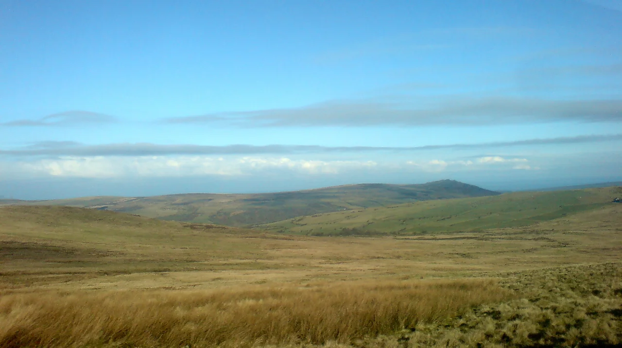

Preseli Mountains
Around 3000 BC, a community of Neolithic stoneworkers in what is now north Pembrokeshire began breaking blue-grey dolerite away from the cliffs at a place called Carn Goedog and a rocky outcrop called Craig Rhos-y-Felin. Some of the stones they detached weighed two or three tonnes. They lashed them to wooden sledges, dragged them down to lower ground, and then - through some combination of overland haulage, river barges, and willpower that archaeologists still argue over - moved roughly eighty of them across 180 miles of southern Britain. They reassembled them on Salisbury Plain as the inner ring of what is now the most famous prehistoric monument in the world. The Preseli Mountains, where this work began, are not high. The highest peak, Foel Cwmcerwyn, rises only 1,759 feet above sea level. But they are the source of Stonehenge.
The Range You Can Walk in a Day
The Preselis stretch about 13 miles east-west, from near Newport to Crymych, entirely within Pembrokeshire and mostly within the Pembrokeshire Coast National Park. The ancient ridgeline track is known as the Golden Road, eight miles of moorland walking that has carried travellers between the coast and the Irish Sea for at least four thousand years. There are 14 peaks above 980 feet, three of them above 1,300. The geology divides cleanly: Foel Drygarn at the eastern end is built of tuffs and lavas from the Fishguard Volcanic Group, ancient volcanic ash welded by heat into the spotted dolerite that prehistoric Britons valued so highly. The sedimentary rocks of Frenni Fawr further east belong to the late Ordovician Nantmel Mudstone Formation. Cwm Gwaun, the long glacial meltwater channel to the north, separates the main massif from the outlying tops like Mynydd Carningli. From the air the range reads as a green-brown spine running across north Pembrokeshire, more shoulders than peaks, with the dark glittering scatter of rocky outcrops along the ridgelines.
The Stonehenge Connection
For decades, archaeologists assumed the bluestones came from a single peak called Carn Menyn. Recent geological work has shown that theory to be incorrect. The stones come from multiple sources along the northern flanks of the Preselis, principally Carn Goedog - a dolerite outcrop on the slopes - and Craig Rhos-y-Felin, a riverside rocky face where the geological match to specific Stonehenge stones is so precise that excavators have identified the very stone-faces from which individual monoliths were broken away. The lead archaeologist on much of this work, Mike Parker Pearson of University College London, has spent more than a decade at the Preseli quarries, finding stone wedges, ramps, and platforms that point to deliberate prehistoric quarrying around 3000 BC. The mechanism of transport is still debated. Some scholars believe glaciation during the last Ice Age may have moved bluestones partway toward Salisbury; most argue for purposeful human movement. A 2021 paper proposed that a dismantled stone circle at Waun Mawn, on the Preseli northern slopes, was the original home of some Stonehenge bluestones - effectively that the monument was moved from Wales to Wiltshire. A 2024 study disputed that conclusion. The argument continues.
A Landscape of Stones
The Preselis are dotted with prehistoric remains in a density that no other Welsh mountain range matches. Pentre Ifan, on the northern slopes, is the largest dolmen in Wales - a 5,000-year-old burial chamber whose capstone seems to balance impossibly on three pointed uprights. Bedd Arthur is a Neolithic stone arrangement that local tradition calls Arthur's grave. Carreg Coetan Arthur is another Neolithic dolmen, smaller but similarly elegant. Mynydd Carningli is crowned with an Iron Age hillfort and is a Site of Special Scientific Interest. There are stone circles at Gors Fawr, standing stones at Parc-y-Meirw, Bronze Age stone rows at Cerrig Lladron, Iron Age hillforts at Foel Drygarn. The 2018 heatwave that scorched Britain revealed dozens more sites from the air - parchmarks where Neolithic and Bronze Age structures had once stood, now visible through the dry grass. Castell Henllys, on the A487 between Eglwyswrw and Felindre Farchog, is a reconstructed Iron Age settlement built on the actual remains of one - a window onto the kind of fortified roundhouse settlement that once dotted these hills.
Slate, War, and Damselflies
Slate quarrying was once an important industry in the Preselis. The 19th-century workings at Rosebush, Tafarn-y-Bwlch, and elsewhere closed mostly by the 1930s. Preseli slate was too dense for roofing but ideal for machining; a workshop at Llangolman still uses it for crafted goods. During the Second World War the War Office used the Preselis extensively as a training ground for British and American troops. After the war, the military proposed to keep the land. A two-year campaign by local leaders forced the War Office to back down - one of the early Welsh land-rights victories of the 20th century, commemorated in 2009 with plaques at each end of the Golden Road. Today the Preselis carry Special Area of Conservation status and three Sites of Special Scientific Interest. The range is one of the most important UK habitats for the rare Southern damselfly, Coenagrion mercuriale, whose population was boosted by a habitat restoration programme that began in 2015 and was reported in 2020 to have succeeded. The same hills that produced Stonehenge are now producing damselflies.
Walking the Golden Road
The Preselis fall under the Countryside and Rights of Way Act 2000 as open country, which means walkers have freedom to roam across most of the unenclosed land. The Golden Road is the obvious route, but every village around the range has its own approach: from Crymych in the east, from Maenclochog in the south, from Mynachlog-ddu on the southern slopes, from Newport and the coast in the west. Foel Cwmcerwyn, the highest point at 1,759 feet, is reachable in a couple of hours from any of these starting points. The B4329 mountain road crosses the range at Bwlch-gwynt, the windy gap, at 1,325 feet - and the name is accurate, as the gap funnels Atlantic weather across the ridge with concentrated force. Paragliding is not permitted by agreement of the landowners since 2014. Walking, cycling, and quiet contemplation are. The view from the top reaches to Snowdonia on a clear day, north across Cardigan Bay, south across Pembrokeshire to the sea.
From the Air
51.95 degrees N, 4.77 degrees W. The Preseli Mountains run roughly east-west across north Pembrokeshire, with Foel Cwmcerwyn (1,759 ft) the highest point. The Preseli transmitting station on the eastern end is a prominent 235-metre mast visible from far away. Nearest airports: EGFE Haverfordwest (10 nm southwest), EGFH Swansea (45 nm east), EGFP Pembrey (25 nm south). Mountain weather can change quickly - low cloud and orographic rain are frequent on the windward (western) side. Foel Drygarn at the eastern end has a clearly visible Iron Age hillfort summit; Carn Goedog and Craig Rhos-y-Felin (the Stonehenge bluestone sources) lie on the northern flanks.
Nearby Stories
- Tenby Town Hall 3.2 km away
- St Davids Lifeboat Station 7.6 km away
- HMS Whirlwind (R87) 9.3 km away
- Gower Peninsula 9.8 km away
- Dryslwyn Castle 12 km away
- German Submarine U-1302 14 km away
- Action of 17 November 1917 17 km away
- Aberystwyth Lifeboat Station 24 km away