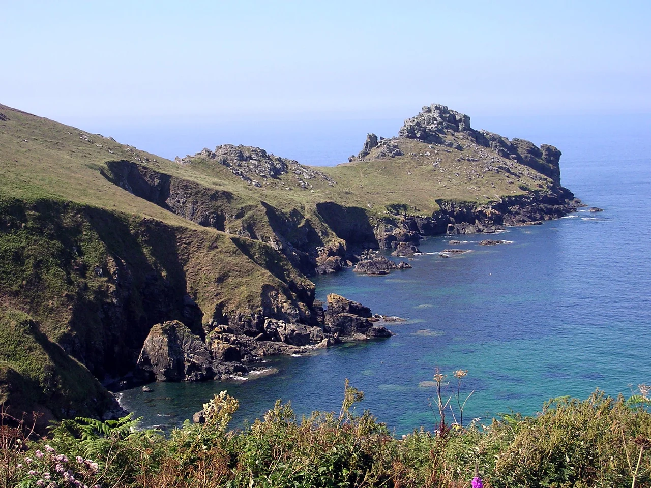

Promontory forts of Cornwall
The cliffs do most of the work. To build a Cornish promontory fort, you find a headland already cut off from the mainland on three sides by sheer drops into the Atlantic, and you wall off the fourth. One earthwork, sometimes several, with ditches dug to provide the spoil for the ramparts. The Iron Age engineers who raised these cliff castles understood that the ocean was both their best defense and their worst landlord. Storms quarried away their work century by century. Today the South West Coast Path winds past one ruined fort after another, each one barely legible, each one once important enough that someone moved tons of earth and stone by hand to mark it off from everywhere else.
Defending the Indefensible
British promontory forts were built during the Iron Age and remained in more-or-less continuous use into the early Roman period. What they were used for remains the great unanswered question. They sit in spots so exposed that year-round habitation seems implausible: bone-cold in winter, lashed by gales, often miles from fresh water. Inland hillforts show clear signs of houses, hearths, and daily life. Cliff castles do not. Many appear to have been occupied sparsely, if at all. The archaeologist William Borlase, writing in the 18th century, assumed they were fortifications, and the assumption stuck. Modern thinking gives more weight to other possibilities: prestigious sites for religious ceremonies, trade, and administration, where defense was a secondary function. Treryn Dinas on the Penwith peninsula, one of the few systematically excavated, may have developed from a Bronze Age site of ceremonial or social significance, with the ramparts added later to mark the place rather than guard it.
Trevelgue and the Seven Walls
Just north-east of Newquay, Trevelgue Head is among the most heavily defended prehistoric sites in Cornwall. Seven ramparts. The defensive ditches and banks step inward across the headland, with two early Bronze Age round barrows incorporated into the layout, suggesting the builders absorbed an older sacred landscape into their fortification. C. K. Croft Andrew began excavating in 1939, then the war started and the dig was abandoned mid-trench. The findings were not published for many years. When the work was finally written up, it revealed Iron Age roundhouses dating to the 2nd century BC, smelting pits for bronze and iron, decorated pottery sherds, and worked tin and copper. The headland had been a workshop as well as a stronghold, a place where the products of the Cornish metal trade were turned into goods.
The Granite Walls of the West
Further west, the cliff castles take on a different character. Gurnard's Head on the Zennor coast, its Cornish name meaning desolate one, has a single massive inner rampart over five metres wide at the base. Sixteen huts on the eastern side, sheltered from the prevailing wind, survive as shallow scoops in the turf. The 2nd century BC dates them, an iron knife and buckle, spindle whorls, and pottery sherds dropped into the soil and forgotten. Nearby Bosigran, Kenidjack, and Maen Castle make a chain of fortified headlands along just a few miles of cliff. Maen Castle, between Sennen Cove and Land's End, may be one of the earliest, with three hundred pottery sherds dated to between 800 and 400 BC. A 1986 National Trust survey found that its wall was built directly into a still-earlier Bronze Age field system, layering Iron Age ambition onto older agricultural land.
The Eroding Record
Time is hard on these places. Crane Castle on Carvannel Downs has lost much of its cliff to the sea, but a double rampart and ditches survive, the inner one originally five and a half metres deep below the rampart top. The only artifact found in the small 2012 excavations was the rim of a fine Roman bottle, probably imported from Gaul, suggesting contact with the continent continued long after the fort was new. At Carn Les Boel near Land's End, one rampart may actually date to a 19th-century cliff enclosure rather than the Iron Age, a reminder that not every bank on a Cornish headland is what it looks like. At Cape Cornwall, William Copeland Borlase confidently identified a cliff castle in the 1870s. A 1960 survey could find only a possible ridge. English Heritage now concludes the place probably never was a fort at all. The headlands keep their secrets, and the ocean keeps taking them, headland by headland, century by century.
From the Air
Cornish cliff castles occupy headlands from Boscastle (50.7 N, 4.7 W) on the north coast around to Rame Head (50.31 N, 4.21 W) in the southeast, with concentrations on the Penwith peninsula near Land's End and on the Lizard. Approach from Newquay (EGHQ) for the central north coast forts or from Land's End (EGHC) for the western group. From 1,500 feet AGL the ramparts read as dark crescents cutting across each headland's narrow neck; lower angles and morning or evening light deepen the shadow lines. Treryn Dinas at 50.04 N, 5.65 W and Trevelgue Head at 50.42 N, 5.07 W are the most architecturally legible from the air. Sea fog can close in quickly along the Atlantic coast year-round; spring and autumn offer the clearest light.
Nearby Stories
- Mount Edgcumbe Country Park 2.6 km away
- Tintagel 4.2 km away
- Wheal Trewavas 6.1 km away
- Tehidy Country Park 14 km away
- Battle of Plymouth (1652) 15 km away
- Okehampton Castle 19 km away
- Goonhilly Satellite Earth Station 32 km away
- Action of 17 November 1917 101 km away