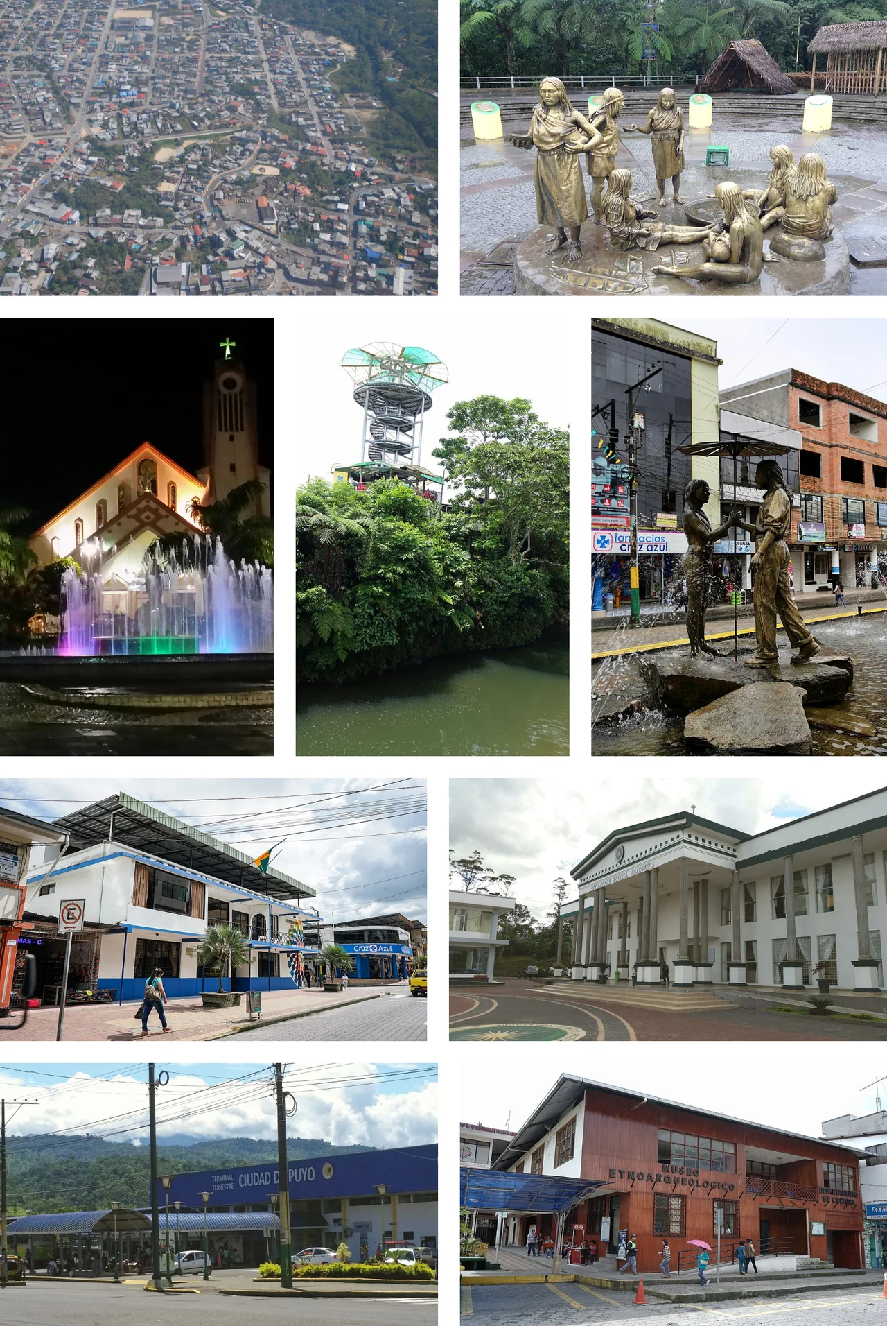
Puyo, Pastaza
On 12 May 1899, a Dominican missionary named Alvaro Valladares was walking east from Baños toward Canelos with nine indigenous Canelos men - Captain Eustaquio Palate or Illanes, Ignacio Vargas, Sebastian Illanes, Toribio Santi, and others whose names the records no longer fully preserve. They needed somewhere to stop and rest. They found it beside a modest river the Kichwa called Puyo, meaning cloudy, for the grey mist that hung over its banks most days of the year. The group built three large huts, planted a wooden cross, and celebrated a Mass dedicating the place to Our Lady of the Rosary of Pompeii. That was the founding of Puyo. The settlement would not see much traffic for decades. But it survived, and today it is the commercial, cultural, and political capital of Pastaza Province.
Cloudy by Name, Cloudy by Fact
The Kichwa name is accurate. Puyo sits at about 950 meters above sea level in a perpetually damp transition zone where the Andean foothills drop into the Amazon basin. Annual rainfall averages 4,603.8 millimeters - roughly fifteen feet of water a year. The climate is classified Af under the Köppen system: equatorial tropical rainforest, dominated by the Intertropical Convergence Zone and unvisited by cyclones. Heavy rain falls throughout the year. But Puyo's elevation gives it an advantage over lowland Amazonian cities with the same climate type. The average temperature hovers around 21.1 degrees Celsius, with daytime highs between 18 and 24 - cool by jungle standards, often overcast, never brutally hot. The city sits beside the Puyo River, a tributary of the larger Pastaza, which eventually pours its flow east into the Amazon two thousand miles away.
The Long Fight for a Province
Before Ecuador had a Pastaza Province, it had a complicated administrative patchwork. At the beginning of the nineteenth century, the Canelos region was integrated into the township of Ambato within the Presidency of Quito - at the time part of the Viceroyalty of New Granada. In 1802, King Carlos IV of Spain issued a decree creating the Bishopric of Mainas that included the Canelos Mission. Though the decree was purely ecclesiastical, it would come back to haunt Ecuador in later border disputes with Peru. During the early republican period, the Ecuadorian Oriente was largely abandoned by the central government. Missionaries came and went. Traders passed through sporadically, trading in gold, furs, latex, and the cinnamon that had given the region its oldest legend, the Land of Cinnamon. President Eloy Alfaro finally created a Special Act for the East in 1899, giving the region preferential treatment. The Canton of Pastaza was established on 13 November 1911, and Puyo became its administrative center. The Province of Pastaza was carved out later, and Puyo assumed its role as capital.
Fastest Growing City in Ecuador
In 2006, Puyo was the fastest growing city in Ecuador - approximately 25,000 residents at the end of that year, up from a much smaller population at the start of the decade. Location explains some of it. Puyo sits at the junction of routes running between Baños (the adventure-tourism hub on the Andes side) and the Amazonian cities of Tena to the north and Macas to the south. Anyone traveling overland between the central Andes and the eastern rainforest passes through Puyo. The city has become the logical base for jungle excursions, community-based indigenous tourism projects, and journeys deeper into the Amazon. A small airport operates at Shell, about 10 kilometers northwest, primarily serving Amazon communities with light aircraft and occasional medical emergency flights to Quito.
Water Fights and Worms
Puyo's cultural calendar centers on Carnaval, celebrated in the days leading up to Lent. Small neighborhood parties form across the city, and water fights - ubiquitous in Ecuadorian Carnaval - are enthusiastic here for obvious reasons. The Day of the Ecuadorian East Amazon on February 12 commemorates the regional identity that took so long to achieve official recognition. The chonta-palm festival marks the seasonal harvest of a tropical fruit central to local cuisine. At restaurants near the terminal terrestre, travelers encounter maito - fish wrapped in bijao leaves and steamed - and chontacura, the fat palm-weevil larvae that indigenous communities have eaten for millennia and that urban Ecuadorians now consume as a regional delicacy. The Omaere Ethnobotanical Park, along the Paseo Turístico del Río Puyo, offers tours in Spanish and English about the medicinal and cultural uses of native Amazonian plants. Everything about Puyo insists on its hybrid identity: Andean city, Amazon outpost, indigenous heritage, missionary founding, 125 years old and still, in 2026, growing.
From the Air
Located at 1.49°S, 78.00°W at the Andean-Amazon interface, 950m elevation - the transition zone where Andes foothills drop into Amazon basin. Viewing altitude 4,500m reveals the change in terrain: to the west, steep green slopes climbing toward the active Tungurahua and Sangay volcanoes; to the east, flat unbroken rainforest extending toward Brazil. Puyo appears as an urban grid along the Puyo River. Nearest airport: Río Amazonas Airport (SESM) at Shell, 10km northwest - a short paved strip handling light aircraft for Amazon communities. Larger Tena Airport (SETE) is ~45nm north. Weather frequently overcast (true to the Kichwa name meaning cloudy); flight operations here depend on visual contact with ridges. The Pastaza River valley provides the primary navigation reference eastward into the Amazon basin.
Nearby Stories
- Tungurahua 5.7 km away
- Tena 28 km away
- Eastern Cordillera Real Montane Forests 34 km away
- Cotopaxi 61 km away
- Ecuadorian Amazon 69 km away
- Alausi 69 km away
- Oriente (Ecuador) 92 km away
- Napo moist forests 278 km away