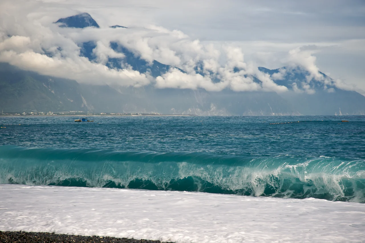

Qixingtan Beach
The beach at Qixingtan faces east, directly into the Pacific. On clear mornings, before the tourists arrive, the pebbles — smooth, gray-black, polished by the same ocean that deposits them — catch the first light off the water in a way that makes the curve of the bay look like it was planned. It was not, of course. But the name was deliberate, given by people who had lost something and chose to remember it.
The Original Place and the Airport That Replaced It
Qixingtan Beach has two histories that never quite align. The original Qixingtan lay at the east end of what is now Hualien Airport — a lake and shoreline whose shape, in the minds of those who lived there, resembled the Big Dipper constellation. *Qixingtan* carries both meanings: Seven Stars Pool, a name drawn from the seven stars of that asterism.
In 1936, the Japanese colonial administration decided to build an airport on the Hualien plain. The lake was filled. The construction crews worked through what had been shoreline and community. Of the original water body, only four ponds remain. The residents who had lived at that original Qixingtan were relocated to a coastal area called Crescent Bay — a bay shaped, as it happens, like a half-moon, the kind of curve you could recognize from above. Those residents gave their new home the old name, Qixingtan, carrying the memory of what had been erased into the geography of the place they were given.
A Crescent of Pebbles Facing the Pacific
The beach that carries the name today is not sandy in the way that beaches further south might be. The shoreline is pebble — smooth, water-worn stones in shades of gray and charcoal and black that clatter softly underfoot and shift with the waves. The bay curves in its half-moon shape, the arms of land enclosing a stretch of water calmer than the open ocean just beyond.
The Pacific here is serious. The east coast of Taiwan faces open water for thousands of kilometers — no barrier island, no sheltering reef of any consequence. The swells that arrive at Qixingtan have traveled across deep ocean before meeting the gravel shore. Swimmers should take note of conditions and currents. Visitors who come to watch rather than to enter the water have a view of extraordinary expanse: gray-green Pacific in every eastern direction, the Coastal Mountain Range at the back, and the beach's stones polished by the meeting of both.
The Sakizaya Name and the Deeper History
Before the Japanese filled the lake, before the Chinese name Qixingtan, before any colonial administration mapped this coast, the Sakizaya people — one of Taiwan's recognized indigenous groups — called this place *Malongayangay*. The name has survived into the modern record, documented alongside the two Chinese names that most visitors know.
The Sakizaya have lived along the Hualien coast for centuries, a community whose history was shaped profoundly by a 19th-century conflict with Qing dynasty forces. Their presence at this stretch of coastline is older than any of the airports, monuments, or resort developments that now define the landscape. The beach that carries a Japanese-origin name reclaimed by displaced residents was itself built on ground where a different people had their own name for the same water, the same stones, the same Pacific horizon.
The Katsuo Museum and the Headland
Near the beach stands the Chihsing Tan Katsuo Museum, dedicated to the traditional bonito fishing and processing industry that once anchored coastal communities along the east Taiwan shoreline. Katsuo — bonito, the fish prized for its flesh when dried and fermented into the flakes that define Japanese dashi — was fished in quantity from these Pacific waters. The museum preserves equipment, techniques, and social history from an industry that connected this coastline to Japanese culinary culture during the colonial period and beyond.
The beach is accessible on foot from Beipu Station on the Taiwan Railway line — a short walk east from the station brings you to the shore. For visitors coming from Hualien City, the trip north along the coast road passes rice paddies and small settlements before the Pacific opens up on the right side of the road and the pebbles begin.
From the Air
Qixingtan Beach lies at approximately 24.033°N, 121.628°E in Xincheng Township, north of Hualien City, on the Pacific coast of eastern Taiwan. From the air, the crescent bay shape is visible at low altitudes — a distinctively curved shoreline with the pebble beach bright against the Pacific. Hualien Airport (RCYU) sits approximately 8 km to the south-southeast, on the coastal plain. Pilots approaching RCYU from the north will fly directly over or near Qixingtan Beach on the coastal track — the beach and the adjacent remaining ponds from the original 1936 lake fill are visible landmarks confirming proximity to the field. The Coastal Mountain Range runs parallel to the shore inland, rising steeply and quickly from the narrow coastal plain.
Nearby Stories
- Paper Dome 6 km away
- Lintianshan Forestry Culture Park 6.8 km away
- Dongshi District 11 km away
- Xitou Nature Education Area 16 km away
- Taiping Mountain Forest Railway 27 km away
- Sinking of MV Sewol 1172 km away
- Yellow Sea 1228 km away
- Twin Forts of Romblon 1240 km away