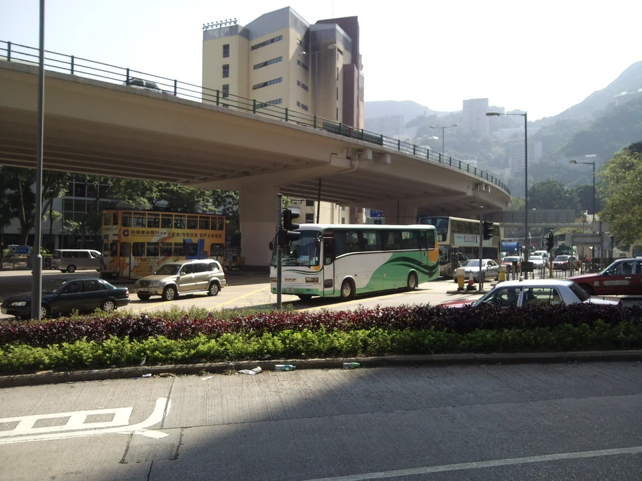

Queen's Road East
In 1991, as the clock ran down on British rule, Taiwanese songwriter Lo Ta-yu and Hong Kong singer-composer Ram Chiang recorded a song called 'Queen's Road East'. It wasn't a cheerful tune. It described the anxiety of a city watching its future approach, unsure what the communists would rename, unsure what would survive. The street they chose as their symbol runs through Wan Chai, roughly parallel to the harbour but set back from it — because the harbour, through decades of reclamation, had been steadily pushed further north. Queen's Road East follows the line of the old shoreline, the one that existed before Hong Kong began eating the sea.
The Line the Shore Left Behind
Queen's Road East connects Admiralty in the west to Happy Valley in the east, forking south from Queensway near Justice Drive and running along what was once the northern coast of Hong Kong Island. The reclamation that moved the waterfront north also created the streets that cross Queen's Road East from the south — lanes like Swatow Street and Amoy Street, built on land that did not exist in the 19th century. The settlement of Wan Chai itself began before the British arrived, as a small Chinese community clustered around what is now the Hung Shing Temple on Queen's Road East, originally built facing the sea. After 1841, the British developed the street as a European commercial and residential quarter, but by the 1860s it had become predominantly a Chinese residential, working, and shop-keeping neighbourhood. The name 'Queen's Road East' has been in documented use since at least the 1870s, though the street it refers to has always been, in a sense, a ghost of the shoreline it once was.
Shophouses, Temples, and a Street of Wedding Cards
The most vivid remnants of old Wan Chai along this corridor are the tong lau buildings at nos. 186–190, three narrow tenement shophouses built in the 1930s in a Guangzhou style — four storeys high, with verandahs facing the street, shops on the ground floor and family apartments above. They are now Grade III historic buildings. Nearby, the Hung Shing Temple on Ship Street marks the community's pre-colonial roots. Lee Tung Street, just off the main road, was for decades Hong Kong's centre for printing wedding cards and other stationery; locals called it Wedding Card Street. In November 2005 the government resumed all interests in the street for urban renewal, and it was demolished in December 2007, replaced by a luxury shopping and residential development. The Old Wan Chai Post Office at no. 221 survived, a declared monument in its small colonial-era shell, while the Khalsa Diwan Sikh Temple at no. 371 — a Grade II historic building — marks the long presence of South Asian communities in this part of Hong Kong.
Spring Garden Lane and Its Complicated History
Spring Garden Lane, running south from Johnston Road to Queen's Road East, carries a mistranslation in its name that no one ever corrected. The English 'spring' referred to a water spring; when translated into Chinese, the character chosen meant spring the season instead. In the early 1900s, Spring Garden Lane and neighbouring Sam Pan Street were a red-light district, where brothels displayed oversized street number plates to attract attention, earning the area the name 'Big Number Brothels'. This corner of Wan Chai held all the friction of a colonial port city in one block: Chinese families in the lanes above, sailors and merchants below, churches and temples within walking distance, the smell of the harbour still close.
Air-Raid Tunnels and the View from Above
Hidden behind the buildings along the south side of Queen's Road East, under Mount Parish, are three surviving portals — nos. 79, 80, and 81 — of the air raid precaution tunnels dug before the Battle of Hong Kong in 1941. The Japanese captured Hong Kong on 25 December 1941, and during the occupation from 1942 to 1945, nearby Queen's Road Central was briefly renamed Meiji-dori. The tunnels under Mount Parish were cut off from that daily life, sealed in the hillside. Today Wah Yan College occupies the hill, separated from the road below by the tunnel portals. The Dah Sing Financial Centre at no. 248 — 156 metres tall, 40 floors, completed in 1998 — rises just to the east, offering the kind of vertical contrast that defines contemporary Hong Kong: wartime concrete beneath, gleaming finance above.
A Street That Kept Its Name
The song Lo Ta-yu and Ram Chiang wrote in 1991 was born from genuine fear that streets like this one would be renamed after the handover. It was, in retrospect, an unnecessary worry — Queen's Road East kept its name after 1997, as did Queen's Road Central and Queen's Road West. But the song captured something real about the city's mood in that decade: the sense that a place could be erased not just by demolition but by renaming, by the quiet substitution of one symbol for another. The street itself, meanwhile, kept accumulating its layers. Old shophouses beside modern towers, a Sikh temple near a declared-monument post office, pedestrianised lanes where printing presses once ran. Queen's Road East is not a preserved museum district. It is a working street that simply hasn't forgotten what it used to be.
From the Air
Queen's Road East runs through Wan Chai on Hong Kong Island at approximately 22.2759°N, 114.1700°E, tracing an east-west corridor between Admiralty and Happy Valley. From 2,000 feet approaching from the north over Victoria Harbour, the Wan Chai district appears as a dense band of towers behind the harborfront; the curve of Happy Valley Racecourse at the eastern end of the road is a clear visual reference point. The cylindrical Hopewell Centre (216 metres) at no. 183 is one of the district's most distinctive landmarks. Nearest major airport: Hong Kong International Airport (VHHH), approximately 32 km to the northwest on Lantau Island.
Nearby Stories
- Lok Ma Chau Loop 2.3 km away
- Portas do Cerco 2.3 km away
- Kweilin Incident 17 km away
- Wanshan Archipelago Campaign 34 km away
- Nanxiong Formation 115 km away
- Battle of Nanpeng Island 148 km away
- Heyuan 169 km away
- Cape Maobitou 632 km away