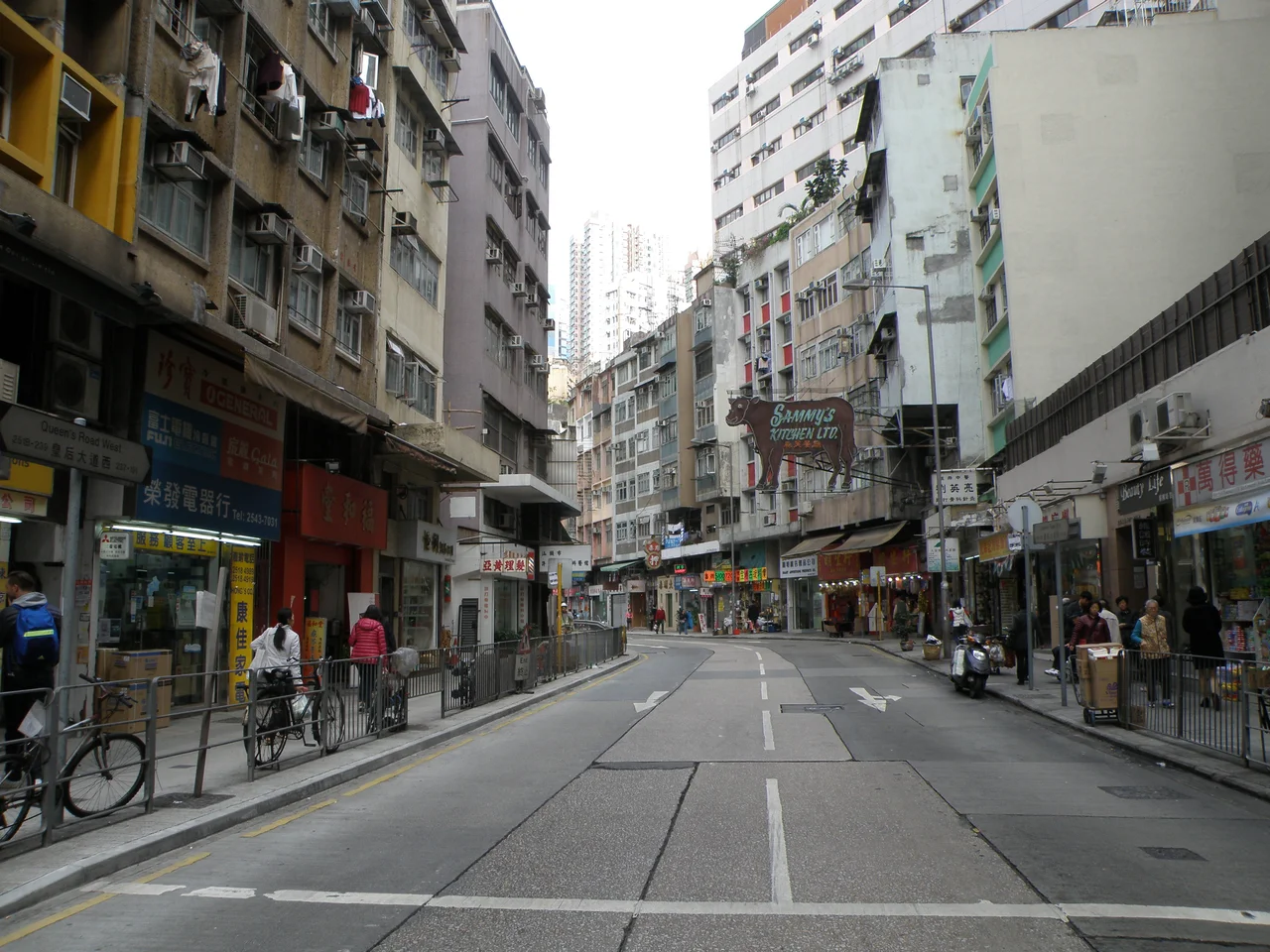

Queen's Road, Hong Kong
The name was wrong from the start. When the Royal Engineers built Hong Kong's first road between 1841 and 1843, it was named in honour of the British sovereign — but Chinese translators rendered it 皇后 (queen consort) rather than 女皇 (sovereign queen). Nobody corrected it. The error stuck, and so did the road. Queen's Road was 4 miles long, running from Shek Tong Tsui in the west to Wan Chai in the east, the spine of a city that barely existed yet. Where it ran, there was beach, then a dirt track prone to dust clouds and puddles of mud, then everything Hong Kong eventually became.
A Dirt Track Becomes a City
When Sir Henry Pottinger set up his tent on the beach in 1842, Queen's Road ran parallel to the shoreline just behind him. The Royal Engineers built the first sections with the labour of 300 workers from Kowloon, then still a Chinese territory. In those earliest years, Hong Kong was a haphazard collision: the Hong Kong Club for taipans and merchant princes at one end, squatter huts, military encampments, and taverns at the other. The first governors built their houses along Queen's Road. The first post office arrived, then the first Christian churches. What the newcomers found was not yet a road in any civic sense — it was a muddy track that flooded in the rains and choked with dust in the dry months. That was Hong Kong's founding artery, and everything that followed grew outward from it.
Christmas Fire, 1878
On Christmas Day 1878, fire broke out in the slums along Queen's Road and did not stop for 17 hours. When it was over, 400 houses had burned across a 10-acre area and thousands of residents were left without homes. Constance Gordon-Cumming, a Scottish travel writer, witnessed the disaster and recorded it in her 1886 book Wanderings in China. The ruins did not sit idle. They were cleared and used as fill for reclamation adjacent to the burned area — what is now Bonham Strand. Out of the ashes came some of Hong Kong's most expensive real estate. The fire remade the neighbourhood it destroyed, which is a very Hong Kong kind of story. After 1878, Queen's Road became home to the island's most prominent buildings and its costliest land.
Four Sections, One Road
Today Queen's Road exists in four named sections running west to east. Queen's Road West links Sheung Wan to Shek Tong Tsui, beginning at the junction with Possession Street. Queen's Road Central — one of the first roads built by the British, along with Hollywood Road — runs from Central to Sheung Wan and became the infrastructure of Queen's Town, later renamed the City of Victoria. At its eastern end it merges with Des Voeux Road Central to become Queensway at the junction of Garden Road. Queensway itself was the westernmost section of Queen's Road East until 1967, when the development of Admiralty as a business district prompted the renaming. Queen's Road East picks up from there, following the old original shoreline through Wan Chai to Happy Valley. At every point along the route, the road marks where Hong Kong's shoreline used to be — before reclamation pushed the harbour steadily north.
Occupied, Renamed, Restored
During the Japanese occupation from 1942 to 1945, the colonial authorities renamed Queen's Road Central as Meiji-dori, after Emperor Meiji. The name lasted only as long as the occupation. In December 1941, the Battle of Hong Kong had lasted just 18 days before the British surrender on Christmas Day. The road that had been the hub of colonial commerce became part of an occupied city. After the war, the original names returned along with the administration that had used them. The four sections of Queen's Road today carry names that predate the occupation, names that predate the fire of 1878, names that go back to a translation error made by a clerk in 1841 or 1842 that no one ever thought worth fixing.
In Popular Memory and on Film
Queen's Road has made its way into unexpected corners of culture. In the 1941 film The Maltese Falcon, a hat belonging to Mary Astor's character carries the label 'Lucille Shop — Queen's Road C Hong Kong' — a small detail that places the most famous MacGuffin in cinema history in the orbit of this street. Decades later, as Hong Kong's handover approached, songwriter Lo Ta-yu and lyricist Albert Leung composed 'Queen's Road East' in 1991, performed by Lo Ta-yu and Ram Cheung Chi Kwong. The song expressed the fear that streets named for colonial figures would be renamed after the communists arrived. It was a fear the street itself outlasted. Queen's Road still runs where it always ran, still carries its mistranslated name, still traces a shoreline that the harbour no longer remembers.
From the Air
Queen's Road traces the northern coast of Hong Kong Island at approximately 22.2812°N, 114.1570°E for its Central section, running roughly east-west for about 6.5 km. Approaching from Victoria Harbour at 3,000 feet, the road is not individually visible but the dense urban corridor it anchors — from Shek Tong Tsui in the west through Central and Wan Chai to Happy Valley — forms the entire northern face of the island. The International Finance Centre towers in Central and the cylindrical Hopewell Centre in Wan Chai are useful visual reference points. The original shoreline the road follows is now buried under several blocks of reclaimed land between the road and the current harbourfront. Nearest major airport: Hong Kong International Airport (VHHH), approximately 30 km northwest on Lantau Island.
Nearby Stories
- Lok Ma Chau Loop 2.3 km away
- Portas do Cerco 2.3 km away
- Kweilin Incident 17 km away
- Wanshan Archipelago Campaign 34 km away
- Nanxiong Formation 115 km away
- Battle of Nanpeng Island 148 km away
- Heyuan 169 km away
- Cape Maobitou 632 km away