
Ras Muhammad National Park
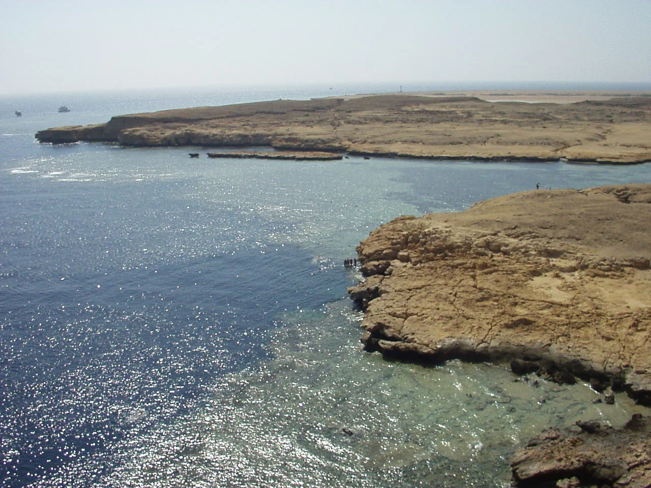
Stand at the very tip of the Sinai Peninsula and the desert simply stops - cliffs of pale, layered rock drop away, and two seas press in from either side. To the west, the Gulf of Suez; to the east, the Gulf of Aqaba. Their currents collide here, dragging plankton up from the deep and feeding one of the richest stretches of coral reef on Earth. The ancients knew this cape and built a shrine to Poseidon on it, calling it Poseidion. The modern Arabic name, Ras Muhammad, means Cape of Muhammad - given, it is said, because the profile of the cliff resembles the face of a bearded man, the hard horizontal strata forming the nose and chin.
The Wall Where Worlds Meet
What makes Ras Muhammad extraordinary is geometry as much as biology. The reef does not slope gently away here - it plunges, forming sheer underwater walls that drop into blue darkness. Two sites in particular draw divers from across the world: Shark Reef, a dramatic vertical face patrolled by schooling barracuda, tuna, and the occasional shark, and Yolanda Reef beside it, scattered with the surreal cargo of a wrecked freighter - porcelain toilets and bathtubs now colonized by coral. The collision of the two gulfs keeps the water charged with nutrients, and the fish gather in numbers that can leave a first-time diver simply hovering, watching the silver storms wheel past.
An Astonishing Census
The numbers read like a naturalist's fever dream. More than 220 species of coral grow in these waters, around 125 of them soft corals that ripple in the current like underwater meadows. The reefs shelter over a thousand species of fish, alongside 40 kinds of starfish, 25 of sea urchin, more than a hundred mollusks, and 150 species of crustacean. Green turtles and hawksbill turtles glide through regularly. The park covers 480 square kilometers in all - only 135 of them dry land, the remaining 345 underwater - making it as much a marine sanctuary as a terrestrial one. The famous wreck of the SS Thistlegorm, sunk in 1941, lies off this coast and ranks among the finest wreck dives in the world.
Saving a Fragile Edge
Protection came not a moment too soon. When the Sinai returned to Egyptian control, the reefs faced fishing by dynamite and knife - methods that shattered coral and gutted fish populations. In 1983 the Egyptian Environmental Affairs Agency declared Ras Muhammad a marine reserve, making it the country's first protected area, with a mandate to guard both the wildlife and the cape itself against the sprawl creeping out from nearby Sharm El Sheikh. The reserve once included the islands of Tiran and Sanafir, until sovereignty over them passed to Saudi Arabia. Today it stands as a center of Egyptian eco-tourism, a model for keeping a place wild while letting people in to marvel at it.
Cracks, Mangroves, and a Restless Crust
The wonders are not all underwater. Ras Muhammad sits at the junction of three tectonic plates - the Arabian, the African, and the Sinai subplate - and the ground bears the marks of their slow grinding. Earthquakes have torn open fissures in the land, one of them around 40 meters long, holding pools of water more than 14 meters deep. At the peninsula's southern end, a small mangrove forest clings to a shallow tidal channel, its salt-tolerant roots a green anomaly in a desert of gravel plains, wadis, and dunes. Acacia trees and doum palms gather at the mouths of dry valleys, and migrating birds drop in to rest and feed. It is a landscape stitched together from extremes - reef and desert, fault line and forest, all crowded onto a single cape.
From the Air
Ras Muhammad National Park occupies the southern tip of the Sinai Peninsula at 27.769 N, 34.210 E, about 12 km south of Sharm El Sheikh. From the air the cape is unmistakable: a wedge of pale desert thrusting into the Red Sea where the Gulf of Suez (west) and Gulf of Aqaba (east) converge, fringed by vivid turquoise shallows that mark the reefs before they drop to deep blue. Recommended viewing altitude 3,000-7,000 ft for the full peninsula and reef structure. Sharm El Sheikh International Airport (ICAO HESH, IATA SSH) lies about 20 km north. The area is extremely dry with reliable visibility year-round; summer heat and occasional coastal haze are the main considerations, and the meeting of the two gulfs can produce noticeable surface chop and current lines visible from above.
Nearby Stories
- Tiran Island 28 km away
- Neom 40 km away
- Hurghada 50 km away
- Dendera Temple complex 178 km away
- Naqada culture 218 km away
- Wadi Rum 219 km away
- 2021 Suez Canal Obstruction 257 km away
- Hegra 318 km away