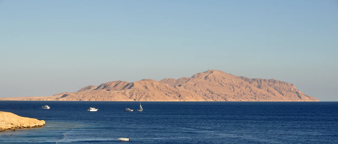

Tiran Island
Almost nobody lives here. A handful of soldiers, a scatter of gulls, beaches that some reports say are still seeded with mines from old wars. Yet for a place barely thirty square miles of rock and reef, Tiran Island has cast a shadow far larger than itself. The reason lies just off its western shore, where the seabed pinches the water into a channel only a few hundred meters wide. Whoever holds that channel can open or close the only sea route into the Gulf of Aqaba, to the ports of Eilat and Aqaba beyond. On Tiran, geography is destiny, and the destiny has rarely been peaceful.
The Width of a War
The Straits of Tiran are the gateway between the Red Sea and the Gulf of Aqaba, and Tiran Island marks their narrowest, most defensible point. For Israel, the strait was the only maritime door to the south, the path for oil tankers and trade with Asia and East Africa. So when Egyptian President Gamal Abdel Nasser closed the strait to Israeli shipping on 22 May 1967, the act was understood on both sides as something more than a blockade. Israel treated it as a casus belli, a cause for war. Within two weeks the Six-Day War had begun, and Israeli troops had seized the island. A line drawn through shallow water had moved armies. Few places on Earth show so plainly how a stretch of sea barely wider than a runway can pull whole countries toward conflict.
Passed From Hand to Hand
Tiran's modern history reads like a deed passed between neighbors who could not quite agree on who owned it. King Abdulaziz Al Saud placed the island under Egyptian administration in 1950, when Saudi Arabia lacked a navy and feared an Israeli advance. Egypt held it until Israel seized the island during the 1956 Suez Crisis and occupied it until March 1957, when international pressure forced a withdrawal. Egypt regained control, then lost the island again to Israel in the 1967 Six-Day War. Egypt recovered it under the 1979 peace treaty, which guaranteed free passage for Israeli ships through the strait. Then, in 2016 and 2017, Egypt agreed to transfer Tiran and its sister island Sanafir back to Saudi Arabia. The handover was contested in Egyptian courts, where lawyers argued the islands had always been Egyptian and the government had merely been a custodian. President Abdel Fattah el-Sisi ratified the agreement in June 2017 despite the legal challenges. Sovereignty had changed, but the strait's old rules remained: Saudi Arabia pledged to honor the freedom of navigation the treaties had promised.
Ghosts of Iotabe
Long before warships and peace treaties, this scrap of land may have been Iotabe, a toll station described by the Byzantine historian Procopius. Ships bound for India paid duties here. Around the year 473 a Saracen leader named Amorkesos seized the island and pocketed its revenues, until the Byzantine Empire took it back a quarter-century later. Procopius wrote of an autonomous Jewish community that lived on the island into the sixth century, a detail that would be invoked, fifteen hundred years later, in the rhetoric of twentieth-century wars. By the time of the Islamic conquests, the place had fallen silent and empty. Scholars still debate whether Tiran was truly Iotabe or whether another island in the gulf wore that name. The uncertainty suits the island, a guardpost remembered mostly for who passed by, not who stayed.
A Sanctuary for Wings
Strip away the geopolitics and Tiran becomes something quieter: a desert island ringed by some of the Red Sea's most vivid coral, once part of Egypt's Ras Muhammad National Park. BirdLife International has named it an Important Bird Area because it shelters breeding white-eyed gulls, a species found only around the Red Sea and the Gulf of Aden. The reefs that make the surrounding waters a magnet for divers are the same shallows that make the strait so narrow and so strategic. There is an irony in that. The very geography that armies fought over is also what gives the island its beauty, the bright water and the seabirds wheeling above a place where, for most of history, the most important traffic has been passing through rather than coming ashore.
From the Air
Tiran Island sits at 27.95 degrees N, 34.57 degrees E, at the mouth of the Gulf of Aqaba between the Sinai Peninsula and the Saudi coast. From altitude it reads as a distinct teardrop of pale rock ringed by reef, with the even smaller Sanafir Island just to its east and the narrow shipping channel hugging its western flank. The nearest major airport is Sharm El Sheikh International (ICAO HESH) on the Sinai side, roughly 30 km northwest; King Abdulaziz / Hala airfields near the Saudi NEOM coast lie to the northeast. Visibility over the gulf is typically excellent, and the contrast between deep-blue open water and turquoise shallows makes the straits easy to identify from a cruising aircraft. The planned Saudi-Egypt Causeway is routed to cross the strait by way of the island.
Nearby Stories
- Neom 5.7 km away
- SS Thistlegorm 31 km away
- Saint Catherine's Monastery 31 km away
- Ras Muhammad National Park 41 km away
- Hurghada 64 km away
- Wadi Rum 144 km away
- Tomb of Aaron (Jordan) 237 km away
- Hegra 296 km away