.jpg)
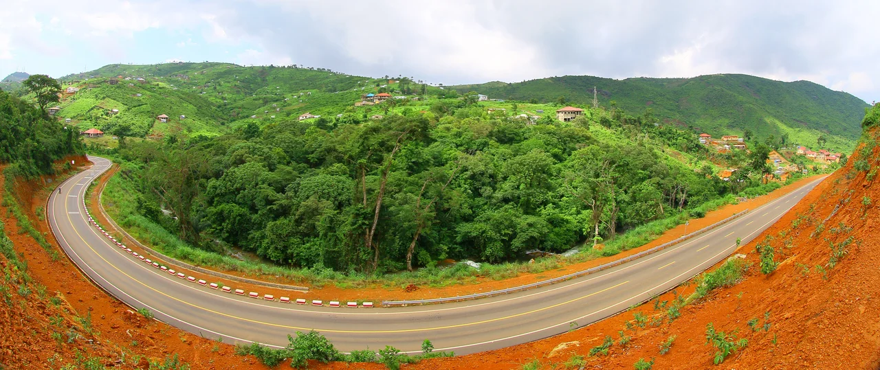
Regent, Sierra Leone
Before it was Regent, this place in the hills above Freetown was called Hogbrook - an ordinary name for a stream in the forest. Then, in 1812, it became something extraordinary: a town built from scratch by men and women who had been on slave ships only weeks earlier, intercepted at sea and set free on this coast. They came off the boats with nothing but their lives and a second chance, and in the green folds of the Lion Mountains, six miles east of the capital, they made a community out of strangers.
Freed at Sea, Rebuilt on Land
These were the Liberated Africans - people captured for the transatlantic slave trade whose ships were stopped by the Royal Navy's West Africa Squadron after Britain banned the trade. Pulled from the holds of slavers off the West African coast, they were brought to Freetown and resettled in villages carved into the surrounding hills. Regent was one of the first. The people who landed here came from dozens of nations and spoke dozens of languages; many had been torn from homes they would never see again. What they built together - alongside Jamaican Maroons and Black settlers from Nova Scotia - became the foundation of the Sierra Leone Creole people, a wholly new society assembled by the survivors of an atrocity. The town's English name honored George IV, then Prince Regent, but the town itself belonged to them.
The First Stone Church in West Africa
At the center of that new community rose St Charles' Church, its foundation stone laid in 1809 and the building completed in 1816 when the German-born missionary William A. B. Johnson of the Church Missionary Society arrived. It is widely held to be the first stone church built in West Africa, raised by liberated Africans on a hilltop that had been wilderness a few years before. Johnson, who served here from 1816 until his death in 1823, drew crowds so large the church had to be enlarged - though the deeper story is the congregation itself, people who had every reason to despair choosing instead to build, learn, and worship in a language and a faith many were encountering for the first time. The stone walls still stand, weathered but solid, a monument less to one missionary than to the thousands who laid them.
A Diverse Town in the Hills
Two centuries on, Regent is a mountainous town of roughly 22,000 people, and its religious diversity - churches and mosques sharing the same steep streets - reflects the patchwork of origins that founded it. It produced figures like the economist and politician Solomon Athanasius James Pratt, whose career carried the town's name into national life. The setting is dramatic: houses cling to slopes thick with forest, the air cooler than the city below, the Atlantic glittering in the distance beyond ridge after green ridge. It is a quiet place now, more village than suburb, but every stone in it sits on a story of people who were never meant to be free and built a home anyway.
When the Hillside Gave Way
The same hills that shelter Regent can turn against it. In August 2017, after relentless rain, a portion of Mount Sugar Loaf above the Regent area collapsed in a catastrophic mudslide and flood that killed an estimated 500 people, many in their sleep, with hundreds more never recovered. Floodwaters carried the dead toward the Atlantic, and some were found as far away as the coast near Conakry, in neighboring Guinea. It was one of the deadliest natural disasters in the country's modern history, and it struck a community already defined by endurance. Regent grieved, buried its dead where it could, and stayed. The town that began with survivors of one tragedy has, more than two centuries later, survived another.
From the Air
Regent sits in the hills of the Western Area Peninsula at roughly 8.333°N, 13.067°W, about six miles (10 km) east of central Freetown, near the village of Gloucester. Look for the town tucked into forested slopes below the peaks of the Lion Mountains; the historic St Charles' Church is its landmark. Lungi International Airport (GFLL) lies across the estuary to the north. Terrain is steep and forested - maintain safe clearance and expect cloud and heavy rain on the slopes during the May-November wet season, the same conditions that triggered the 2017 mudslide on nearby Mount Sugar Loaf.
Nearby Stories
- Mabilafu 48 km away
- Turtle Islands 55 km away
- Sierra Leone 63 km away
- Bonthe 64 km away
- Îles de Los 95 km away
- Sandervalia National Museum 115 km away
- Loos Islands 126 km away
- Rocas Atoll 2595 km away