Rio São Francisco Mangroves
Red mangrove trees do something no other tree can. Their roots arch out of the mud on curved stilts, holding the tree above tidal water while aerial rootlets dip down for brackish oxygen. Shrimp nurseries form in their shade. Crabs climb them at high water. Oysters cling to the bark. The whole structure filters sediment from rivers meeting the sea, protects coastlines from storm surge, and stores carbon at a rate that makes rainforest look modest. The Rio São Francisco mangrove ecoregion - five hundred kilometers of fragmented mangrove stands along the Atlantic coast of eastern Brazil - is one of the most biologically rich stretches of this curious, overlooked biome.
Three Pockets Along Five Hundred Kilometers
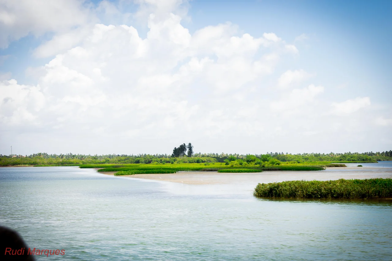
The ecoregion, cataloged by the World Wildlife Fund as NT1433, stretches from the outskirts of Maceió in Alagoas southward to a point just below Salvador in Bahia. The mangroves are not continuous; they cluster wherever rivers reach the sea, in three main concentrations. The northernmost is at Barra de São Miguel in Alagoas, a small sector around the inlet of the Lagoa do Roteiro. The central cluster surrounds the enormous estuary of the São Francisco River, South America's fourth-longest, where the river empties into the Atlantic after a 3,000-kilometer journey from the highlands of Minas Gerais - joined along this coast by the Sergipe River at Aracaju and the Vaza-Barris River to the south. The southernmost concentration wraps the Bay of All Saints, fed by the Paraguaçu River above Salvador, where the mangroves ring the shallower bays and islands like dark-green fringes.
Climate on an Edge
The Köppen classification calls it a tropical monsoon climate - Am in the shorthand - which sits midway between true rainforest and tropical savanna. Temperatures stay above 18 degrees Celsius every month, and annual rainfall runs between 1,250 and 1,500 millimeters. What varies is the dry season. In the north of the ecoregion, near Maceió, the driest stretch lasts four to five months around the southern-hemisphere winter solstice. Further south, near Salvador, the rain becomes more evenly distributed across the year. This climate gradient, rather than geography alone, is what gives the ecoregion its unusually high biodiversity - the mangroves at the two ends of its range experience different seasonal pressures, and different species thrive at each.
Three Mangroves, Many Birds
Three mangrove species do most of the structural work here. The red mangrove, Rhizophora mangle, stands at the seaward edge on its distinctive stilt roots. Black mangrove, Avicennia schaueriana, grows further back, where soil oxygen is slightly less scarce, sending up pencil-thin pneumatophores through the mud to breathe. White mangrove, Laguncularia racemosa, prefers the landward margin where salinity drops. Inland of the mangroves lie beaches on the coast side and forest or coastal restinga on the other. The whole system is a critical stop on the great shorebird migrations of the Atlantic flyway. Ruddy turnstones - stout, orange-legged waders that breed in the high Arctic - rest and feed on Bahian mud. Spotted sandpipers work the water's edge. Whimbrels, with their long curved bills, probe crab burrows at low tide. These birds will be back in Canadian tundra by July, having used the São Francisco mangroves to fuel part of the journey.
Fragments of Protection
Legal protection across the ecoregion is patchy. Piaçabuçu Environmental Protection Area, at the mouth of the São Francisco itself, protects one of the richest segments where the river meets the sea. The Área de Proteção Ambiental Mangue Seco, near the small village of Mangue Seco on the Bahia-Sergipe border, preserves a stretch of dunes and mangrove creeks famous for their cinematic beauty. Santa Isabel Biological Reserve covers another important pocket. Much of the rest of the ecoregion faces the usual pressures - shrimp farming, coastal real estate, port expansion, sediment changes upstream as dams on the São Francisco shift the volume and timing of freshwater flow. The mangroves that hold out along these five hundred kilometers of coast do so in scattered patches, each valuable in itself, and more valuable still because the migratory birds that need them have no alternative to chain together.
From the Air
The Rio São Francisco mangrove ecoregion stretches from approximately 9.5°S in Alagoas southward to about 13°S just south of Salvador, Bahia - roughly 500 km of Brazilian Atlantic coast. Centerpoint near 12.77°S, 38.82°W. Salvador Bahia Airport (ICAO: SBSV, IATA: SSA) serves the southern sector; Aracaju's Santa Maria Airport (ICAO: SBAR, IATA: AJU) serves the central estuary around the São Francisco mouth; Maceió's Zumbi dos Palmares (ICAO: SBMO, IATA: MCZ) serves the northern cluster. From 3,000-5,000 feet the mangroves read as dark-green fringes around river mouths and inside bays, distinct from the lighter forest and cleared land inland. Tropical monsoon climate; easterly trade winds; 1,250-1,500 mm annual rainfall with a pronounced dry season in the north.
Nearby Stories
- Recôncavo Baiano 31 km away
- Battle of 4 May 39 km away
- 2019 Northeast Brazil Oil Spill 41 km away
- Pé de Serra 76 km away
- MV Araraquara 121 km away
- SS Annibal Benévolo 185 km away
- Sincura 209 km away
- Chapada Diamantina 217 km away