
River Lea
Stand on Lea Bridge at low light and the river looks unremarkable, brown water sliding past concrete embankments, narrowboats moored gunwale to gunwale, the rumble of traffic overhead. Yet the River Lea is one of the oldest political boundaries in England. Iron Age Catuvellauni faced the Trinovantes across its valley. Alfred the Great and the Danish king Guthrum drew their treaty along its course in the 890s. When the Boundary Commission redraws London's parliamentary seats today, it still refuses to let any new constituency cross the Lea. The river has been arguing with the land for at least two thousand years and the land has never quite won.
Bright Water from the Chilterns
The Lea rises at Well Head inside Waulud's Bank, a Neolithic henge at Leagrave Common in the Luton suburbs. The henge was built around 3000 BC by people who clearly thought the spring mattered. The name itself probably descends from a Brythonic Celtic root, lug, meaning bright or light, perhaps a dedication to the god Lugus. A simpler theory connects it to the modern Welsh word for a flow or current. Either way, the river is old in language and older in geology. It cuts through the Chiltern chalk, which is why London tap water is famously hard. The Lea is what scientists call a chalk stream: cold, clear, mineral-rich, and globally rare. Most chalk streams in the world flow in southern England. Most of them are not in good health. The upper Lea, before it hits Hertford, is still one of the country's better examples.
Forty-two Miles to the Thames
From Leagrave the young river runs through Luton, through the Luton Hoo estate, then into Hertfordshire. It passes Harpenden, Wheathampstead (once the capital of the Catuvellauni tribe), and the gap between Welwyn Garden City and Hatfield. At Hertford it turns south, takes on the tributaries Mimram, Beane, Rib, Ash, and finally the Stort, and from there becomes a different river entirely. The Lee Navigation, a canalised channel that begins at Hertford Castle Weir, runs alongside the natural river for the rest of its course. Past Ware, where Izaak Walton fished, past Hoddesdon and Broxbourne and the long string of reservoirs and former gravel pits known as the Lee Valley Park, the river slides into Greater London. By Hackney Marshes it has become urban. By Bow Creek it has become tidal. At Leamouth it meets the Thames between Blackwall and Canning Town.
Cockney 'Lea' and the Spelling Wars
There are two ways to spell the river: Lea and Lee. The upstream stretch, in Bedfordshire and Hertfordshire, prefers Lea. From Hertford to the Thames, both spellings appear. The Lee Navigation was established by Acts of Parliament and uses only that spelling; the Lee Valley Regional Park Authority follows suit. But London road signs, walking paths, geological surveys, and Adele's 2015 album track all use Lea. Cockney rhyming slang turned the river into a word for tea, with a long-vowel "lea" rhyming with a long-vowel "tea." The river also gave its name to the suburbs that grew along it: Leagrave at its source, Leyton and Luton further along, both derived from words meaning farmstead on the Lea. The pronunciation has been steady for centuries even when the orthography has wobbled.
Water for London
By the early 17th century London was thirsty and the Lea was already dirty. In 1613 Sir Hugh Myddleton opened the New River, a 40-mile artificial channel that abstracted clean water from the Lea and its tributaries above Hertford and ran it gently downhill to a reservoir at New River Head in Clerkenwell. The New River is still in service. It still delivers eight per cent of London's drinking water. The Lea below the abstraction point, deprived of much of its flow, became progressively the working river of east London. By the 19th century its banks held the Waltham Abbey Royal Gunpowder Mills, the Royal Small Arms Factory at Enfield Lock, the Thames Ironworks shipyard at Bow Creek (whose works football team became West Ham United), and the Congreve Rocket Factory at Stratford. A.V. Roe built and flew the first all-British powered aeroplane from a railway arch on Walthamstow Marshes in 1909. The arch is still there.
Olympic Park and the Mile-Long Hidden Country
Below Hackney Wick the river enters what for most of the 20th century was an industrial badlands of gasworks, power stations, scrapyards, and abandoned factories, knitted together by the Bow Back Rivers, a network of medieval mill channels that had silted up into half-forgotten waterways. London chose this exact patch as the site for the 2012 Olympic Games. Cleaning the soil took years and millions of tonnes of contaminated earth had to be moved. The Olympic Stadium was built on an island between two branches of the Lea and is now home to West Ham United. The Lee Valley White Water Centre in Hertfordshire, which hosted the canoe slalom events in 2012, has gone on to host the ICF World Championships twice. The Lea today carries kayakers, narrowboats, occasional seals, and one or two suspected wels catfish.
Boundaries and Stories
The river is still a boundary. Between Essex and Hertfordshire upstream, between London boroughs downstream, between communities that have looked across it at one another for sixty generations. In 894, Alfred the Great trapped a Viking fleet that had sailed up the river to Hertford by digging a channel that lowered the water level enough to leave them stranded. In 1110, Henry I's wife Matilda is said to have fallen at the ford near Bow and ordered the building of a distinctively bow-shaped bridge over the river: the first bridge over the lower Lea, the origin of Bow's name. There are still arguments about whether the "fair lady" of London Bridge Is Falling Down refers to her, or to the river itself. The Lea has always been about crossings: of water, of borders, of centuries.
From the Air
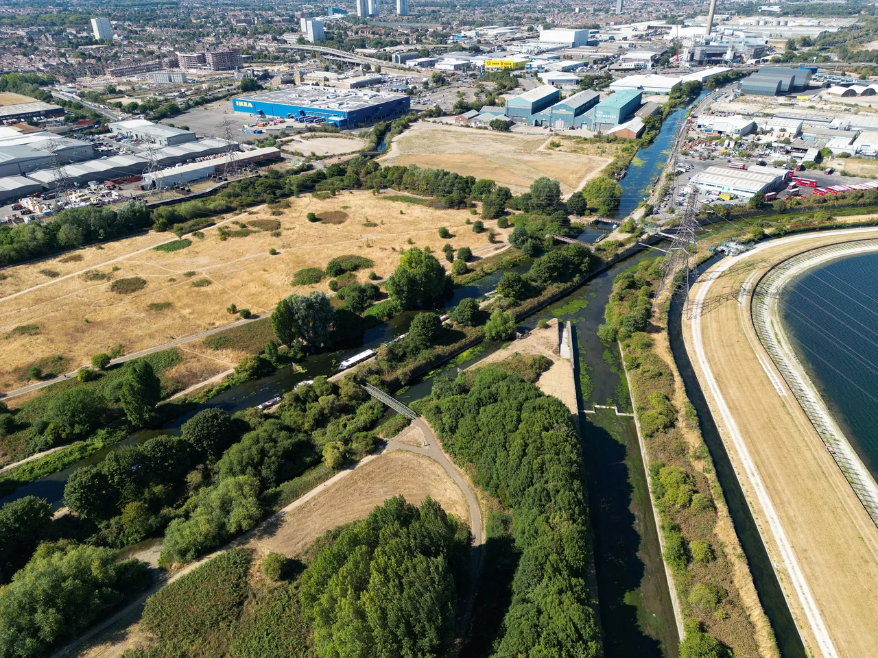
The River Lea rises at Leagrave Common in Luton at approximately 51.9103°N, 0.4612°W and runs roughly 42 miles southeast to meet the Thames at Bow Creek near Canning Town (51.5074°N, 0.0089°E). The river is best viewed in three sections: upper (around Hertford), middle (the chain of 13 reservoirs of the Lee Valley Reservoir Chain north of Tottenham, including the King George V, William Girling, and Banbury reservoirs), and lower (Hackney Marshes through the Queen Elizabeth Olympic Park to Bow Creek). Recommended viewing altitude 2,000 to 4,000 feet to trace the river course; the reservoir chain is a striking dark band visible for miles. Nearest airports: Luton (EGGW) sits adjacent to the river's source, Stansted (EGSS) lies 17 miles east of Hertford, Heathrow (EGLL) 20 miles southwest of Bow Creek, London City (EGLC) is 2 miles from the river's confluence with the Thames. Note: most of the lower Lea is within London's controlled airspace; VFR routing requires Special VFR or transit clearance.
Nearby Stories
- Epping Forest 4.1 km away
- Girton College, Cambridge 6.2 km away
- Hunt family murders 11 km away
- Death of Harry Dunn 11 km away
- Waytemore Castle 14 km away
- Wellingborough 15 km away
- Abingdon-on-Thames 15 km away
- Chesterton Windmill 30 km away