.jpg)
Robin's Nest (Hong Kong)
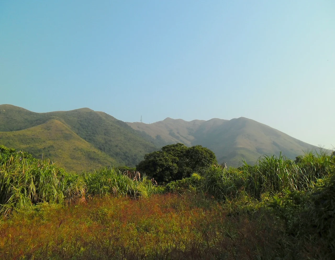
The English name is evocative and soft. The Chinese name is something altogether different: Hung Fa Leng, Red Flower Ridge — a name that carries the colour of whatever wildflowers once carpeted its slopes in season, or perhaps the colour of the soil, or perhaps the light at dusk when the ridge catches the last sun before it disappears behind Shenzhen. Robin's Nest sits in northeastern Hong Kong, in the North District, on the southern side of the border with Shenzhen. For decades it was inaccessible to ordinary Hongkongers, a restricted zone in the Frontier Closed Area. Then, on 1 March 2024, it became Hong Kong's 25th country park — the end of a planning process that stretched more than seven years and the beginning of something else entirely.
Red Flower Ridge at the Edge of Two Worlds
Robin's Nest stands at the 55th-highest elevation among Hong Kong's hills and mountains — not the dramatic summit the name might suggest, but a ridge that earns its significance from position rather than height. To the north, just across the boundary, the Shenzhen skyline is visible on clear days: a wall of apartment towers and office blocks rising from the Pearl River Delta plain. To the south, the view opens across the green terrain of Hong Kong's rural north, toward Plover Cove Country Park and the distant shimmer of the harbour. It is a landscape defined by contrast — one of the world's densest cities visible from one of its most contested pieces of protected countryside. The border that runs along the ridge's northern flank is not abstract. It is a fence, a patrol road, and a dividing line between two different legal systems, policed and surveilled, crossing which requires documentation and intent.
A Long Road to Protected Status
The Hong Kong government first announced plans to designate Robin's Nest as a country park in 2017. The formal proposal came in June 2019. Then came the legislative machinery: public consultations, technical assessments, boundary negotiations, and the ordinary slowness of the process by which wild land becomes officially protected. As of 2021, the final legislative work was still in progress. The designation finally came through on 1 March 2024 — seven years after the first announcement. The new Robin's Nest Country Park joins the network of 25 parks that collectively cover approximately 40 percent of Hong Kong's land area, a proportion remarkable for a territory of its density. Below the ridge, the village of Lin Ma Hang contains an abandoned lead mine and the ruins of MacIntosh Fort, remnants of colonial-era industrial and military presence in this border zone.
The Former Name and What It Means
Ma Tseuk Leng was the older Chinese name for the area, the same name used for a nearby village and the surrounding terrain. When 'Robin's Nest' became the official English designation, something was gained and something was lost. The English name invites a particular image: a small, sheltered, warm space, a place of nurturing. Hung Fa Leng — Red Flower Ridge — suggests something wilder, more elemental, more connected to the specific landscape of rocky ridgelines and the seasonal blooms of Hong Kong's native shrubs. Both names coexist on maps. Hikers who make the approach from Lin Ma Hang pass through a valley that the former name fits well: enclosed, wooded, quiet in a way that border zones sometimes are, emptied of the ordinary traffic of Hong Kong life by the permit requirements that govern movement here.
Opening the Ridge
Country park designation brings a particular set of changes. Trail maps appear. Signage goes up. Ferry services, bus schedules, and visitor facilities become subjects of government planning. The Frontier Closed Area restrictions that once governed access to this part of Hong Kong have been progressively relaxed in recent years, though the immediate border zone remains controlled. Robin's Nest Country Park sits in a landscape that also includes Plover Cove Country Park to the east and Pat Sin Leng Country Park to the south — a connected sweep of protected terrain across the northern New Territories that becomes, with the 2024 designation, slightly more complete. The wildflowers that may have given Hung Fa Leng its name — perhaps the red blooms of Hong Kong's native azaleas in spring, or the scarlet of wild impatiens in summer — grow here still, on a ridge that is finally, formally, recognised as worth protecting.
From the Air
Robin's Nest (Hung Fa Leng) sits at 22.541°N, 114.190°E in the North District of Hong Kong. The ridge runs roughly northeast-southwest along the southern edge of the Shenzhen border. From the air, it is identifiable as a prominent green ridge separating the urbanised areas of Shenzhen (visible to the north) from the rural terrain of the northern New Territories below. The Man Kam To border crossing is approximately 3 km to the west-southwest. Hong Kong International Airport (VHHH) is approximately 45 km to the southwest. The best aerial perspective is from the south or southeast at low altitude — the contrast between the densely built Shenzhen plain and the forested Hong Kong hills is striking and immediate from this vantage point.
Nearby Stories
- Hong Kong Disneyland 4.1 km away
- Mount Guanyin (Dongguan) 7 km away
- 2024 Lixinsha Bridge Collapse 7.4 km away
- Portas do Cerco 12 km away
- Lotus Hill 15 km away
- Nanxiong Formation 78 km away
- Heyuan 130 km away
- Checheng Fu'an Temple 629 km away