
Rock Creek Park
On September 27, 1890, Benjamin Harrison signed a bill that did something almost nobody noticed at the time: it set aside 1,754 acres of wooded creek valley in the middle of the nation's capital and ordered the federal government to keep its timber, animals, and curiosities in their natural condition, as nearly as possible. Yellowstone had been first in 1872. Mackinac came in 1875. Rock Creek Park was third. Sequoia was created the same week and Yosemite the next month, but Washingtonians can claim, with a straight face, that their daily commute crosses one of the oldest national parks in America - and the only natural urban park in the system.
The Forest That Cuts a City in Half
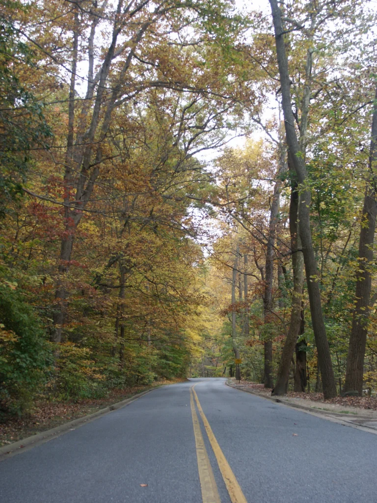
Rock Creek Park is shaped like a long green wedge driving down through Northwest Washington from the Maryland line to the Potomac. It is roughly twice the size of Manhattan's Central Park, and unlike Central Park it was never planted - the oaks and tulip poplars and beeches are the same hardwoods that grew here before John Smith came up the Potomac. The park separates Georgetown, Cathedral Heights, and Spring Valley from the rest of the city so completely that Washingtonians use the shorthand WOTP and EOTP, west of the park and east of the park, to describe whole neighborhoods. Drive Beach Drive on a Saturday in October and you cannot believe you are inside the District. Counting the satellite properties the park administers - Meridian Hill Park, Dumbarton Oaks Park, Battery Kemble, the Old Stone House in Georgetown, the Civil War forts on the city's edges - the unit oversees 99 separate sites and more than 2,000 acres.
Peirce Mill
Eight grist mills once ground grain along Rock Creek inside what is now the District. Seven are gone. Peirce Mill, built in the 1820s by Isaac Peirce, still stands beside the creek, its overshot wheel still turning when staff demonstrate the machinery on weekends. The mill became part of the park in 1892, two years after the park was created, and it was listed on the National Register in 1969. Joshua Peirce, Isaac's son, and a nephew named Peirce Shoemaker kept the operation running through the nineteenth century, milling cornmeal and buckwheat flour for Washington households when the city was still pulling itself together from the Civil War. Walking the trail past the mill today, you can hear the same falling water that pulled grain into stone for two hundred years.
The Capitol Stones
For nearly forty years, one of Rock Creek Park's strangest landmarks was a two-story heap of carved limestone and sandstone tucked at the back of a maintenance yard. The stones were the Capitol's: cornices, columns, balusters, and ornamental fragments removed during a 1958-62 expansion of the East Front. Architect of the Capitol crews trucked them up to Rock Creek and stacked them roughly, intending to find a use for them later. They never did. The pile grew into an unmarked, unsanctioned attraction, a place where hikers stumbled across the very ornament that once framed Lincoln's second inaugural. In August 2022 the Architect of the Capitol finally hauled the stones away to a storage yard for possible reuse. The Washington Post, The New York Times, and Smithsonian Magazine all eulogized them. The pile was beloved precisely because almost nobody officially knew it existed.
Beach Drive, Battle Drive
For sixty years, cyclists and the National Park Service have fought a slow, polite war over Beach Drive, the four-lane road that threads the park's middle. The Park Service experimented with weekend closures starting in 1963. By 1972 the section between Joyce and Broad Branch was closed to cars on Sundays year-round. In 1983 the park almost permanently closed Beach to traffic, then reversed under pressure from the AAA and local governments. In the 1990s a group called Auto-Free DC staged 'rolling road block' protests, slowing rush-hour traffic to force the issue. Mayor Anthony Williams campaigned in favor of closure, then opposed it once elected, citing post-9/11 evacuation concerns. The 2005 management plan kept Beach open. When the COVID-19 pandemic emptied Washington's roads in 2020, the Park Service finally closed major sections to cars - and never reopened them. Cyclists, joggers, parents with strollers, and a few dazed commuters now share a road that was a four-lane highway when Reagan was inaugurated.
The Park's Inhabitants
Over two million people visit Rock Creek Park each year, but most of the park's residents are not human. White-tailed deer browse the understory in numbers high enough that the Park Service runs an active deer-management program. Beavers have returned to the creek. Wood thrush nest in the canopy. A herd of horses lives at the Rock Creek Park Horse Center, founded in 1972 - 57 stalls, two outdoor rings, and a therapeutic riding program called Rock Creek Riders that has worked with veterans wounded in Iraq and Afghanistan, children with autism, and adults with cerebral palsy. The park's golf course, designed by William Flynn and opened in 1923, was segregated until 1941, when Secretary of the Interior Harold Ickes ordered every public course in the city integrated. The William H.G. FitzGerald Tennis Center, the planetarium at the Nature Center, picnic groves, and dozens of trails fill the rest. For two million people a year, this is what an urban national park can do: stop the city at its own edges, and leave the forest standing.
From the Air
Rock Creek Park runs roughly north-south through Northwest Washington, centered near 38.9514 degrees N, 77.0500 degrees W, threading from the Maryland line at Chevy Chase Circle south to Klingle Ford near the National Zoo, then continuing as the Rock Creek and Potomac Parkway to the Lincoln Memorial. From the air it reads as a continuous wooded corridor 1.5 to 2 miles wide at its widest, dividing the dense city to either side. Best viewed at 2,000 to 4,000 feet AGL in clear conditions; the corridor lies entirely within the Washington FRZ. Nearest airports are Ronald Reagan Washington National (KDCA) 5 nm south, College Park (KCGS) 5 nm east, and Washington Dulles (KIAD) 22 nm west.
Nearby Stories
- Gunston Hall 1.1 km away
- 2023 Baltimore Shooting 4.9 km away
- Battle of Middleburg 6.6 km away
- Crownsville Hospital Center 10 km away
- Battle of Loudoun Heights 13 km away
- First Battle of Rappahannock Station 20 km away
- Howard County, Maryland 21 km away
- Harriet Tubman Underground Railroad 50 km away