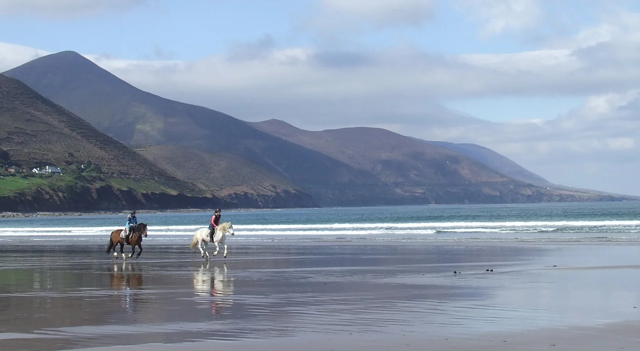

Rossbeigh
In one winter storm, the Atlantic took a road. Not a paved road - a sandspit two miles long, a thin curling arm of dune and beach that for centuries had reached out from the Iveragh Peninsula into Dingle Bay, sheltering the harbour behind it. In 2008, waves brought down a stretch of dune said to be twelve hundred feet long and split Rossbeigh in two. The outer half became, overnight, a tidal island. The lighthouse that had stood at the end of the spit for more than a hundred years held on for another three winters, then collapsed in February 2011. The villagers moved its remains a kilometre inland, to Glenbeigh, and rebuilt it on dry ground - a memorial, mostly, to the geography it once described.
A Spit Among Three
Rossbeigh - sometimes spelled Rossbehy - is one of three sandspits that together regulate the mouth of Dingle Bay. Cromane reaches in from the inner harbour at Castlemaine. Inch Strand juts south from the Dingle Peninsula opposite. Rossbeigh extends north from Glenbeigh, on the Iveragh side. Together they form a complex of barrier beaches against a narrow, deep, sediment-rich bay where Atlantic swells funnel in and force their freight of sand back and forth along the shore. The result is some of the most spectacular and most unstable coastline in Ireland - miles of dune systems built up over centuries, then rearranged in a single bad season. It is also a habitat: marram grass, sea holly, herbaceous flora, nesting wildfowl. Salmon and clam are farmed in the sheltered water behind the spit. The land is wild and worked at once.
The 2008 Breach
The breach was the kind of event that coastal engineers had been quietly predicting, and locals had been quietly dreading, for years. Rossbeigh's outer dunes were unusually high but unusually thin - sand stacked vertically with little reserve behind it. In the winter of 2008, a sustained run of storms struck the spit at the right angle and at the right tide, and a long section of dune simply collapsed into the surf. By spring there was open water where there had been a continuous beach. Aerial photographs from the years that followed show the spit truncating mid-arc, the severed outer section sitting as a separate sandbar offshore. Local reporting in 2020 framed the loss as a climate-change warning: 'homes across the bay at risk,' the Irish Examiner wrote, as extreme events grew more frequent.
The Tower's Second Life
The Rossbeigh Strand Tower had stood for more than a century at the seaward tip of the spit, a navigation marker for Castlemaine Harbour. After the breach, it stood on the new tidal island - cut off from the mainland, surrounded by water at every high tide, the sand beneath it eroding faster than anyone could shore up. In February 2011 it fell. Volunteers from Glenbeigh recovered what they could and, over the years that followed, rebuilt the tower in the village itself. It now sits a kilometre from the sea it once watched, a stone reminder that this coast does not stand still. The reconstruction was a community project. Local money, local labour, local stubbornness.
Sand Does Not Disappear
Jimmy Murphy, an engineer at University College Cork who has spent years studying the Rossbeigh system, told the Irish Examiner in 2020 that the breach was not the end of the spit. 'People think when you get erosion that the sand disappears,' he said, 'but the sand has to go somewhere.' His estimate: roughly ten million tonnes of sand had been deposited offshore by the storm, and was sitting in deeper water waiting to migrate back. The dunes, he believed, would rebuild themselves over decades if not centuries. Coastal sediment systems are patient. They are also unforgiving. The spit that exists now is not the spit that existed in 2007, and it will not be the spit that exists in 2050. The Atlantic edits its own work.
The Wild Atlantic Way
What survives is still spectacular. Rossbeigh sits on the Wild Atlantic Way, the touring route that traces Ireland's west coast from Donegal to Cork. The beach on the inland side remains long and walkable. The Slieve Mish mountains rise to the northeast across Dingle Bay, often hidden by weather, occasionally lit by sudden sun. In 2008, after the storm, the timbers of a nineteenth-century schooner called the Sunbeam emerged from the disturbed sand - a wreck that had lain hidden for generations, briefly exposed before the dunes covered it again. Even the disasters here have layers. The coast keeps secrets and gives them up unevenly. To walk Rossbeigh is to walk on something the sea is still deciding.
From the Air
Located at 52.06 degrees N, 9.97 degrees W on the Iveragh Peninsula side of Dingle Bay. Recommended viewing altitude 1,500 to 3,000 feet AGL to trace the curving sandspit and the breach point where the outer section sits as a tidal island. The Slieve Mish range rises to the northeast on the Dingle Peninsula. Nearest airport is Kerry (EIKY), about thirty kilometres northeast near Farranfore. The bay is exposed to Atlantic systems - expect crosswinds at low altitude, particularly in winter, and rapid visibility changes as fronts come ashore.
Nearby Stories
- Inishtooskert 2.5 km away
- Staigue stone fort 5.6 km away
- Listowel 7.1 km away
- Castleisland 13 km away
- Ballyheigue Castle 13 km away
- Kealkill stone circle 15 km away
- RMS Carinthia (1925) 93 km away
- Sao Miguel 1951 km away