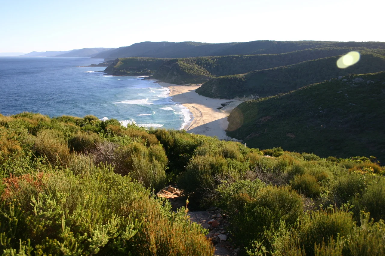

Royal National Park
When a strip of bushland south of Sydney was set aside on 26 April 1879, the men who did it reached for a phrase that had never been used quite this way before. They called it, simply, The National Park. Yellowstone had been protected seven years earlier, in 1872, but it was first proclaimed a public park; this place in New South Wales was the first land anywhere dedicated under the words national park. That makes it the second national park in the world and the originator of the name we now use for thousands of them. It was renamed Royal National Park in 1955, after Queen Elizabeth II passed by on her Australian tour. Today it sits barely an hour from the centre of Sydney, and on a hot summer weekend it can fill to capacity and shut its gates.
An Idea Before Its Time
Consider how strange the gesture was in 1879. The notion that ordinary land should be locked away from development for the simple pleasure and health of the public was barely a decade old anywhere on Earth. Australia was not even a country yet; this was still the Colony of New South Wales, which would not federate until 1901. The reservation was driven partly by a Victorian belief that working city dwellers needed fresh air and open country, a place to escape the smoke of Sydney. That colonial origin, and the fact that the park is still run by the state rather than the national government, is part of why the world tends to crown Yellowstone the first and quietly forget Royal. But the park earned its place. It is listed on the Australian National Heritage List precisely because it marks the very beginning of nature conservation on the continent.
Two Worlds in One Park
What makes Royal extraordinary is the collision of landscapes packed into a relatively small area. Walk one way and you are on the coast track, following spectacular sandstone cliffs that drop straight to the Pacific, with views north toward Sydney and south toward Wollongong. Turn inland and within minutes you descend into deep river valleys where tall rainforest closes overhead, lilly pilly and fragrant celery wood scenting the air. The Hacking River runs through the heart of it at Audley, where a historic boatshed still hires out rowboats, canoes, and kayaks much as it has for generations. Paddle upstream and the picnickers fall away; after forty-five minutes you can have the river entirely to yourself, the banks alive with birds and the occasional turtle sunning on a fallen log.
The Coast Track
The park's signature walk is a 30-kilometre coastal route from Bundeena in the north to Otford in the south, a journey best taken over two days. It threads past the great beaches, Wattamolla, Garie, Era, Burning Palms, climbing headlands and rounding rocky foreshores between them. In the valley at Era, weathered huts built during the Great Depression still stand, and deer move through the grass alongside kangaroos. The reward for timing the walk to the humpback migration is the chance, from high on a cliff, to spot a mother whale and her calf moving slowly up the coast below. The fit and determined can swallow the whole track in a single day, but the country deserves to be lingered in, with a night camped under the stars at North Era.
Beauty With Sharp Edges
Royal can lull you, and it should not. Its most Instagram-famous feature, the Figure Eight Pools, sits on an exposed ocean rock shelf near Burning Palms where rogue waves have caught and injured the unwary; the pools are safe only at low tide in calm seas. The bush itself asks respect. Eastern brown snakes, among the most venomous in the world, sun themselves on quiet tracks, though they are shy and want nothing to do with you if you give them room. Carry your own water, because the streams that run so clear through the gullies are not reliable to drink and not reliable to flow. When rain comes, so do the leeches. None of this is reason to stay away. It is the price of a true wild place sitting on a great city's doorstep, still wild after nearly a century and a half.
From the Air
Royal National Park occupies the coast and hinterland at roughly 34.13 degrees south, 151.05 degrees east, on the southern fringe of Sydney. From the air it reads as a broad block of dark forested plateau pushed right up against the Pacific, its eastern edge a line of pale sandstone sea cliffs broken by pocket beaches like Wattamolla and Garie. The Hacking River and the village of Bundeena mark the northern side; the Sea Cliff Bridge and Stanwell Park lie just beyond the southern boundary. Recommended viewing altitude is 1,500 to 3,500 feet to trace the cliff line and river valleys. The park sits beneath Sydney's busy controlled airspace, with Sydney Airport (ICAO YSSY) about 30 km north, so expect restrictions and check NOTAMs carefully before any low overflight. Clear days after a southerly change give the sharpest views of the cliffs and the green canopy inland.
Nearby Stories
- Parramatta 12 km away
- Jervis Bay 71 km away
- Australian War Memorial 152 km away
- Canberra 174 km away
- Apsley Falls 321 km away
- Walcha, New South Wales 357 km away
- Mount Hope, New South Wales 440 km away
- 2003 Fiordland Earthquake 1767 km away