.jpg)
Canberra
The shortlist of names was magnificent and absurd. Before the new capital was christened in 1913, the public proposed "Sydmelperadbrisho" - a mash-up of the rival cities - along with "Wheatwoolgold" and "Kangaremu." In the end the planners chose Canberra, drawn from a word of the Ngambri and Ngunnawal peoples whose country this had always been. Sydney and Melbourne had spent years fighting over which should be the nation's capital, and at federation in 1901 the constitution settled it with a compromise: neither would win, and a brand-new city would rise on empty pasture in between. Critics called it a waste of good sheep country. They were not entirely wrong, and that tension - between the grand plan and the stubborn land - still defines the place.
A City Drawn in Chicago
In 1911 the young government held an international competition to design its capital from scratch, and more than 130 entries arrived from around the world. The winner, announced in May 1912, was Walter Burley Griffin, a landscape architect from Chicago who had worked in Frank Lloyd Wright's studio. He had never set foot in Australia. His design, rendered in luminous ink and gold by his wife and creative partner Marion Mahony Griffin, threaded geometric avenues and a chain of lakes between the surrounding hills, so that the city's axes lined up with natural peaks. It was a vision of the City Beautiful, idealistic and rigorous. Much of it would not be built in Griffin's lifetime, derailed by two world wars, the Depression, and his own bitter feuds with the bureaucrats meant to realise it.
The Bush Capital
Canberra wears two faces. One is the planned capital of monuments and ministries; the other is what locals call the bush capital, where wild country presses right up against the suburbs. Kangaroos sometimes hop down Northbourne Avenue into the heart of the city. After dinner on a summer evening, families wander up the local hills, and the climb to the lookout atop Mount Ainslie is a civic ritual. The Australian National Botanic Gardens gather plants from every Australian climate, from northern rainforest to desert spinifex, on the slopes of Black Mountain. Beyond the urban fringe, Namadgi National Park fills nearly half the entire territory with alpine ridges, walking tracks and Aboriginal rock art at sites like Yankee Hat.
A Town of Comings and Goings
Around 480,000 people live here, and a great many of them did not grow up in the city. The classic Canberra story is to arrive for study or a posting with the federal government, stay a few years, and move on - so the population is forever cycling through, public servants and contractors and diplomats. That transience took its toll on the city's sense of itself; it was long dismissed as "several suburbs in search of a city." Yet an identity has slowly settled in. Census figures show the territory has the highest proportion of same-sex couples in the country, and a culture of cafes, cool-climate wineries and festivals has grown up to fill the planned spaces with unplanned life.
Watching the Sky
The same emptiness that critics mocked turned out to be an asset for looking upward. Canberra's clear, dry, high-altitude air drew the science of the stars. In the hills southwest of the city, the Canberra Deep Space Communication Complex tracks spacecraft across the solar system as one of just three such NASA stations on Earth. Deeper into Namadgi lie the quiet remnants of Honeysuckle Creek, the tracking station that received the first television pictures of Neil Armstrong stepping onto the Moon in 1969 and relayed them to the world. Mount Stromlo Observatory, badly burned in the 2003 bushfires and partly rebuilt, still opens its domes to the public on Saturday nights. For a city accused of being dull, Canberra has a remarkable habit of reaching past the horizon.
From the Air
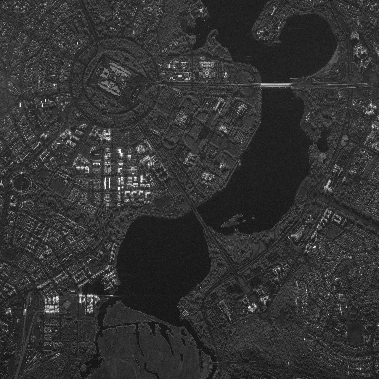
Canberra sits at roughly -35.28, 149.13, inland in the Australian Capital Territory, ringed by the hills of the Australian Alps' northern foothills at about 580 m elevation. From altitude the planned geometry is unmistakable: Lake Burley Griffin's irregular silver ribbon splits the city, with the dead-straight land axis of Anzac Parade crossing it between the War Memorial and Parliament House. Black Mountain (with its tower), Mount Ainslie and Mount Majura frame the basin. Canberra Airport (YSCB / CBR) is the primary field, on the city's eastern edge, with a control zone and a restricted area over the Parliamentary Triangle. Expect cold, clear, often frosty winter mornings with excellent visibility; summer can bring heat haze and occasional bushfire smoke. Sydney (YSSY) lies about 240 km northeast.
Nearby Stories
- Mount Kosciuszko summit trails 69 km away
- Hive shipwreck 79 km away
- Snowy Mountains Scheme 89 km away
- Wollongong 119 km away
- Murray River 179 km away
- Royal National Park 191 km away
- Warangesda Aboriginal Mission 250 km away
- 2003 Fiordland Earthquake 1800 km away