
Sai Wan Ho
In 1901, Sai Wan Ho had 420 residents and a market with red brick outer walls. There was a tea stall outside, a noodle shop, a cotton tire shop, and — inevitably — a slaughterhouse. The Xin'an County Chronicle of 1819 hadn't even bothered to mention the place. By 1909, the Taikoo Dockyard dormitories were complete, housing over 10,000 workers in three streets of four-story buildings, each unit with its shared wood-burning stove and rows of bunk beds for single men. Sai Wan Ho grew because work demanded it — not glamour, not planning, just the straightforward arithmetic of a dockyard that needed labor and labor that needed somewhere to sleep.
The Dockyard That Made the Neighborhood
Taikoo Dockyard was the engine of Sai Wan Ho's early growth. The dormitory complex completed in 1909 was divided into 1st, 2nd, and 3rd Streets — a grid as utilitarian as its purpose. Married staff had rooms with space for four or five families; single workers shared bunk beds three high in the corridors outside. The kitchen and toilet were communal. Running water came courtesy of the dockyard itself, which operated its own water supply. The arrangement was functional and dense, designed to keep the workforce close to the ships. By the 1911 census, the neighborhood's population had reached 876, with men outnumbering women nearly three to two — a demographic that reflected the industrial character of a dockyard town where most of the work, and most of the workers, were male.
Tai On Building: A Landmark in Stages
In 1968, Swire — successor to the Taikoo Dockyard interest — completed the Tai On Building on the waterfront. It was an H-shaped tower, 28 floors tall, and it was built to the water's edge: the platform on the first floor faced the sea, and fishing boats took on water from a station at the base. The basement held a shopping mall, a gas station, a theatre, and a parking area. Fresh fish, butchers, grocery stores, and a restaurant on the tramway side — the building contained an entire neighborhood's worth of daily life in vertical form. For more than a decade, the sea lapped against its foundations. Then, in the 1980s, land reclamation pushed the shoreline progressively northward. By the time the Island Eastern Corridor was built, Tai On Building was no longer on the water. It was inland. The sea it once faced had become road and then apartments.
Reclamation Rewrites the Shore
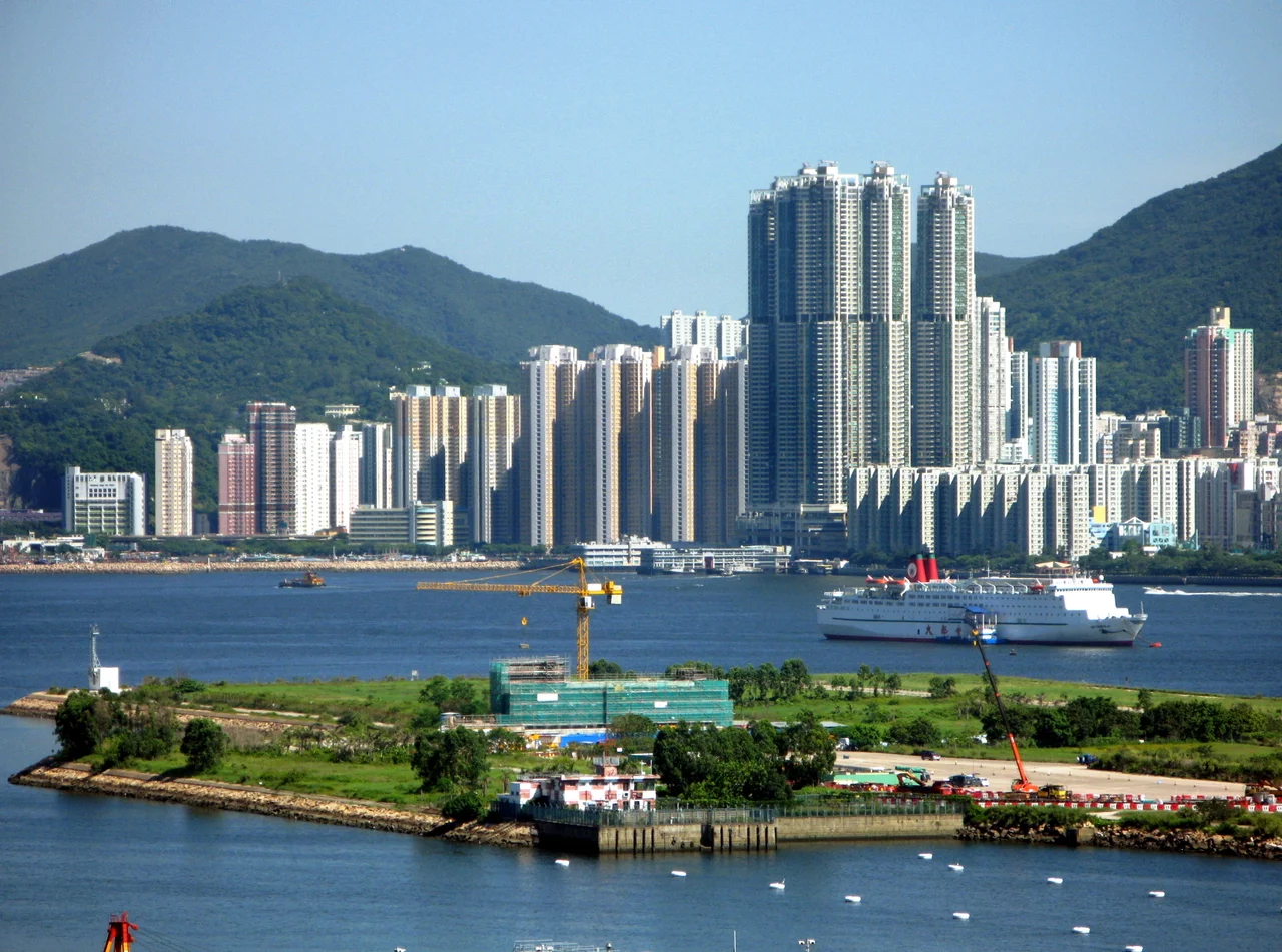
From the 1980s through the 2000s, Hong Kong's hunger for buildable land steadily remade Sai Wan Ho's northern edge. Squatter settlements on the hillsides were cleared in 1989, replaced by public housing estates — Yiu Tung Estate and Hing Tung Estate among them. As reclamation extended the island into Victoria Harbour, the new seafront became prime real estate. Grand Promenade, Les Saisons, and Lei King Wan — the major private estates of the new waterfront — appeared where water had been within living memory. The Island Eastern Corridor, a raised highway, now divides old Sai Wan Ho from new: on one side, older buildings and the older fabric of the neighborhood; on the other, the glass and concrete of the reclaimed shore.
What the Waterfront Became
Today the Sai Wan Ho waterfront carries the name Soho East — a designation borrowed from London's Soho and reapplied to a stretch of restaurants, bars, and specialty coffee shops along the harbor promenade. The Hong Kong Film Archive occupies a purpose-built building near the water, preserving the city's cinematic heritage in a neighborhood that once preserved dockyard workers. The Eastern Law Courts building, the Marine Police Regional Headquarters, and Sai Wan Ho Civic Centre give the area an institutional weight that balances the waterfront leisure. The tramway along Shau Kei Wan Road still runs, as it has for generations, connecting Sai Wan Ho to the rest of Hong Kong Island with the same unhurried pace it always has. Twelve minutes to Causeway Bay. Eighteen to Central. A ferry across Victoria Harbour toward Kowloon. The neighborhood that once existed to serve a dockyard now serves the city on its own terms.
From the Air
Sai Wan Ho is located at 22.2816°N, 114.2221°E on the northeastern shore of Hong Kong Island, between Quarry Bay to the west and Shau Kei Wan to the east. From the air at 2,000–3,000 feet, the Island Eastern Corridor — the elevated highway running along the north shore — is a clear visual reference. The reclaimed waterfront estates (Grand Promenade, Les Saisons) are visible as the newer, more regular development north of the corridor. Hong Kong International Airport (VHHH) lies approximately 17 nautical miles to the west-northwest. Victoria Harbour provides north orientation. The MTR Island Line's Sai Wan Ho station marks the neighborhood's center. Taikoo Shing, immediately to the west, is one of the largest private housing estates visible from the air.
Nearby Stories
- Lok Ma Chau Loop 2.3 km away
- Portas do Cerco 2.3 km away
- Kweilin Incident 17 km away
- Wanshan Archipelago Campaign 34 km away
- Nanxiong Formation 115 km away
- Battle of Nanpeng Island 148 km away
- Heyuan 169 km away
- Cape Maobitou 632 km away