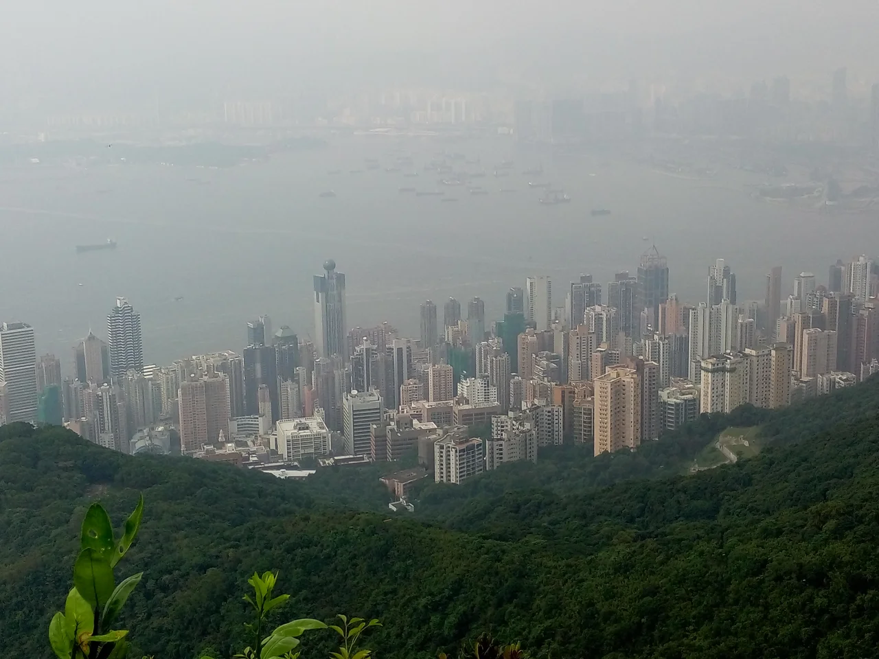

Sai Wan
The name means simply "Western Bay," but in Hong Kong the word "Sai Wan" carries extra weight. After the 1997 handover, the Beijing government established its Liaison Office in this district, and Hongkongers — not without irony — began using "Sai Wan" as shorthand for the office itself, the way Washingtonians say "the White House" when they mean the administration. A place name that once evoked plague and brothels and the western edge of a colonial city had become, quietly, a metonym for a new kind of power.
The Line at High Street
In the early 1800s, Sai Ying Pun — the core of what is now called Sai Wan — was where Chinese immigrants settled on the slopes west of Tai Ping Shan. Europeans were also assigned to the area, but not without careful demarcation: High Street was the dividing line, and Chinese residents were excluded from living to the east of it. The colonial city organized itself in vertical stripes, with race and class determining which strip you occupied.
By 1880, the district had sewerage, macadamized streets, and a dense population packed into the alleys running down to the harbour. Then in the 1890s, bubonic plague arrived. Sai Ying Pun was among the hardest-hit areas. The neighboring district of Tai Ping Shan was so thoroughly infected that the government resumed the land, cleared the buildings, and demolished them entirely — an act of urban surgery that effectively erased a neighborhood. Sheung Fung Lane was nearly wiped out. The disease killed indiscriminately, but the poor, crowded into tenements without adequate drainage, bore the worst of it.
Stone Ponds and Silk Curtains
The neighborhood of Shek Tong Tsui takes its name from a stone pond — "shek tong" — that the Hakka people mined from the 17th century onward. By the early 20th century, that geological past was buried beneath one of Hong Kong's most flamboyant commercial districts.
In 1903, the first land reclamation of Shek Tong Tsui was completed, and Governor Matthew Nathan seized the opportunity. The old brothel district near Possession Street had just burned down in a major fire, and Nathan decided to relocate Hong Kong Island's sex trade to the newly available land in Shek Tong Tsui. The move transformed the neighborhood almost immediately. Cantonese opera theaters opened to serve the clientele. Restaurants followed. The district became, in the language of the era, the place to entertain the affluent Chinese in Hong Kong — a world of red lanterns, sung drama, and the kind of commerce that left no formal record.
Queen's Road, the first road built in Hong Kong by the British between 1841 and 1843, ran through this world, connecting the colonial city from Shek Tong Tsui all the way east to Wan Chai. The 1987 film *Rouge*, starring Anita Mui and Leslie Cheung, drew from this era's atmosphere: a ghost story set in a Shek Tong Tsui brothel, where love and grief outlasted the buildings.
Kennedy Town and the City's Edge
At the western tip of Hong Kong Island, Kennedy Town was the city's frontier. Named after Arthur Edward Kennedy, who served as governor from 1872 to 1877, the town took shape through land reclamation along the coast beginning in 1886 — years after his tenure had ended, but in his honor, it formed a narrow strip: the Kennedy Praya running along the waterfront, backed by steep slopes rising toward the hills.
In 1903, the Hong Kong Government erected seven boundary stones across the city inscribed "City Boundary 1903." One stands at the Kennedy Town Temporary Recreation Ground on Sai Ning Street — a stone marker for the limit of the colonial city, out near the point where the land gave way to open water. Beyond the tram terminus at Kennedy Town, there was originally nowhere left to go.
Land reclamation continued in phases through the 1930s, then stopped when the Battle of Hong Kong interrupted everything in 1941. More reclamation came at the end of the 20th century. Belcher Bay, named after the Royal Navy surveyor Edward Belcher who made the first British survey of Hong Kong Harbour on 25 January 1841, now serves as a goods loading and unloading site — transformed from the bay that once earned a sardonic nickname shared with Gin Drinkers Bay and Tseung Kwan O: collectively known in Cantonese as the "Bay of Trash."
Handover and Haunting
After 1997, Sai Wan's identity shifted in ways its colonial planners could not have anticipated. The Liaison Office of the Central People's Government in the Hong Kong Special Administrative Region opened in the district, drawing the district into the vocabulary of political life. When Zhang Xiaoming was head of the Liaison Office, even he used "Sai Wan" as a casual reference to his own institution — a sign that the metonym had fully taken hold.
The district's older layers remain visible beneath the new ones. The Lo Pan Temple, a Grade I historic building, still stands — dedicated to the patron deity of construction workers, an apt presence in a city that has never stopped building. The University of Hong Kong occupies the heights of Sai Ying Pun. The old high street that once divided European from Chinese Hong Kong is now just a street, running without enforced meaning through a neighborhood that has outlasted the logic that built it.
From the Air
Sai Wan occupies the western tip of Hong Kong Island at approximately 22.285°N, 114.132°E. Approaching Hong Kong International Airport (VHHH) from the east, the district is visible as the dense urban cluster at the rounded western end of the island, with the University of Hong Kong rising on the slopes above the waterfront. Kennedy Town's reclaimed shore and the container handling area at Belcher Bay are identifiable below. The Victoria Harbour narrows between Sai Wan and Stonecutters Island to the north. Recommended viewing altitude: 2,000–3,000 feet for a full sense of Hong Kong Island's shape, with the urban density of Sai Wan contrasting sharply with the wooded ridges immediately behind it.
Nearby Stories
- Lok Ma Chau Loop 2.3 km away
- Portas do Cerco 2.3 km away
- Kweilin Incident 17 km away
- Wanshan Archipelago Campaign 34 km away
- Nanxiong Formation 115 km away
- Battle of Nanpeng Island 148 km away
- Heyuan 169 km away
- Cape Maobitou 632 km away