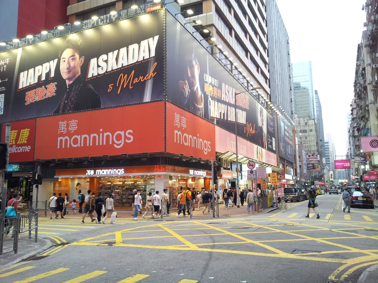

Sai Yeung Choi Street
Watercress once grew here. The name Sai Yeung Choi — 西洋菜, literally "Western vegetable" in Cantonese, the common term for watercress — preserves a memory of the cultivation fields that covered this part of Mong Kok in the village of Mong Kok Tsuen. The fields were gone before most living memory; the streets were formally laid out in 1924. But the name stayed. It is a small, unassuming kind of permanence in a city that does not often practice it.
One Street, Split in Two
Officially, Sai Yeung Choi Street is two streets — South and North — divided by the Mong Kok Police Station. The split dates to the station's construction, which physically severed what had been a continuous road. In the late 1970s, the Postmaster General recommended formalizing the distinction by appending "south" and "north" to reduce the confusion that a shared name and separate addresses had created. On 12 January 1979, the names were officially changed.
The two streets run in different worlds. Sai Yeung Choi Street South, running from Dundas Street in Yau Ma Tei north to Prince Edward Road West, became one of Mong Kok's busiest commercial corridors — electronics shops at street level, upstairs bookstores above, dense foot traffic, neon. Sai Yeung Choi Street North, crossing Boundary Street into New Kowloon, is largely residential and substantially quieter. The police station between them is not the only thing separating them; the city's energy simply drops off as you cross Argyle Street and keep walking.
The Pedestrian Zone Experiment
In 2000, the busiest portion of Sai Yeung Choi Street South was pedestrianised — cars removed, the street opened to foot traffic seven days a week. For over a decade it worked well enough, drawing shoppers and street performers to one of the densest neighborhoods in the world.
Then the noise became untenable. Street performers multiplied, loudspeakers compounded, and decibel levels on Saturday nights reached 101.5 — a figure measured by a study commissioned by the Liberal Party. The sound source was a phenomenon that became a flashpoint in broader debates about Hong Kong's identity: amateur singers, some performing in the style common to mainland Chinese public squares and parks, broadcasting to the street through portable PA systems. Hong Kong media began calling it an example of the "mainlandisation" of public space — a charged term for a charged argument.
The Yau Tsim Mong District Council voted in November 2013 to restrict pedestrianisation to weekends only. A government survey found 80 percent of residents and shop owners supported the change, while most people surveyed on the street itself opposed it. The restriction took effect in January 2014, and retail rents subsequently fell. By May 2018, following more than 1,000 complaints, the council voted to suspend the pedestrian zone entirely. At 10pm on 29 July 2018, the cars returned.
When the Street Turned Dangerous
The pedestrian zone controversy was only one form of public drama the street has seen. Over a stretch of less than two years, Sai Yeung Choi Street was the site of three acid attacks. On 13 December 2008, two bottles of corrosive liquid were thrown from buildings, burning 46 people. On 16 May 2009, a second attack injured 30. A third occurred on 8 June 2009, injuring 24 more. The police offered increased rewards for information. The Yau Tsim Mong District Council installed CCTV. A similar attack on nearby Temple Street followed on 9 January 2010.
The perpetrator or perpetrators of these attacks were never publicly identified in the sources available. The attacks left dozens of people — ordinary shoppers and workers on an ordinary street — permanently scarred.
In June 2014, a pedestrian was killed on Sai Yeung Choi Street when a swivel chair was thrown from a rooftop. The street also saw significant presence during the 2014 Hong Kong protests, becoming one of the routes and gathering points for demonstrators during the months-long occupation of city streets.
Mong Kok's Particular Energy
Before the 1970s, when Nathan Road emerged as the dominant commercial spine of Kowloon, Mong Kok was the densest and most prosperous district on the peninsula — and streets like Sai Yeung Choi were its circulatory system. The electronics shops that now define the southern stretch replaced earlier commercial layers, which were themselves layered over the fields and the village.
Mong Kok MTR station, with its multiple exits opening directly onto the street network, pumps thousands of people per hour into the area. The station exits — B2, B3, D2, D3, E2 for Mong Kok station; A2 for Yau Ma Tei — are printed on maps, but the actual experience is harder to chart. The street performs differently at different hours: breakfast crowds at the cha chaan tengs, electronics bargain-hunters midday, street performers and protest crowds in the evening. The watercress fields are long gone. The energy of Mong Kok Tsuen, transformed into something the village farmers would not recognize, remains.
From the Air
Sai Yeung Choi Street runs north-south through Mong Kok in Kowloon at approximately 22.322°N, 114.169°E. From the air, Mong Kok is identifiable as the grid of streets immediately north of Yau Ma Tei, dense with mid-rise commercial buildings. The street runs parallel to and a block west of Tung Choi Street (Ladies' Market). Approaching Hong Kong International Airport (VHHH) from the northeast, the Kowloon peninsula is visible as the rectangular landmass pointing south into Victoria Harbour, with Nathan Road as its prominent central axis running to the Star Ferry terminal. Recommended altitude for viewing the area: 2,500–3,500 feet for context, or as low as 1,000 feet for the urban density of the street grid.
Nearby Stories
- Lok Ma Chau Loop 2.3 km away
- Portas do Cerco 2.3 km away
- Kweilin Incident 17 km away
- Wanshan Archipelago Campaign 34 km away
- Nanxiong Formation 115 km away
- Battle of Nanpeng Island 148 km away
- Heyuan 169 km away
- Cape Maobitou 632 km away